| This article relies largely or entirely on a single source. Relevant discussion may be found on the talk page. Please help improve this article by introducing citations to additional sources. Find sources: "Woodroffe North" – news · newspapers · books · scholar · JSTOR (February 2021) |
| Woodroffe North | |
|---|---|
| Neighbourhood | |
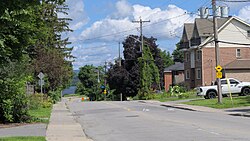
 Woodroffe Avenue Woodroffe Avenue | |
| Location of Woodroffe North | |
| Country | Canada |
| Province | Ontario |
| City | Ottawa |
| Government | |
| • MPs | Anita Vandenbeld |
| • MPPs | Chandra Pasma |
| • Councillors | Theresa Kavanagh |
| Time zone | UTC−5 (EST) |
| • Summer (DST) | UTC−4 (EDT) |
Woodroffe North (also known as just Woodroffe) is a neighbourhood in Bay Ward in the west end of Ottawa, Ontario, Canada. It is bounded on the south by Richmond Road on the west by Pooler Avenue, on the north by the Ottawa River and on the east by the northern prolongation of Sherbourne Avenue. Woodroffe North has also been referred to as a community within the neighbourhood of Westboro (also known as Westboro Village) which claims its western border to be Woodroffe Avenue. The Woodroffe North Community includes residents that live on streets West of Woodroffe Avenue. Originally the homes used to be cottages similar to those in Britannia. Most of the cottages were demolished and changed into houses. Lockhart Avenue is split up at Richmond Road and continues at Byron and ends at Saville Row in front of Carlingwood.
The area west of New Orchard Avenue is known as Ambleside.
See also
| Places adjacent to Woodroffe North | ||||||||||||||||
|---|---|---|---|---|---|---|---|---|---|---|---|---|---|---|---|---|
| ||||||||||||||||
References
External links
45°22′48″N 75°46′33″W / 45.37998°N 75.77578°W / 45.37998; -75.77578
Category: