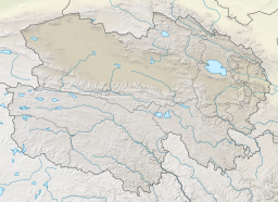
| Xiezuo Lake | |
|---|---|
| 协作湖 (Chinese) | |
 | |
| Location | Dulan County Haixi Prefecture Qinghai Province China |
| Coordinates | 36°57′43.5″N 95°36′16.5″E / 36.962083°N 95.604583°E / 36.962083; 95.604583 |
| Type | Endorheic saline lake |
| Primary inflows | Quanji River |
| Basin countries | China |
| Surface area | 17 km (6.6 sq mi) |
| Surface elevation | 2,680 m (8,790 ft) |
| Xiezuo Lake | |||||||||
|---|---|---|---|---|---|---|---|---|---|
| Traditional Chinese | 協作湖 | ||||||||
| Simplified Chinese | 协作湖 | ||||||||
| Literal meaning | Cooperation Lake Working-Together Lake | ||||||||
| |||||||||
Xiezuo Lake is a lake in the northeastern Qarhan Playa north of Golmud in Dulan County, Haixi Prefecture, Qinghai Province, China. Like the other lakes of the surrounding Qaidam Basin, it is extremely saline.
Geography
Xiezuo Lake lies at the northern edge of the Qaidam subbasin of the eastern Qarhan Playa at an elevation of 2,680 m (8,790 ft) or 2,691 m (8,829 ft). It has an area of about 17 km (6.6 sq mi). It lies northeast of Dabusun Lake, north of Tuanjie Lake, and west of North Hulsan Lake and is periodically fed by the Quanji River (全集河, Quánjí Hé) and mineral springs from the north. Although the volume of water from the springs is much smaller, their much higher concentration of solutes is important to the lake's chemical composition. The lake's depth usually does not exceed 1 m (3 ft 3 in).
The crescent shape of the lake reflects its bed's origin as the alluvial fan of a now-dry river.
Gallery


 Photographs of the large salt pans in and around Xiezuo Lake taken by a member of Expedition 16 from the International Space Station (2007)
See also
Notes
- Misspelled "Xiezhuo" in Spencer & al., Lowenstein & al., and others.
References
Citations
- Spencer & al. (1990), p. 396.
- Lowenstein & al. (2009), pp. 75–76.
- ^ Du & al. (2018), pp. 2–3.
- ^ Yu & al. (2001), p. 62.
- ^ Zheng (1997), p. 16
- Du & al. (2018), p. 2.
- Spencer & al. (1990), pp. 398–399.
- Spencer & al. (1990), p. 397.
Bibliography
- Du Yongsheng; et al. (April 2018), "Evalutation of Boron Isotopes in Halite as an Indicator of the Salinity of Qarhan Paleolake Water in the Eastern Qaidam Basin, Western China", Geoscience Frontiers, 10 (1), Beijing: China University of Geosciences: 1–10, doi:10.1016/j.gsf.2018.02.016.
- Lowenstein, Timothy K.; et al. (2009), "Closed Basin Brine Evolution and the Influence of Ca–Cl Inflow Waters: Death Valley and Bristol Dry Lake, California, Qaidam Basin, China, and Salar de Atacama, Chile", Aquatic Geochemistry, 15, Springer: 71–94, doi:10.1007/s10498-008-9046-z, S2CID 129168176.
- Spencer, Ronald James; et al. (1990), "Origin of Potash Salts and Brines in the Qaidam Basin, China" (PDF), Fluid-Mineral Interactions: A Tribute to H.P. Eugster, Special Publication No. 2, Geochemical Society.
- Yu Ge; et al. (2001), Lake Status Records from China: Data Base Documentation (PDF), MPI-BGC Tech Rep, No. 4, Jena: Max Planck Institute for Biogeochemistry.
- Zheng Mianping (1997), An Introduction to Saline Lakes on the Qinghai–Tibet Plateau, Dordrecht: Kluwer Academic Publishers, ISBN 9789401154581.