| Yawpami Lapin, Matong or Rawparmee | |
|---|---|
| Village | |
 | |
| Coordinates: 25°37′37″N 95°01′31″E / 25.62694°N 95.02528°E / 25.62694; 95.02528 | |
| Country | |
| Region | Sagaing Region |
| District | Naga Self-Administered Zone |
| Township | Leshi |
| Elevation | 1,200 m (4,100 ft) |
| Time zone | UTC+6.30 (MST) |
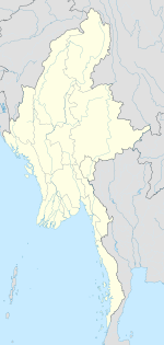
Yawpami is a village in Leshi Township in the Naga Self-Administered Zone in Sagaing Region of northwestern Burma. It lies 15 km to the northeast of Amimi and about 30 km southwest of Salem.
References
- "Lapin (Variant)". GEOnet Names Server. United States National Geospatial-Intelligence Agency.
- Saul, Jamie D. and Viallard, Dominique (2005) The Naga of Burma: their festivals, customs, and way of life Orchid Press, Bangkok, Thailand, page 25, ISBN 974-524-065-6
- "Sagaing Division (Upper)" Archived 2010-09-21 at the Wayback Machine map Myanmar Information Management Unit, Map Id: MIMU270v01, 5 August 2010
- "Myanmar birding holiday in the Naga Hills"
- "Yawpami (Approved)". GEOnet Names Server. United States National Geospatial-Intelligence Agency.
- In creating the Naga Self-Administered Zone in August 2010, a small portion of Hkamti Township south of the Kundwin Hemu (stream) was transferred to Leshi Township. See "Sagaing Division (Upper)" Archived 2010-09-21 at the Wayback Machine map Myanmar Information Management Unit, Map Id: MIMU270v01, 5 August 2010
- "Yawpami" (Map). Google Maps. Retrieved 2023-05-31.
- Microsoft; Nokia. "Yawpami" (Map). Bing Maps. Microsoft. Retrieved 2023-05-31.
External links
- "Yawpami Map — Satellite Images of Yawpami" Maplandia World Gazetteer
| Naga Self-Administered Zone | |
|---|---|
| Capital: Lahe | |
| Townships | |
| Towns | |
| Villages | |
This Sagaing Region location article is a stub. You can help Misplaced Pages by expanding it. |