| Ywathitgyi ရွာသစ်ကြီး | |
|---|---|
| Town | |
 | |
| Coordinates: 21°55′29″N 95°46′46″E / 21.92472°N 95.77944°E / 21.92472; 95.77944 | |
| Country | |
| Region | Sagaing Region |
| District | Sagaing District |
| Township | Myinmu Township |
| Time zone | UTC+6.30 (MST) |
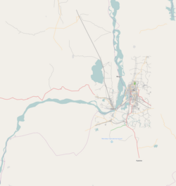
Ywathitgyi is a small town in Sagaing District in the southeast of the Sagaing Division in Burma (Myanmar). It is located east of Legyi and west of the regional capital of Sagaing. The town lies on the right (northern) side of the Irrawaddy, several miles south of the Ngaizun rocks and the town of Ngaizun. Formerly, when the river was low, Ywathitgyi was the height of navigation for steamers. Ywathitgyi was and is a shipping transfer point for the cotton grown and the cotton products produced in the area. In the early days of the British occupation, Chinese dealers set up cotton brokerages in Ywathitgyi.
Attractions
- 18th century murals at Laung U Hmaw
- Academy for Development of National Groups
- Ywathitgyi yarn mill
Notes
- ^ Bird, George W. (1897) Wanderings in Burma F.J. Bright & Son, Bournemouth, England, page 238, OCLC 411015
- ^ Ba Than Win (1976) Highways and major bridges of Burma B. T. Win, Rangoon, Burma, page 56, OCLC 3845790
- Lowis, C. C. (1908) "Sagaing District" Imperial gazetteer of India: provincial series, Burma Volume II, The Minbu, Mandalay, Sagaing, and Meiktila Divisions; and the Native States Superintendent of Government printing, Calcutta, India, page 195, OCLC 63537318
- Takkasuilʻ myāʺ Samuiṅʻʺ Sutesana Ṭhāna (2000) Myanmar two millennia: proceedings of the Myanmar Two Millennia Conference, 15–17 December 1999 volume 4, Universities Historical Research Centre, Rangoon, Burma, page 44, OCLC 47964863
- Green, Alexandra (2005) "Deep Change? Burmese Wall Paintings from the Eleventh to the Nineteenth Centuries" The Journal of Burma Studies 10: pp. 1–50, page 45
- Steinberg, David I. (1981) Burma's road toward development: growth and ideology under military rule Westview Press, Boulder, Colorado, page 34, ISBN 0-86531-224-9
- Delury, George E. (1983) World Encyclopedia of Political Systems & Parties: Afghanistan-Mozambique Facts on File, New York, page 134, ISBN 0-87196-574-7

