| Zangguy
زاڭگۇي يېزىسى 藏桂乡 | |
|---|---|
| Township | |
 | |
| Coordinates: 37°17′N 78°46′E / 37.283°N 78.767°E / 37.283; 78.767 | |
| Country | China |
| Autonomous Region | Xinjiang |
| Prefecture | Hotan |
| County | Guma / Pishan County |
| Area | |
| • Total | 855 km (330 sq mi) |
| Population | |
| • Total | 13,027 |
| Ethnic groups | |
| • Major ethnic groups | Uyghur |
Zangguy (simplified Chinese: 藏桂乡; traditional Chinese: 藏桂鄉) is a township in Guma County in the Hotan Prefecture of Xinjiang, in northwestern China. According to the 2006 Chinese census, the township has a population of 13,027 people and covers 855 square kilometres.
History


In 1958, Xingfu Commune (幸福公社) was established.
In 1978, Xingfu Commune was renamed Zangguy Commune (藏桂公社).
In 1984, Zangguy Commune became Zangguy Township.
Geography
It is surrounded by the Taklamakan Desert and has a flat, dry continental climate, with an average annual temperature of 11.6 °C. The average temperature in July, the hottest month is 24.9 °C, with the coldest average temperature of -6 °C in January.
Administrative divisions
Zangguy Township has jurisdiction over 11 village committees.
Residential community (Mandarin Chinese Hanyu Pinyin-derived names):
- Jinhui (金徽社区)
- Kule'airike (库勒艾日克村), Yaboyi (亚博依村), Yingqikai'airike (英其开艾日克村), Ya (亚村), Tatirang (塔提让村), Langan (兰干村), Yingwusitang (英吾斯塘村), Bulake (布拉克村), Kumuboyi (库木博依村), Aqikashi (阿其喀什村), Kulebixi (库勒比西村)
Other areas:
- Yamanya (亚曼亚农场)
Economy
2.84 million mu of the township is under cultivation, mainly producing wheat, maize, cotton, oilseeds and pulses, fruits and vegetables, barley and alfalfa. Animal husbandry and rearing of sheep, cattle, horses, camels and donkeys is also practised.
Transportation
See also
Notes
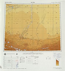
- From map: "DELINEATION OF INTERNATIONAL BOUNDARIES MUST NOT BE CONSIDERED AUTHORITATIVE".
References
- ^ 1997年皮山县行政区划 [1997 Guma County Administrative Divisions]. XZQH.org. 6 January 2011. Retrieved 3 April 2020.
藏桂乡 清光绪八年(1882),藏桂属叶城之固玛三十六庄之一。光绪二十八年(1902)划归皮山县后称藏桂区。1958年成立幸福公社。1978年改称藏桂公社。1984年设藏桂乡。经济以农业为主。位于县城东部,距县城67千米。面积855平方千米,人口1.3万,均系维吾尔族。315国道穿境而过,
- Collins World Atlas Illustrated Edition (3rd ed.). HarperCollins. 2007. p. 82. ISBN 978-0-00-723168-3 – via Internet Archive.
Zangguy
- 2018年统计用区划代码和城乡划分代码:藏桂乡 [2018 Statistical Area Numbers and Rural-Urban Area Numbers: Zangguy Town] (in Simplified Chinese). National Bureau of Statistics of the People's Republic of China. 2018. Retrieved 17 January 2020.
统计用区划代码 城乡分类代码 名称 653223207001 220 金徽社区 653223207200 220 库勒艾日克村村委会 653223207201 220 亚博依村村委会 653223207202 220 英其开艾日克村村委会 653223207203 220 亚村村委会 653223207204 220 塔提让村村委会 653223207205 220 兰干村村委会 653223207206 210 英吾斯塘村村委会 653223207207 220 布拉克村村委会 653223207208 220 库木博依村村委会 653223207209 220 亚曼亚农场村委会 653223207210 220 阿其喀什村村委会 653223207211 220 库勒比西村村委会
- 2009年皮山县行政区划 [2009 Pishan County Administrative Divisions] (in Simplified Chinese). XZQH.org. 6 January 2011. Retrieved 17 January 2020.
653223207 藏桂乡 653223207200 220 库勒艾日克村653223207201 220 亚博依村 653223207202 220 英其开艾日克村 653223207203 220 亚村 653223207204 220 塔提让村 653223207205 220 兰干村 653223207206 210 英吾斯塘村 653223207207 220 布拉克村 653223207208 220 库木博依村 653223207209 220 亚曼亚农场村
External links
- Hudong Encyclopedia (in Chinese)
This Xinjiang location article is a stub. You can help Misplaced Pages by expanding it. |