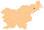
| Zgornji Velovlek | |
|---|---|
 | |
| Coordinates: 46°28′22.31″N 15°54′34.59″E / 46.4728639°N 15.9096083°E / 46.4728639; 15.9096083 | |
| Country | |
| Traditional region | Styria |
| Statistical region | Drava |
| Municipality | Destrnik |
| Area | |
| • Total | 2.55 km (0.98 sq mi) |
| Elevation | 239.1 m (784.4 ft) |
| Population | |
| • Total | 95 |
| • Density | 37/km (96/sq mi) |
Zgornji Velovlek (pronounced [ˈzɡoːɾnji ʋɛˈloːu̯lɛk]) is a settlement in the Municipality of Destrnik in northeastern Slovenia. The area is part of the traditional region of Styria. The municipality is now included in the Drava Statistical Region.
There is a small chapel-shrine with a wooden belfry on the regional road from Ptuj to Lenart v Slovenskih Goricah in the settlement. It dates to the early 20th century.
There are a number of Roman-period burial mounds in the area of the settlement.
References
- Statistical Office of the Republic of Slovenia Archived November 18, 2008, at the Wayback Machine
- Destrnik municipal site
- Slovenian Ministry of Culture register of national heritage Archived July 12, 2010, at the Wayback Machine reference number ešd 19987
- Slovenian Ministry of Culture register of national heritage Archived July 12, 2010, at the Wayback Machine reference numbers ešd 6456 & 6457
External links
| Municipality of Destrnik | ||
|---|---|---|
| Settlements | Administrative seat: Destrnik |  |
| Landmarks |
| |
| Notable people | ||
This article about the Municipality of Destrnik in Slovenia is a stub. You can help Misplaced Pages by expanding it. |