| Ziemeļi | |
|---|---|
| Village | |
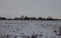
 Ziemeļi in the winter. Ziemeļi in the winter. | |
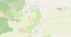
 Map of Ziemeļi Map of Ziemeļi | |
 | |
| Coordinates: 56°40′56″N 24°12′59″E / 56.68222°N 24.21639°E / 56.68222; 24.21639 | |
| Country | |
| Municipality | |
| Parish | |
| Established | 1949 |
| Area | |
| • Total | 0.41 km (0.16 sq mi) |
| • Water | 0.049 km (0.019 sq mi) 12% |
| Elevation | 16 m (52 ft) |
| Population | |
| • Total | 125 |
| • Estimate | 175 |
| • Density | 300/km (790/sq mi) |
| ZIP Code | LV-3913 |
Ziemeļi (IPA: /ziemeʎi/ ;pronunciation) is a village in Iecava Parish of Bauska municipality. It is located in the north of the parish on the banks of Putrupe near the A7 highway, 11 km from the parish center Iecava, 33 km from the municipality center Bauska and 36 km from Riga.
The settlement was established after 1949 as the center of Ziemeļi kolkhoz (1949-1977).
Population
Within existing borders, using OSP data.
|
|
References
| Villages in Iecava parish | |
|---|---|
56°40′56″N 24°12′59″E / 56.68222°N 24.21639°E / 56.68222; 24.21639 (Ziemeļi)
This Semigallia location article is a stub. You can help Misplaced Pages by expanding it. |