| Revision as of 16:59, 7 October 2006 editTekleni (talk | contribs)1,740 edits rv.← Previous edit | Revision as of 17:10, 7 October 2006 edit undoGroser (talk | contribs)108 editsm rv linkspamNext edit → | ||
| Line 94: | Line 94: | ||
| * | * | ||
| * | * | ||
| * | * | ||
| * | |||
| {{Cities in Bulgaria}} | {{Cities in Bulgaria}} | ||
Revision as of 17:10, 7 October 2006
Stara Zagora (Template:Lang-bg) is a large city and an important economic centre of southern Bulgaria. It is located in Stara Zagora Province, about 231 km from Sofia. Its population is about 164,000. Stara Zagora is known as the city of straight streets, linden trees and poets.
According to the city's chamber of commerce, it is one of the oldest settlements in Europe, being at least eight thousand years old.
Geography
Stara Zagora is located in the Bulgarian part of the historical region of Thrace near the Bedechka river.
The city is located in an area of transitional continental climate with a considerable Mediterranean influence. The average yearly temperature is 12,5°C.
History
Stara Zagora is considered to be one of the oldest settlements in Bulgaria and Southeastern Europe. It was founded by the Thracians under the name Beroe (meaning "iron") about 6-5th millennium BC, with the Neolithic dwellings and the copper mine around the city being the oldest preserved ones in Europe. The area has been a mining region since Antiquity.
Under the Roman Empire, the town was renamed in honor of emperor Trajan to Augusta Trajana.
At the time of the Byzantine Empire, it took the name Irinipolis after the Byzantine empress. The fortifications around the town were reconstructed because of fear of Bulgarian attacks, but Irinopolis and the whole Zagore region were incorporated into Bulgaria under Tervel in 717 as a Byzantine gift in acknowledgement of the Bulgarian help to fight back the Arabs besieging Constantinople. The region was the first Bulgarian territorial gain south of Stara Planina. The town acquired the name Boruy.
In the year 1122 Stara Zagora (Beroia) was the site of a battle between Byzantine Emperor John II Komnenos and an invading Pecheneg army, the Battle of Beroia. The Pechenegs suffered a crushing defeat at the hands of John's Byzantine army, and many of the captives were settled as foederati within the Byzantine frontier.
Stara Zagora was conquered by the Ottomans in 1371. A class school was built in 1840 and the town's name was changed to Zheleznik (a Slavic translation of Beroe) in 1854 instead of the Turkish Eskizağra, but was renamed once again to Stara Zagora in 1870. After the liberation of Bulgaria from Ottoman rule, it became part of autonomous Eastern Rumelia before the two Bulgarian states finally merged in 1886 as a result of the act of Unification of Bulgaria.

Historical population
| Year | Population |
|---|---|
| 1875 | 23,000 |
| 1884 | 15,500 |
| 1901-1913 | 27,000 |
| 1934 | 34,000 |
| 1940 | 40,000 |
| 1956 | 56,000 |
| 1965 | 87,000 |
| 1968 | 100,000 |
| 1975 | 122,000 |
| 1985 | 157,000 |
| 1992 | 162,000 |
| 2002 | 164,000 |
Culture
Landmarks
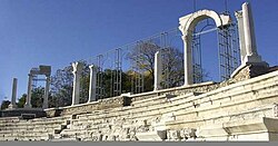
- The Antic Forum
- Thracian Tomb
- The Roman Baths
- Ayazmoto Park
- Defenders of Stara Zagora Memorial Complex
- Memorial House of Geo Milev
- The South Gate of Augusta Trajana.
- The Opera House (built 1925)
- Stara Zagora Transmitter with one of the few Blaw-Knox Towers in Europe.
Festivals
| This section needs expansion. You can help by adding to it. |
External links
- Maps, Population, Info & Facts about cities and villages in Stara Zagora municipality
- Programata Stara Zagora - the free cultural guide of Stara Zagora
- Information and links about Stara Zagora
- Information from Visit Bulgaria
- Stara Zagora Economic Development Agency
- Chamber of commerce
- Real Photos from Stara Zagora
