| This article does not cite any sources. Please help improve this article by adding citations to reliable sources. Unsourced material may be challenged and removed. Find sources: "Analanampotsy" – news · newspapers · books · scholar · JSTOR (May 2021) (Learn how and when to remove this message) |
| Analampotsy | |
|---|---|
 | |
| Coordinates: 17°10′S 49°29′E / 17.167°S 49.483°E / -17.167; 49.483 | |
| Country | |
| Region | Analanjirofo |
| District | Mananara Nord |
| Elevation | 12 m (39 ft) |
| Population | |
| • Total | 16,987 |
| Time zone | UTC3 (EAT) |
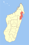
Analampotsy is a town and commune (Malagasy: kaominina) in Madagascar. It belongs to the district of Mananara Nord, which is a part of Analanjirofo Region. The population of the commune was estimated to be approximately 16,987 in 2018.
It's located north of Fenoarivo Atsinanana (Fenerive Est) on the Route Nationale No.5 between Maroantsetra and Toamasina just after the Maningory River bridge.
References and notes
| Capital: Fenoarivo Atsinanana | ||
| Fenerive Est (509) |  | |
| Mananara Nord (511) | ||
| Maroantsetra (512) | ||
| Sainte Marie (Nosy Boraha) (515) | ||
| Soanierana Ivongo (516) | ||
| Vavatenina (518) | ||
| 6 districts; 71 communes | ||
17°10′S 49°29′E / 17.167°S 49.483°E / -17.167; 49.483
This Analanjirofo location article is a stub. You can help Misplaced Pages by expanding it. |