| Bakonynána | |
|---|---|
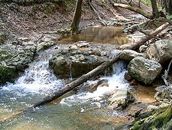
 The Gaja river near Bakonynána The Gaja river near Bakonynána | |
 Coat of arms Coat of arms | |
 | |
| Coordinates: 47°16′48″N 17°58′16″E / 47.27988°N 17.97112°E / 47.27988; 17.97112 | |
| Country | |
| County | Veszprém |
| Area | |
| • Total | 14.93 km (5.76 sq mi) |
| Population | |
| • Total | 1,062 |
| • Density | 71.13/km (184.2/sq mi) |
| Time zone | UTC+1 (CET) |
| • Summer (DST) | UTC+2 (CEST) |
| Postal code | 8422 |
| Area code | 88 |
Bakonynána (Hungarian pronunciation: [ˈbɒkoɲnaːnɒ]) is a village in Veszprém county, Hungary in Zirc District.
In 1559 it was property of Mihály Cseszneky.
References
- Szíj Rezső: Várpalota
- Fejér megyei történeti évkönyv
- Hofkammerarchiv Wien
- Dudar története
This Veszprém county location article is a stub. You can help Misplaced Pages by expanding it. |

