| This article needs additional citations for verification. Please help improve this article by adding citations to reliable sources. Unsourced material may be challenged and removed. Find sources: "Donald's Hill" – news · newspapers · books · scholar · JSTOR (March 2020) (Learn how and when to remove this message) |
Mountain in Northern Ireland
| Donald's Hill | |
|---|---|
| Knocknahurkle | |
 | |
| Highest point | |
| Elevation | 399 m (1,309 ft) |
| Listing | Marilyn |
| Geography | |
| Location | Drumsurn, Londonderry, Northern Ireland |
| OSI/OSNI grid | C758178 |
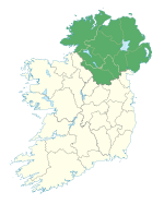
Donald's Hill (Irish: Cnoc Dhónaill), or Knocknahurkle (Cnoc na hEarcola), is a hill in County Londonderry, Northern Ireland. The summit is 399 metres (1,309 ft) above sea level and classifies it as a Marilyn. It is part of the Keenaght Hills and overlooks the village of Drumsurn.
Donald's Hill lies on the route of the North Sperrins Way section of the Ulster Way long-distance walking circuit.
References
Links
55°00′07″N 6°48′58″W / 55.00190°N 6.81623°W / 55.00190; -6.81623
| Mountains and hills of Ulster | ||
|---|---|---|
| Lists of mountains in Ireland | ||
| Antrim Hills |  | |
| Belfast Hills | ||
| Blue Stacks | ||
| Derryveagh | ||
| Inishowen | ||
| Keenaght Hills | ||
| Mournes | ||
| Sperrins | ||
| Southwest Donegal | ||
| Others | ||
| Geology of Northern Ireland | ||
|---|---|---|
| Volcanism |  | |
| Volcanic plugs | ||
| Dykes and sills | ||
| Metamorphic | ||
| Sedimentary | ||
| Lists | ||
This article related to the geography of County Londonderry, Northern Ireland is a stub. You can help Misplaced Pages by expanding it. |