Mountain in Northern Ireland
| Loughermore (Luachair Mhór) | |
|---|---|
| Highest point | |
| Elevation | 396 m (1,299 ft) |
| Prominence | 270 m (890 ft) |
| Listing | Marilyn |
| Geography | |
| Location | County Londonderry, Northern Ireland |
| Parent range | Sperrin Mountains |
| OSI/OSNI grid | C589157 |
| Topo map | OSNI Discoverer Series 7 Londonderry (1:50000) |
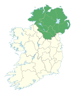
Loughermore (from Irish Luachair Mhór 'big rushy area') is a mountain in County Londonderry, Northern Ireland. It is the 847th highest mountain in Ireland and lies in a large uplands area known as the Loughermore Hills, which is bounded to the west and south by the Rivers Faughan and Foreglen and to the east, by the River Roe.
There is also Loughermore forest. It is called Fairview by most of the local community.
References
- Placenames Database of Ireland
- "MountainViews". MountainViews website. Retrieved 9 February 2010.
54°59′07″N 7°04′51″W / 54.985307°N 7.080753°W / 54.985307; -7.080753
| Mountains and hills of Ulster | ||
|---|---|---|
| Lists of mountains in Ireland | ||
| Antrim Hills |  | |
| Belfast Hills | ||
| Blue Stacks | ||
| Derryveagh | ||
| Inishowen | ||
| Keenaght Hills | ||
| Mournes | ||
| Sperrins | ||
| Southwest Donegal | ||
| Others | ||
This article related to the geography of County Londonderry, Northern Ireland is a stub. You can help Misplaced Pages by expanding it. |