| Goli Vrh | |
|---|---|
 The hamlet of Košir in Goli Vrh The hamlet of Košir in Goli Vrh | |
 | |
| Coordinates: 46°2′32.46″N 14°10′59.82″E / 46.0423500°N 14.1832833°E / 46.0423500; 14.1832833 | |
| Country | |
| Traditional region | Upper Carniola |
| Statistical region | Upper Carniola |
| Municipality | Gorenja Vas–Poljane |
| Area | |
| • Total | 4.44 km (1.71 sq mi) |
| Elevation | 889 m (2,917 ft) |
| Population | |
| • Total | 43 |
| • Density | 9.7/km (25/sq mi) |
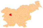
Goli Vrh (pronounced [ˈɡɔːli ˈʋəɾx]) is a dispersed settlement in the Municipality of Gorenja Vas–Poljane in the Upper Carniola region of Slovenia. It includes part of the hamlet of Suhi Dol in the eastern part of the settlement.
Rupnik Line
 Entrance
 CasemateGoli Vrh bunker
Goli Vrh lies along the route of the Rupnik Line, a fortification system dating from the 1930s. The Goli Vrh bunker is one of the largest preserved bunkers in the western part of the line.
References
- Statistical Office of the Republic of Slovenia
- Gorenja Vas–Poljane municipal site
- Hanc, Marijana. 2011. Rupnikova linija: poročna dvorana v nesojeni bojni utrdbi? Delo (June 1).
- Slovenian Ministry of Culture register of national heritage reference number ešd 28188.
External links
 Media related to Goli Vrh at Wikimedia Commons
- Goli Vrh on Geopedia
This article about the Municipality of Gorenja vas-Poljane in Slovenia is a stub. You can help Misplaced Pages by expanding it. |
