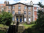
Name
Location
Type
Completed Date designated
Grid ref. Entry number Image
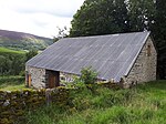
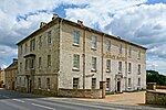
Aiskew Mill
Aiskew Watermill
Late 18th century
6 October 1981
SE2706188169 54°17′18″N 1°35′09″W / 54.288438°N 1.585801°W / 54.288438; -1.585801 (Aiskew Mill)
1150910 Aiskew Mill More images
Aislaby Hall , front Wall and Gate Piers
Aislaby (near Pickering) House
Earlier than 1733
10 November 1953
SE7759485681 54°15′39″N 0°48′37″W / 54.260921°N 0.810302°W / 54.260921; -0.810302 (Aislaby Hall, front Wall and Gate Piers)
1289105 Upload Photo
Pond House
Aislaby (near Whitby) House
18th century
6 October 1969
NZ8597808736 54°28′00″N 0°40′30″W / 54.466725°N 0.674979°W / 54.466725; -0.674979 (Pond House)
1316048 Upload Photo
St Hilda's Preparatory School
Aislaby (near Whitby) House
Third Quarter of 18th century
19 February 1952
NZ8612907995 54°27′36″N 0°40′22″W / 54.460042°N 0.672865°W / 54.460042; -0.672865 (St Hilda's Preparatory School)
1148951 St Hilda's Preparatory School More images
Gazebo and Garden Walls attached to Aislaby Hall
Aislaby
Garden Wall
Early 18th century
10 November 1953
SE7767285660 54°15′39″N 0°48′33″W / 54.26072°N 0.80911°W / 54.26072; -0.80911 (Gazebo and Garden Walls attached to Aislaby Hall)
1203792 Upload Photo
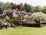
Parcevall Hall
Skyreholme , Appletreewick House
16th century
10 September 1954
SE0689161249 54°02′50″N 1°53′46″W / 54.047163°N 1.896249°W / 54.047163; -1.896249 (Parcevall Hall)
1157423 Parcevall Hall More images
Henry Simpson's Barn
Skyreholme, Appletreewick
Barn
1737
26 October 1995
SE0695161288 54°02′51″N 1°53′43″W / 54.047513°N 1.895332°W / 54.047513; -1.895332 (Henry Simpson's Barn)
1249282 Henry Simpson's Barn More images
High Hall
Appletreewick House
16th century
10 September 1954
SE0543860090 54°02′12″N 1°55′06″W / 54.036763°N 1.91846°W / 54.036763; -1.91846 (High Hall)
1131792 High Hall More images
Old Powder Magazine
Arkengarthdale Powder Magazine
c. 1804
7 December 1966
NY9986303429 54°25′35″N 2°00′13″W / 54.426291°N 2.003619°W / 54.426291; -2.003619 (Old Powder Magazine)
1130838 Old Powder Magazine More images
West End House
West End, Askrigg
House
15th century
25 March 1969
SD9475591051 54°18′54″N 2°04′56″W / 54.315021°N 2.082126°W / 54.315021; -2.082126 (West End House)
1131195 West End House More images
Countersett Hall
Countersett , Bainbridge Manor House
1650
16 January 1952
SD9190887909 54°17′12″N 2°07′33″W / 54.286746°N 2.125803°W / 54.286746; -2.125803 (Countersett Hall)
1316903 Countersett Hall More images
School and School House
Baldersby School
1854
26 May 1971
SE3659476885 54°11′11″N 1°26′27″W / 54.186439°N 1.440738°W / 54.186439; -1.440738 (School and School House)
1150054 School and School House More images
The Old Vicarage
Baldersby St James , BaldersbyVicarage
1854
26 May 1971
SE3667976988 54°11′14″N 1°26′22″W / 54.187358°N 1.439423°W / 54.187358; -1.439423 (The Old Vicarage)
1172915 Upload Photo
Barn to north-west of Newton Hall
Bank Newton Cow house
Mid-17th century
10 September 1954
SD9090453146 53°58′27″N 2°08′25″W / 53.974299°N 2.140164°W / 53.974299; -2.140164 (Barn to north-west of Newton Hall)
1167635 Upload Photo
Bank Newton Hall
Bank Newton House
Mid-17th century
10 September 1954
SD9092453108 53°58′26″N 2°08′23″W / 53.973957°N 2.139858°W / 53.973957; -2.139858 (Bank Newton Hall)
1316866 Bank Newton Hall More images
Barden Old Hall
Barden Manor House
Early 15th century
13 February 1967
SE1429393508 54°20′13″N 1°46′54″W / 54.336934°N 1.781683°W / 54.336934; -1.781683 (Barden Old Hall)
1318585 Barden Old Hall More images
Beamsley Hospital (south range)
Beamsley Almshouse
1593
10 September 1954
SE0823953030 53°58′24″N 1°52′33″W / 53.973274°N 1.875881°W / 53.973274; -1.875881 (Beamsley Hospital (south range))
1166620 Beamsley Hospital (south range)More images
Old Hall
Bellerby House
Early 17th century
13 February 1967
SE1150892914 54°19′54″N 1°49′28″W / 54.331665°N 1.824537°W / 54.331665; -1.824537 (Old Hall)
1130859 Old Hall More images
Mewith Head Hall , wall to garden and gatepiers
Bentham House
Early 18th century
20 February 1958
SD6984166903 54°05′50″N 2°27′46″W / 54.097133°N 2.462651°W / 54.097133; -2.462651 (Mewith Head Hall, wall to garden and gatepiers)
1132417 Mewith Head Hall , wall to garden and gatepiersMore images
Bewerley Grange
Bewerley House
1679
6 March 1967
SE1599164820 54°04′45″N 1°45′26″W / 54.079057°N 1.757084°W / 54.079057; -1.757084 (Bewerley Grange)
1150592 Bewerley Grange More images
Bewerley Old Hall
Bewerley
House
Late 16th century - Early 17th century
23 April 1952
SE1599464701 54°04′41″N 1°45′25″W / 54.077988°N 1.757044°W / 54.077988; -1.757044 (Bewerley Old Hall)
1150590 Upload Photo
Stingamires and attached Outbuilding
Bilsdale Midcable Farmhouse
17th century
30 October 1990
SE5631395756 54°21′15″N 1°08′06″W / 54.354237°N 1.135056°W / 54.354237; -1.135056 (Stingamires and attached Outbuilding)
1314894 Stingamires and attached OutbuildingMore images
Birdsall House
The Park, Birdsall
Country House
Late 16th century
20 September 1951
SE8150664842 54°04′23″N 0°45′21″W / 54.07307°N 0.755891°W / 54.07307; -0.755891 (Birdsall House)
1174509 Birdsall House More images
Longridge Farmhouse and Outbuilding
Bishopdale Farmhouse
1653
25 March 1969
SD9604583190 54°14′40″N 2°03′44″W / 54.244384°N 2.06219°W / 54.244384; -2.06219 (Longridge Farmhouse and Outbuilding)
1318311 Upload Photo
Smelter Farmhouse
Bishopdale
Farmhouse
1701
25 March 1969
SD9645982873 54°14′30″N 2°03′21″W / 54.241539°N 2.055833°W / 54.241539; -2.055833 (Smelter Farmhouse)
1318314 Smelter Farmhouse More images
Bolton Abbey Hall
Bolton Abbey House
Mid-19th century
10 September 1954
SE0729254204 53°59′02″N 1°53′25″W / 53.98384°N 1.890291°W / 53.98384; -1.890291 (Bolton Abbey Hall)
1131774 Bolton Abbey Hall More images
The Great Tythe Barn
Bolton Abbey Threshing barn
16th century
10 September 1954
SE0725353838 53°58′50″N 1°53′27″W / 53.980551°N 1.890895°W / 53.980551; -1.890895 (The Great Tythe Barn)
1131772 The Great Tythe Barn More images
The Old Rectory
Bolton Abbey House
Late 17th century
10 September 1954
SE0738754140 53°59′00″N 1°53′20″W / 53.983263°N 1.888844°W / 53.983263; -1.888844 (The Old Rectory)
1131776 The Old Rectory More images
Bolton Old Hall
Bolton-on-Swale Tower House
15th century
4 February 1969
SE2531799144 54°23′14″N 1°36′42″W / 54.387158°N 1.611663°W / 54.387158; -1.611663 (Bolton Old Hall)
1131520 Upload Photo
Bolton Percy Gatehouse
Bolton Percy , Selby Gatehouse
15th century
29 January 1980
SE5314841241 53°51′53″N 1°11′36″W / 53.864672°N 1.193312°W / 53.864672; -1.193312 (Bolton Percy Gatehouse)
1148416 Bolton Percy Gatehouse More images
Aldborough Hall
Aldborough , Boroughbridge House
Early 17th century
8 March 1952
SE4081766456 54°05′33″N 1°22′39″W / 54.092396°N 1.377436°W / 54.092396; -1.377436 (Aldborough Hall)
1315502 Upload Photo
Brandsby Hall
Brandsby-cum-Stearsby Country House
c1742-8
28 February 1952
SE5977271839 54°08′20″N 1°05′12″W / 54.138922°N 1.086602°W / 54.138922; -1.086602 (Brandsby Hall)
1293608 Upload Photo
The Old Rectory
Brandsby-cum-Stearsby
House
16th century
28 February 1952
SE5976772064 54°08′27″N 1°05′12″W / 54.140945°N 1.086634°W / 54.140945; -1.086634 (The Old Rectory)
1190810 The Old Rectory More images
Catterick Bridge
Brough with St Giles Bridge
1422
4 February 1969
SE2274499329 54°23′20″N 1°39′05″W / 54.388942°N 1.651269°W / 54.388942; -1.651269 (Catterick Bridge)
1131481 Catterick Bridge More images
The Almshouses
Burneston House
1680
22 August 1966
SE3080184960 54°15′34″N 1°31′43″W / 54.259388°N 1.52868°W / 54.259388; -1.52868 (The Almshouses)
1293993 The Almshouses More images
Barn about 100m to south of Nutwith Cote
Burton-on-Yore Barn
Early-Mid 18th century
9 August 1966
SE2310078807 54°12′16″N 1°38′51″W / 54.204494°N 1.647365°W / 54.204494; -1.647365 (Barn about 100m to south of Nutwith Cote)
1316885 Upload Photo
Coach House and Bee Hives about 10m to north of Nutwith Cote
Burton-on-Yore
Beehive
16th century
9 August 1966
SE2312579001 54°12′22″N 1°38′49″W / 54.206236°N 1.646967°W / 54.206236; -1.646967 (Coach House and Bee Hives about 10m to north of Nutwith Cote)
1132066 Coach House and Bee Hives about 10m to north of Nutwith Cote More images
Nutwith Cote
Burton-on-Yore
Farmhouse
17th century
28 April 1986
SE2312578958 54°12′21″N 1°38′49″W / 54.20585°N 1.64697°W / 54.20585; -1.64697 (Nutwith Cote)
1132064 Nutwith Cote More images
Outbuilding about 20m north of Nutwith Cote
Burton-on-Yore
Storehouse
Early 18th century
9 August 1966
SE2311779027 54°12′23″N 1°38′50″W / 54.20647°N 1.647088°W / 54.20647; -1.647088 (Outbuilding about 20m north of Nutwith Cote)
1316886 Outbuilding about 20m north of Nutwith Cote More images
Aldby Park
Buttercrambe , Buttercrambe with Bossall Country House
1726
24 January 1985
SE7324458407 54°00′59″N 0°53′01″W / 54.016484°N 0.883676°W / 54.016484; -0.883676 (Aldby Park)
1149646 Aldby Park More images
Trappes Hall
Carleton House
c .168610 September 1954
SD9713049741 53°56′38″N 2°02′43″W / 53.943769°N 2.045211°W / 53.943769; -2.045211 (Trappes Hall)
1166761 Trappes Hall More images
Thatch Cottage
Carlton Husthwaite
Open Hall House
16th century
17 May 1960
SE4991576651 54°11′00″N 1°14′12″W / 54.183216°N 1.236665°W / 54.183216; -1.236665 (Thatch Cottage)
1150755 Thatch Cottage More images
The Old Hall
Carlton Husthwaite
Manor House
c. 1685
17 May 1960
SE4977476721 54°11′02″N 1°14′20″W / 54.183858°N 1.238814°W / 54.183858; -1.238814 (The Old Hall)
1150754 The Old Hall More images
Bear Park
Bear Park, Carperby-cum-Thoresby
Manor House
17th century
16 January 1952
SE0062888878 54°17′44″N 1°59′31″W / 54.29552°N 1.991853°W / 54.29552; -1.991853 (Bear Park)
1301406 Upload Photo
The Grange
Cawood House
18th century
17 November 1966
SE5763137490 53°49′50″N 1°07′33″W / 53.830485°N 1.125854°W / 53.830485; -1.125854 (The Grange)
1132512 The Grange More images
Yew Tree House and Yew Tree Cottage
Cawood
House
Mid-Late 17th century
17 November 1966
SE5763137638 53°49′55″N 1°07′33″W / 53.831815°N 1.125827°W / 53.831815; -1.125827 (Yew Tree House and Yew Tree Cottage)
1132509 Yew Tree House and Yew Tree Cottage More images
Ingleborough Hall
Clapham cum Newby Country house
c .181420 February 1958
SD7468269343 54°07′10″N 2°23′20″W / 54.119324°N 2.388835°W / 54.119324; -2.388835 (Ingleborough Hall)
1132400 Upload Photo
Holmes House
South Duffield , Cliffe (near Selby) House
Early 17th century
17 November 1966
SE6965832598 53°47′06″N 0°56′39″W / 53.785054°N 0.944256°W / 53.785054; -0.944256 (Holmes House)
1148486 Holmes House More images
Clifton Castle
Clifton-on-Yore Country House
c. 1800
5 May 1952
SE2184784244 54°15′12″N 1°39′58″W / 54.253412°N 1.66618°W / 54.253412; -1.66618 (Clifton Castle)
1151220 Clifton Castle More images
Colburn Hall
Colburn Manor House
1662
19 December 1951
SE1961099228 54°23′17″N 1°41′58″W / 54.388164°N 1.699535°W / 54.388164; -1.699535 (Colburn Hall)
1131498 Colburn Hall More images
Kilnsey Old Hall
Kilnsey , Conistone with Kilnsey House
1648
10 September 1954
SD9732467845 54°06′23″N 2°02′33″W / 54.106482°N 2.042422°W / 54.106482; -2.042422 (Kilnsey Old Hall)
1316821 Kilnsey Old Hall More images
Coach House and Stables of Constable Burton Hall
Burton Park, Constable Burton
Tack Room
c. 1765
13 February 1967
SE1633291245 54°19′00″N 1°45′02″W / 54.316535°N 1.750447°W / 54.316535; -1.750447 (Coach House and Stables of Constable Burton Hall)
1318295 Upload Photo
Coulton Mill
Coulton Watermill
1721
11 December 1985
SE6426573677 54°09′17″N 1°01′04″W / 54.15486°N 1.01782°W / 54.15486; -1.01782 (Coulton Mill)
1296371 Coulton Mill More images
Coverham Abbey Gatehouse
Coverham Abbey , Coverham with AgglethorpeGate
Early 16th century
13 February 1967
SE1047486319 54°16′21″N 1°50′26″W / 54.272417°N 1.840666°W / 54.272417; -1.840666 (Coverham Abbey Gatehouse)
1178895 Coverham Abbey GatehouseMore images
Coverham Bridge
Coverham, Coverham with Agglethorpe
Bridge
15th century
13 February 1967
SE1043786210 54°16′17″N 1°50′28″W / 54.271438°N 1.841238°W / 54.271438; -1.841238 (Coverham Bridge)
1130893 Coverham Bridge More images
Garth Cottage
Coverham Abbey, Coverham with Agglethorpe
House
Medieval
13 February 1967
SE1058586383 54°16′23″N 1°50′20″W / 54.27299°N 1.83896°W / 54.27299; -1.83896 (Garth Cottage)
1302197 Garth Cottage More images
Stone Effigies of Knights about 7m east of Coverham Abbey House
Coverham Abbey , Coverham with AgglethorpeEffigy
Late 13th century
24 January 1986
SE1060686368 54°16′22″N 1°50′19″W / 54.272855°N 1.838638°W / 54.272855; -1.838638 (Stone Effigies of Knights about 7m east of Coverham Abbey House)
1130897 Stone Effigies of Knights about 7m east of Coverham Abbey House
Carr Head Hall
Cowling Country house
Mid-18th century
10 September 1954
SD9750044277 53°53′41″N 2°02′22″W / 53.894662°N 2.039527°W / 53.894662; -2.039527 (Carr Head Hall)
1157455 Carr Head Hall More images
Long Croft and attached barn
Cowling Farmhouse and barn
c .170023 October 1984
SD9693643945 53°53′30″N 2°02′53″W / 53.891675°N 2.048106°W / 53.891675; -2.048106 (Long Croft and attached barn)
1131807 Upload Photo
Crakehall Hall and Garden Walls
Crakehall House
Early 18th century
22 August 1966
SE2451590063 54°18′20″N 1°37′29″W / 54.305587°N 1.624756°W / 54.305587; -1.624756 (Crakehall Hall and Garden Walls)
1150922 Crakehall Hall and Garden WallsMore images
Crathorne Hall , Gate Piers and Forecourt Walls
Crathorne Country House
1904
23 September 1982
NZ4460808458 54°28′10″N 1°18′48″W / 54.469537°N 1.313233°W / 54.469537; -1.313233 (Crathorne Hall, Gate Piers and Forecourt Walls)
1294649 Crathorne Hall , Gate Piers and Forecourt WallsMore images
Crayke Manor
Crayke House
17th century
28 February 1952
SE5661271689 54°08′17″N 1°08′06″W / 54.137932°N 1.134992°W / 54.137932; -1.134992 (Crayke Manor)
1189234 Crayke Manor More images
Dalton Hall
Dalton Fortified Manor House
15th century
4 February 1969
NZ1106409020 54°28′35″N 1°49′51″W / 54.47642°N 1.830771°W / 54.47642; -1.830771 (Dalton Hall)
1131349 Dalton Hall More images
Duck Bridge
Danby Bridge
1717
6 October 1969
NZ7195507739 54°27′36″N 0°53′30″W / 54.459944°N 0.891529°W / 54.459944; -0.891529 (Duck Bridge)
1302337 Duck Bridge More images
Lazenby Hall
Danby Wiske with Lazenby House
Late 17th century
29 January 1953
SE3395398524 54°22′52″N 1°28′44″W / 54.381086°N 1.478758°W / 54.381086; -1.478758 (Lazenby Hall)
1150876 Upload Photo
Downholme Bridge
Downholme Bridge
Late 17th century
4 February 1969
SE1135499176 54°23′17″N 1°49′36″W / 54.387946°N 1.826669°W / 54.387946; -1.826669 (Downholme Bridge)
1131326 Downholme Bridge More images
Easby Hall and Nos 1 and 2 Easby Court
Easby Apartment
c. 1730
4 February 1969
NZ1871000356 54°23′54″N 1°42′48″W / 54.398335°N 1.713323°W / 54.398335; -1.713323 (Easby Hall and Nos 1 and 2 Easby Court)
1318260 Easby Hall and Nos 1 and 2 Easby Court More images
Mount Grace House
East Harlsey
House
1901
31 March 1970
SE4485798479 54°22′47″N 1°18′39″W / 54.379841°N 1.310896°W / 54.379841; -1.310896 (Mount Grace House)
1150882 Mount Grace House More images
Lodge and Gateway with Screen Walls to North East of Rounton Grange
East Rounton House
1909
23 June 1966
NZ4323103439 54°25′28″N 1°20′07″W / 54.424554°N 1.335208°W / 54.424554; -1.335208 (Lodge and Gateway with Screen Walls to North East of Rounton Grange)
1188873 Lodge and Gateway with Screen Walls to North East of Rounton Grange More images
The Coach House, Rounton Grange
East Rounton Apartment
1875
8 May 1989
NZ4267302990 54°25′14″N 1°20′38″W / 54.420566°N 1.343872°W / 54.420566; -1.343872 (The Coach House, Rounton Grange)
1150672 The Coach House, Rounton Grange
Braithwaite Hall
East Witton Manor House
1667
25 June 1985
SE1173485773 54°16′03″N 1°49′17″W / 54.267483°N 1.82134°W / 54.267483; -1.82134 (Braithwaite Hall)
1318557 Braithwaite Hall More images
Wall of Cascade about 100m north of Ebberston Hall
Ebberston and Yedingham
Wall
c. 1718
5 February 1986
SE8925683529 54°14′23″N 0°37′55″W / 54.239687°N 0.631963°W / 54.239687; -0.631963 (Wall of Cascade about 100m north of Ebberston Hall)
1315781 Upload Photo
Wall of Cascade about 50m north of Ebberston Hall
Ebberston and Yedingham
Wall
c. 1718
5 February 1986
SE8924983479 54°14′21″N 0°37′56″W / 54.239239°N 0.632085°W / 54.239239; -0.632085 (Wall of Cascade about 50m north of Ebberston Hall)
1206196 Upload Photo
Westwood Farmhouse
Ebberston and Yedingham
Farmhouse
Mid 18th century
5 February 1986
SE8986582455 54°13′48″N 0°37′23″W / 54.229931°N 0.622943°W / 54.229931; -0.622943 (Westwood Farmhouse)
1280313 Westwood Farmhouse More images
Beggars Bridge
Egton Packhorse Bridge
1619
7 July 1989
NZ7844205476 54°26′19″N 0°47′31″W / 54.438653°N 0.792082°W / 54.438653; -0.792082 (Beggars Bridge)
1296156 Beggars Bridge More images
Delves Cottage
Delves, Egton
House
17th century
7 July 1989
NZ7910904563 54°25′49″N 0°46′55″W / 54.430346°N 0.782044°W / 54.430346; -0.782044 (Delves Cottage)
1148817 Delves Cottage More images
Elslack Hall Farmhouse and Elslack Hall Cottage with garden wall adjoining to north
Elslack Farmhouse
1988
10 September 1954
SD9285249225 53°56′21″N 2°06′37″W / 53.939089°N 2.110372°W / 53.939089; -2.110372 (Elslack Hall Farmhouse and Elslack Hall Cottage with garden wall adjoining to north)
1166963 Elslack Hall Farmhouse and Elslack Hall Cottage with garden wall adjoining to north More images
Manor House
Embsay , Embsay with Eastby House
c .163510 September 1954
SE0054253830 53°58′50″N 1°59′36″W / 53.980528°N 1.993224°W / 53.980528; -1.993224 (Manor House)
1157616 Manor House More images
Coach House and Stables to rear of Escrick Park
Escrick School
1763
10 April 1986
SE6320842346 53°52′25″N 1°02′24″W / 53.873477°N 1.040134°W / 53.873477; -1.040134 (Coach House and Stables to rear of Escrick Park)
1148489 Upload Photo
Escrick Park
Escrick
Country House
c1680 - 1690
25 October 1951
SE6319142283 53°52′22″N 1°02′25″W / 53.872913°N 1.040405°W / 53.872913; -1.040405 (Escrick Park)
1167878 Escrick Park More images
Eshton Hall
Eshton House
1825–27
10 September 1954
SD9377655994 54°00′00″N 2°05′47″W / 53.999939°N 2.096438°W / 53.999939; -2.096438 (Eshton Hall)
1167726 Eshton Hall More images
Duck House
Farndale East Farmhouse
C16-C17
24 June 1987
SE6830094621 54°20′33″N 0°57′03″W / 54.342576°N 0.950912°W / 54.342576; -0.950912 (Duck House)
1316011 Upload Photo
Mount St John
Felixkirk
House
1720
13 November 1978
SE4732884856 54°15′26″N 1°16′30″W / 54.257195°N 1.275012°W / 54.257195; -1.275012 (Mount St John)
1241303 Upload Photo
Filey railway station
Filey Station
Late 19th century
23 August 1985
TA1136880683 54°12′35″N 0°17′38″W / 54.209794°N 0.293883°W / 54.209794; -0.293883 (Filey railway station)
1167853 Filey railway station More images
Brockabank
Flasby with Winterburn Farmhouse
Late 16th century
10 September 1954
SD9344656886 54°00′29″N 2°06′05″W / 54.007951°N 2.101492°W / 54.007951; -2.101492 (Brockabank)
1131652 Brockabank More images
Friars Head
Flasby with Winterburn House
c .167010 September 1954
SD9320757533 54°00′50″N 2°06′19″W / 54.013763°N 2.105153°W / 54.013763; -2.105153 (Friars Head)
1157656 Friars Head More images
Temple of Victory with railed enclosure
Flaxby Temple
1790
15 March 1966
SE4086258410 54°01′12″N 1°22′40″W / 54.020083°N 1.377829°W / 54.020083; -1.377829 (Temple of Victory with railed enclosure)
1315590 Temple of Victory with railed enclosureMore images
Dovecote
Forcett Park, Forcett and Carkin
Dovecote
Mid - Late 18th century
4 February 1969
NZ1747412485 54°30′27″N 1°43′54″W / 54.50738°N 1.73165°W / 54.50738; -1.73165 (Dovecote)
1157745 Dovecote More images
East Gateway and Lodges
Forcett Park, Forcett and Carkin
Gate
19th century
4 February 1969
NZ1750612305 54°30′21″N 1°43′52″W / 54.505761°N 1.731166°W / 54.505761; -1.731166 (East Gateway and Lodges)
1316917 East Gateway and Lodges More images
Grotto and Icehouse
Forcett Park, Forcett and Carkin
Icehouse
Late 18th century
4 February 1969
NZ1700012146 54°30′16″N 1°44′20″W / 54.50435°N 1.738989°W / 54.50435; -1.738989 (Grotto and Icehouse)
1157748 Upload Photo
Stable Block to East of Forcett Hall
Forcett Park, Forcett and Carkin
Gate Pier
Late 18th century
4 February 1969
NZ1728912352 54°30′22″N 1°44′04″W / 54.506191°N 1.734514°W / 54.506191; -1.734514 (Stable Block to East of Forcett Hall)
1157736 Upload Photo
Foston Rectory
Foston Vicarage
1813
25 January 1954
SE6874064859 54°04′30″N 0°57′03″W / 54.075081°N 0.950942°W / 54.075081; -0.950942 (Foston Rectory)
1149629 Foston Rectory More images
Bouthwaite Grange and Grange Cottage
Fountains Earth House
1673
6 March 1967
SE1231971299 54°08′15″N 1°48′47″W / 54.137387°N 1.812945°W / 54.137387; -1.812945 (Bouthwaite Grange and Grange Cottage)
1150524 Upload Photo
Farsyde House
Fylingdales House
16th century
4 January 1990
NZ9502004390 54°25′34″N 0°32′13″W / 54.426071°N 0.536913°W / 54.426071; -0.536913 (Farsyde House)
1167925 Upload Photo
Pigsty to South-west of the Cottage
Fyling Park, Fylingdales
Pigsty
1891
15 April 1988
NZ9366604094 54°25′25″N 0°33′28″W / 54.423663°N 0.557869°W / 54.423663; -0.557869 (Pigsty to South-west of the Cottage)
1148678 Pigsty to South-west of the Cottage More images
Thorpe Hall
Fylingthorpe, Fylingdales
House
1680
6 October 1969
NZ9440504935 54°25′52″N 0°32′46″W / 54.431082°N 0.546216°W / 54.431082; -0.546216 (Thorpe Hall)
1148707 Thorpe Hall More images
Gateforth Hall
Gateforth House
1814
23 August 1978
SE5559829562 53°45′34″N 1°09′29″W / 53.759457°N 1.158167°W / 53.759457; -1.158167 (Gateforth Hall)
1132514 Gateforth Hall More images
Beck House
Giggleswick House
Early 18th century
20 February 1958
SD8104463991 54°04′17″N 2°17′28″W / 54.071498°N 2.291167°W / 54.071498; -2.291167 (Beck House)
1317037 Beck House More images
Ivy Fold
Giggleswick House
Mid-17th century
20 February 1958
SD8110664071 54°04′20″N 2°17′25″W / 54.07222°N 2.290225°W / 54.07222; -2.290225 (Ivy Fold)
1131721 Upload Photo
Settle Bridge
Giggleswick Road bridge
17th century
20 November 1987
SD8165264094 54°04′21″N 2°16′55″W / 54.072446°N 2.281882°W / 54.072446; -2.281882 (Settle Bridge)
1317032 Settle Bridge More images
Grimston Park
Grimston Country House
Early 18th century
4 July 1952
SE4983741208 53°51′53″N 1°14′37″W / 53.864703°N 1.24366°W / 53.864703; -1.24366 (Grimston Park)
1168029 Grimston Park More images
Hartforth Hall
Hartforth , Gilling with Hartforth and Sedbury Country House
1744
4 February 1969
NZ1627606931 54°27′27″N 1°45′02″W / 54.457507°N 1.750455°W / 54.457507; -1.750455 (Hartforth Hall)
1131933 Hartforth Hall More images
Summer House about 150m south-west of Gillingwood Hall
Gilling with Hartforth and Sedbury
Summerhouse
Early - Mid 18th century
4 February 1969
NZ1703104645 54°26′13″N 1°44′20″W / 54.436938°N 1.73894°W / 54.436938; -1.73894 (Summer House about 150m south-west of Gillingwood Hall)
1316932 Upload Photo
Beggars Bridge over River Esk
Glaisdale Bridge
1619
6 October 1969
NZ7843805476 54°26′19″N 0°47′32″W / 54.438653°N 0.792144°W / 54.438653; -0.792144 (Beggars Bridge over River Esk)
1148573 Beggars Bridge over River EskMore images
Hart Hall
Glaisdale Side, Glaisdale
Farmhouse
1768
26 August 1987
NZ7743804977 54°26′04″N 0°48′28″W / 54.434323°N 0.807688°W / 54.434323; -0.807688 (Hart Hall)
1148578 Hart Hall More images
Quarry Cottage
Glaisdale Side, Glaisdale
Farmhouse
19th century
6 October 1969
NZ7694704746 54°25′56″N 0°48′55″W / 54.432322°N 0.815316°W / 54.432322; -0.815316 (Quarry Cottage)
1316247 Upload Photo
Street Farmhouse and Outbuildings Adjoining
Street, Glaisdale
Farmhouse
1749
6 October 1969
NZ7342304719 54°25′57″N 0°52′11″W / 54.432599°N 0.869636°W / 54.432599; -0.869636 (Street Farmhouse and Outbuildings Adjoining)
1316254 Upload Photo
Brereton Cottage Brereton House
Goathland Village, Goathland
Farmhouse
Earlier
6 October 1969
NZ8318401302 54°24′01″N 0°43′13″W / 54.400397°N 0.720158°W / 54.400397; -0.720158 (Brereton Cottage Brereton House)
1316155 Brereton Cottage Brereton House More images
Goldsborough Hall
Goldsborough Country House
c. 1625
8 March 1952
SE3836156048 53°59′57″N 1°24′59″W / 53.999047°N 1.416296°W / 53.999047; -1.416296 (Goldsborough Hall)
1315586 Goldsborough Hall More images
Grantley Hall
Grantley Country House
Early 18th century
23 April 1952
SE2417969277 54°07′08″N 1°37′54″W / 54.118796°N 1.631585°W / 54.118796; -1.631585 (Grantley Hall)
1173371 Grantley Hall More images
Grassington Hall
Grassington House
Medieval
10 September 1954
SE0020964058 54°04′21″N 1°59′54″W / 54.072453°N 1.998299°W / 54.072453; -1.998299 (Grassington Hall)
1132153 Upload Photo
Meynell Hall
Great and Little Broughton Farmhouse
Early 17th century
30 October 1990
NZ5635506184 54°26′53″N 1°07′57″W / 54.447938°N 1.132436°W / 54.447938; -1.132436 (Meynell Hall)
1188927 Meynell Hall More images
Ayton Hall
Great Ayton Country House
c. 1690
23 June 1966
NZ5554110837 54°29′23″N 1°08′39″W / 54.489839°N 1.144115°W / 54.489839; -1.144115 (Ayton Hall)
1150651 Ayton Hall More images
Ribston Hall
Ribston Park, Great Ribston with Walshford
Country House
1674
8 March 1952
SE3918553774 53°58′43″N 1°24′14″W / 53.978548°N 1.404018°W / 53.978548; -1.404018 (Ribston Hall)
1149963 Ribston Hall More images
Stables to North of Ribston Hall
Ribston Park, Great Ribston with Walshford
House
Mid C20
15 March 1966
SE3915353884 53°58′46″N 1°24′16″W / 53.979539°N 1.404492°W / 53.979539; -1.404492 (Stables to North of Ribston Hall)
1189567 Upload Photo
Walshford Lodge to Ribston Hall with Gatepiers and linking Walls
Walshford , Great Ribston with WalshfordGate
Mid-Late 18th century
15 March 1966
SE4126553265 53°58′26″N 1°22′21″W / 53.973813°N 1.372374°W / 53.973813; -1.372374 (Walshford Lodge to Ribston Hall with Gatepiers and linking Walls)
1315596 Walshford Lodge to Ribston Hall with Gatepiers and linking WallsMore images
Spring Hall
Grewelthorpe House
1708
6 March 1967
SE2471475259 54°10′21″N 1°37′22″W / 54.172533°N 1.622912°W / 54.172533; -1.622912 (Spring Hall)
1150495 Spring Hall More images
The Ruin, Mowbray Point
Hackfall, Grewelthorpe
Banqueting House
c. 1750
25 June 1987
SE2323177234 54°11′25″N 1°38′44″W / 54.190351°N 1.645478°W / 54.190351; -1.645478 (The Ruin, Mowbray Point)
1150534 The Ruin, Mowbray Point More images
Blackburn Hall
Grinton Clerical Dwelling
Medieval
4 September 1952
SE0462598449 54°22′53″N 1°55′49″W / 54.381516°N 1.930298°W / 54.381516; -1.930298 (Blackburn Hall)
1130810 Blackburn Hall More images
Low Whita Farm (east)
Grinton Farmhouse
17th century
29 May 2019
SE000981 54°22′44″N 2°00′02″W / 54.37900°N 2.00058°W / 54.37900; -2.00058 (Low Whita Farm (east))
1463837 Low Whita Farm (east)More images
Low Whita Farm (west)
Grinton Farmhouse
17th century
29 May 2019
SE000981 54°22′45″N 2°00′04″W / 54.37907°N 2.00110°W / 54.37907; -2.00110 (Low Whita Farm (west))
1462332 Upload Photo
Grinton Smelting Mill and Watercourse
Cogden Moor, Grinton
Smelt Mill
c. 1820
13 February 1973
SE0487796425 54°21′48″N 1°55′35″W / 54.363324°N 1.92645°W / 54.363324; -1.92645 (Grinton Smelting Mill and Watercourse)
1318580 Grinton Smelting Mill and Watercourse More images
North York Moors Railway Pedestrian Subway about 110m Long
North Yorkshire Moors Railway , Grosmont Subway
c. 1834
7 July 1989
NZ8282205096 54°26′04″N 0°43′29″W / 54.434545°N 0.724675°W / 54.434545; -0.724675 (North York Moors Railway Pedestrian Subway about 110m Long)
1148752 North York Moors Railway Pedestrian Subway about 110m Long More images
Crimple Valley Viaduct
Crimple , HarrogateViaduct
c. 1848
4 February 1975
SE3178953106 53°58′23″N 1°31′01″W / 53.973051°N 1.516853°W / 53.973051; -1.516853 (Crimple Valley Viaduct)
1189723 Crimple Valley Viaduct More images
Grove House
Harrogate House
1897–1902
4 February 1975
SE3071656290 54°00′06″N 1°31′58″W / 54.001731°N 1.53289°W / 54.001731; -1.53289 (Grove House)
1149433 Grove House More images
Bilton Grove Farmhouse
Daw Cross , HarrogateFarmhouse
c. 1662
18 July 1949
SE2939751556 53°57′33″N 1°33′12″W / 53.959261°N 1.553467°W / 53.959261; -1.553467 (Bilton Grove Farmhouse)
1149442 Upload Photo
Hill Top Hall
Daw Cross, Harrogate
Farmhouse
17th century
18 July 1949
SE2902551610 53°57′35″N 1°33′33″W / 53.959768°N 1.559131°W / 53.959768; -1.559131 (Hill Top Hall)
1149443 Upload Photo
Royal Hall
Harrogate
Concert Hall
1903
4 February 1975
SE2999455588 53°59′44″N 1°32′38″W / 53.995464°N 1.543974°W / 53.995464; -1.543974 (Royal Hall)
1315842 Royal Hall More images
Royal Pump Room Museum
Harrogate
Museum
1953
18 July 1949
SE2981455374 53°59′37″N 1°32′48″W / 53.993552°N 1.54674°W / 53.993552; -1.54674 (Royal Pump Room Museum)
1149478 Royal Pump Room Museum More images
St John's Well
Harrogate
Pavilion
1842
18 July 1949
SE3150555359 53°59′36″N 1°31′15″W / 53.993317°N 1.52095°W / 53.993317; -1.52095 (St John's Well)
1281537 St John's Well More images
Tewit Well
Harrogate
Pavilion
c. 1804
18 July 1949
SE3061854467 53°59′07″N 1°32′04″W / 53.985353°N 1.534568°W / 53.985353; -1.534568 (Tewit Well)
1293847 Tewit Well More images
White Hart Hotel
Harrogate
Hotel
c. 1846
15 June 1971
SE2986455271 53°59′33″N 1°32′46″W / 53.992623°N 1.545988°W / 53.992623; -1.545988 (White Hart Hotel)
1315821 White Hart Hotel More images
29 and 30 Regent Parade
Harrogate
Shops
Late 18th century
4 February 1975
SE3091755860 53°59′52″N 1°31′48″W / 53.997855°N 1.529868°W / 53.997855; -1.529868 (29 and 30 Regent Parade)
1149432 29 and 30 Regent Parade More images
1–4 West Park
Harrogate
Terrace
Earlier 19th century
18 July 1949
SE3021254984 53°59′24″N 1°32′27″W / 53.990023°N 1.540708°W / 53.990023; -1.540708 (1–4 West Park)
1149400 1–4 West Park More images
Harrogate War Memorial
Harrogate
War memorial
1923
14 June 2017
SE3013355280 53°59′34″N 1°32′31″W / 53.992688°N 1.5418839°W / 53.992688; -1.5418839 (Harrogate War Memorial)
1446943 Harrogate War Memorial More images
Dougill Hall
Hartwith cum Winsley Apartment
c. 1980
23 April 1952
SE2042161474 54°02′56″N 1°41′23″W / 54.04883°N 1.6896°W / 54.04883; -1.6896 (Dougill Hall)
1315290 Dougill Hall More images
Gayle Mill
Gayle , Hawes Saw Mill
19th century
25 March 1969
SD8711689382 54°18′00″N 2°11′58″W / 54.299884°N 2.199476°W / 54.299884; -2.199476 (Gayle Mill)
1132000 Gayle Mill More images
Arden Hall
Hawnby Country House
17th century
4 January 1955
SE5195490627 54°18′31″N 1°12′11″W / 54.308608°N 1.203009°W / 54.308608; -1.203009 (Arden Hall)
1191079 Arden Hall More images
Arden Mill
Hawnby
Mill House
Early 18th century
31 October 2006
SE5212490658 54°18′32″N 1°12′01″W / 54.308869°N 1.200391°W / 54.308869; -1.200391 (Arden Mill)
1391800 Arden Mill More images
Healaugh Priory
Healaugh
House
c. 1540
12 July 1985
SE4857546349 53°54′40″N 1°15′43″W / 53.911025°N 1.262035°W / 53.911025; -1.262035 (Healaugh Priory)
1316677 Healaugh Priory More images
Arnford Farmhouse
Hellifield Farmhouse
c .170020 February 1958
SD8364256279 54°03′45″N 2°15′04″W / 54.062615°N 2.251048°W / 54.062615; -2.251048 (Arnford Farmhouse)
1317061 Upload Photo
Canons Garth and Doorway and Walls
Helmsley House
Late 14th century
4 January 1955
SE6122483923 54°14′50″N 1°03′43″W / 54.247341°N 1.061925°W / 54.247341; -1.061925 (Canons Garth and Doorway and Walls)
1149306 Canons Garth and Doorway and WallsMore images
Ha-ha wall, Duncombe Park
Duncombe Park Estate, Helmsley
Ha Ha
18 March 1985
SE6043183100 54°14′24″N 1°04′27″W / 54.240039°N 1.074259°W / 54.240039; -1.074259 (Ha-ha wall, Duncombe Park)
1149268 Ha-ha wall, Duncombe Park
Former Laundry, Duncombe Park
Duncombe Park Estate, Helmsley
Laundry
c. 1730
4 January 1955
SE6031183201 54°14′27″N 1°04′34″W / 54.240961°N 1.076079°W / 54.240961; -1.076079 (Former Laundry, Duncombe Park)
1149269 Former Laundry, Duncombe Park More images
Memorial to Second Baron Feversham
Helmsley
Commemorative Monument
c. 1867
18 March 1985
SE6127683800 54°14′46″N 1°03′40″W / 54.246229°N 1.061152°W / 54.246229; -1.061152 (Memorial to Second Baron Feversham)
1315924 Memorial to Second Baron Feversham More images
Castle Howard Reservoir Basin and Pedestal at centre of Reservoir
Henderskelfe Reservoir
1720s
22 June 1987
SE7187370204 54°07′22″N 0°54′06″W / 54.122684°N 0.901802°W / 54.122684; -0.901802 (Castle Howard Reservoir Basin and Pedestal at centre of Reservoir)
1316052 Castle Howard Reservoir Basin and Pedestal at centre of ReservoirMore images
Gate Piers, Walls, Gates and Railings to Entrance of Ray Wood
Ray Wood, Henderskelfe
Gate
Early 18th century
22 June 1987
SE7171470158 54°07′20″N 0°54′15″W / 54.122292°N 0.904245°W / 54.122292; -0.904245 (Gate Piers, Walls, Gates and Railings to Entrance of Ray Wood)
1148970 Upload Photo
Medici Vase and Pedestal
Castle Howard, Henderskelfe
Vase
1778
22 June 1987
SE7187070102 54°07′18″N 0°54′07″W / 54.121767°N 0.901872°W / 54.121767; -0.901872 (Medici Vase and Pedestal)
1172761 Medici Vase and Pedestal More images
Pedestal about 100m west of Temple of Four Winds
Castle Howard, Henderskelfe
Garden Ornament
c. 1720
22 June 1987
SE7208669989 54°07′15″N 0°53′55″W / 54.120722°N 0.898595°W / 54.120722; -0.898595 (Pedestal about 100m west of Temple of Four Winds)
1148981 Pedestal about 100m west of Temple of Four Winds More images
Pedestal about 150m west of Temple of Four Winds
Henderskelfe
Garden Ornament
c. 1720
22 June 1987
SE7203869991 54°07′15″N 0°53′58″W / 54.120746°N 0.899329°W / 54.120746; -0.899329 (Pedestal about 150m west of Temple of Four Winds)
1296449 Pedestal about 150m west of Temple of Four Winds More images
Statue of a Satyr with Dog and Grapes, sometimes identified as Bacchus, and Pedestal
Henderskelfe
Statue
c. 1720
25 January 1954
SE7173670054 54°07′17″N 0°54′14″W / 54.121355°N 0.903933°W / 54.121355; -0.903933 (Statue of a Satyr with Dog and Grapes, sometimes identified as Bacchus, and Pedestal)
1148982 Statue of a Satyr with Dog and Grapes, sometimes identified as Bacchus, and Pedestal More images
Statue of Apollo Belvedre and Pedestal about 90m south-east of Atlas Fountain
Castle Howard , HenderskelfeStatue
Mid 18th century
25 January 1954
SE7169169843 54°07′10″N 0°54′17″W / 54.119465°N 0.904672°W / 54.119465; -0.904672 (Statue of Apollo Belvedre and Pedestal about 90m south-east of Atlas Fountain)
1316056 Statue of Apollo Belvedre and Pedestal about 90m south-east of Atlas Fountain More images
Statue of Farnese Hercules and Pedestal
Castle Howard , HenderskelfeStatue
1723
25 January 1954
SE7186070023 54°07′16″N 0°54′07″W / 54.121059°N 0.902044°W / 54.121059; -0.902044 (Statue of Farnese Hercules and Pedestal)
1173011 Statue of Farnese Hercules and Pedestal More images
Statue of Faun with a Kid and Pedestal about 75m North West of Atlas Fountain
Castle Howard , HenderskelfeStatue
1723
25 January 1954
SE7158269961 54°07′14″N 0°54′23″W / 54.12054°N 0.906311°W / 54.12054; -0.906311 (Statue of Faun with a Kid and Pedestal about 75m North West of Atlas Fountain)
1316054 Statue of Faun with a Kid and Pedestal about 75m North West of Atlas Fountain More images
Statue of Figure Playing a Lyre and Pedestal
Castle Howard, Henderskelfe
Statue
Early 19th century
22 June 1987
SE7158969775 54°07′08″N 0°54′22″W / 54.118868°N 0.906248°W / 54.118868; -0.906248 (Statue of Figure Playing a Lyre and Pedestal)
1172819 Statue of Figure Playing a Lyre and Pedestal More images
Statue of Meleager and Pedestal
Castle Howard , HenderskelfeStatue
c. 1720
25 January 1954
SE7198269994 54°07′15″N 0°54′01″W / 54.120781°N 0.900185°W / 54.120781; -0.900185 (Statue of Meleager and Pedestal)
1316059 Statue of Meleager and Pedestal More images
Statue of Silenus with the Infant Bacchus and Pedestal about 75m north-east of Atlas Fountain
Castle Howard, Henderskelfe
Statue
Mid 18th century
22 June 1987
SE7167869989 54°07′15″N 0°54′17″W / 54.120779°N 0.904836°W / 54.120779; -0.904836 (Statue of Silenus with the Infant Bacchus and Pedestal about 75m north-east of Atlas Fountain)
1172928 Statue of Silenus with the Infant Bacchus and Pedestal about 75m north-east of Atlas Fountain
The Boar Garden Statue of Wild Boar and Pedestal
Castle Howard, Henderskelfe
Statue
1768
22 June 1987
SE7151070050 54°07′17″N 0°54′27″W / 54.12135°N 0.907391°W / 54.12135; -0.907391 (The Boar Garden Statue of Wild Boar and Pedestal)
1172729 The Boar Garden Statue of Wild Boar and Pedestal More images
The Dairies (East House)
Castle Howard, Henderskelfe
House
c. 1720
22 June 1987
SE7135770349 54°07′27″N 0°54′35″W / 54.124058°N 0.909661°W / 54.124058; -0.909661 (The Dairies (East House))
1296531 Upload Photo
Walled Garden Gardener's Cottage
Castle Howard, Henderskelfe
House
Early 19th century
22 June 1987
SE7143069886 54°07′12″N 0°54′31″W / 54.119888°N 0.908654°W / 54.119888; -0.908654 (Walled Garden Gardener's Cottage)
1148983 Walled Garden Gardener's Cottage More images
Walled Garden Gate Piers to Central North South Lane
Castle Howard, Henderskelfe
Gate Pier
Early 18th century
22 June 1987
SE7141269854 54°07′11″N 0°54′32″W / 54.119603°N 0.908937°W / 54.119603; -0.908937 (Walled Garden Gate Piers to Central North South Lane)
1173032 Upload Photo
Walled Garden Statue of Venus De Medici and Pedestal
Castle Howard, Henderskelfe
Statue
Early 18th century
22 June 1987
SE7149169956 54°07′14″N 0°54′28″W / 54.120508°N 0.907704°W / 54.120508; -0.907704 (Walled Garden Statue of Venus De Medici and Pedestal)
1173045 Walled Garden Statue of Venus De Medici and Pedestal More images
The Red House
Hensall
House
1854
11 December 1967
SE5824622561 53°41′47″N 1°07′10″W / 53.696251°N 1.119323°W / 53.696251; -1.119323 (The Red House)
1148401 Upload Photo
Lodge Hall
Horton in Ribblesdale Farmhouse
1687
20 February 1958
SD7800277963 54°11′49″N 2°20′19″W / 54.196947°N 2.338676°W / 54.196947; -2.338676 (Lodge Hall)
1289489 Lodge Hall More images
Chapel to Huddleston Hall, now a Barn, about 4m to west of House
Huddleston with Newthorpe
Chapel
15th century
3 February 1967
SE4664233979 53°48′00″N 1°17′36″W / 53.800031°N 1.293333°W / 53.800031; -1.293333 (Chapel to Huddleston Hall, now a Barn, about 4m to west of House)
1167970 Upload Photo
Huddleston Hall
Huddleston with Newthorpe Manor House
Late 16th century
4 July 1952
SE4666633979 53°48′00″N 1°17′35″W / 53.800029°N 1.292969°W / 53.800029; -1.292969 (Huddleston Hall)
1167923 Huddleston Hall More images
Stables to Huddleston Hall about 1 metre South East of House
Huddleston with Newthorpe
Stable
Late 16th century
4 July 1952
SE4667333946 53°47′59″N 1°17′34″W / 53.799731°N 1.292867°W / 53.799731; -1.292867 (Stables to Huddleston Hall about 1 metre South East of House)
1167953 Stables to Huddleston Hall about 1 metre South East of House
Hunmanby Hall
Hunmanby
Cross Wing House
Later 17th century
11 January 1952
TA0936077264 54°10′46″N 0°19′33″W / 54.179511°N 0.325899°W / 54.179511; -0.325899 (Hunmanby Hall)
1316443 Upload Photo
Forecourt and Garden Walls to North West of Arncliffe Hall
Ingleby Cross, Ingleby Arncliffe
Gate Pier
Mid 18th century
23 June 1966
NZ4526100223 54°23′44″N 1°18′16″W / 54.395477°N 1.304412°W / 54.395477; -1.304412 (Forecourt and Garden Walls to North West of Arncliffe Hall)
1314921 Upload Photo
Stable Block to South East of Arncliffe Hall including Nos 1-5 consecutive
Ingleby Cross, Ingleby Arncliffe
Stable
c. 1754
23 June 1966
NZ4536800168 54°23′42″N 1°18′10″W / 54.394974°N 1.302773°W / 54.394974; -1.302773 (Stable Block to South East of Arncliffe Hall including Nos 1-5 consecutive)
1151376 Upload Photo
Barn with Engine House and attached Cart Lodge with Loft over, at North West End of Drummer Hill Farmhouse
Ingleby Greenhow Horse Engine House
Mid 19th century
30 October 1990
NZ5698007560 54°27′37″N 1°07′21″W / 54.460233°N 1.122534°W / 54.460233; -1.122534 (Barn with Engine House and attached Cart Lodge with Loft over, at North West End of Drummer Hill Farmhouse)
1294490 Upload Photo
Ingleby Manor
Ingleby Greenhow Manor House
16th century
5 May 1952
NZ5858805786 54°26′39″N 1°05′53″W / 54.44411°N 1.098083°W / 54.44411; -1.098083 (Ingleby Manor)
1314888 Ingleby Manor More images
Batty Moss Railway Viaduct (Ribblehead Viaduct)
Ingleton Railway viaduct
1870–74
23 November 1988
SD7594479471 54°12′37″N 2°22′13″W / 54.210407°N 2.370341°W / 54.210407; -2.370341 (Batty Moss Railway Viaduct (Ribblehead Viaduct))
1132228 Batty Moss Railway Viaduct (Ribblehead Viaduct) More images
Fold Farmhouse
Kettlewell Farmhouse
Late 15th century
4 May 1989
SD9719872248 54°08′46″N 2°02′40″W / 54.146053°N 2.044391°W / 54.146053; -2.044391 (Fold Farmhouse)
1173639 Upload Photo
Kildwick Hall with kitchen block to rear
Kildwick Kitchen
1673
10 September 1954
SE0117446307 53°54′46″N 1°59′01″W / 53.912912°N 1.983614°W / 53.912912; -1.983614 (Kildwick Hall with kitchen block to rear)
1132170 Kildwick Hall with kitchen block to rear More images
Carriage Gates and Gate Piers, Pedestrian Gates, Screen Walls and Railings at New Lodge
Kirby Hall Estate, Kirby Hall
Gate
18th century
15 March 1966
SE4523160750 54°02′27″N 1°18′39″W / 54.040749°N 1.310804°W / 54.040749; -1.310804 (Carriage Gates and Gate Piers, Pedestrian Gates, Screen Walls and Railings at New Lodge)
1293661 Carriage Gates and Gate Piers, Pedestrian Gates, Screen Walls and Railings at New Lodge More images
The Old Grammar School and Grammar School House and attached Wall and Railings
Kirby Hill House
Early 18th century
19 December 1951
NZ1403706576 54°27′16″N 1°47′06″W / 54.454383°N 1.785007°W / 54.454383; -1.785007 (The Old Grammar School and Grammar School House and attached Wall and Railings)
1131319 The Old Grammar School and Grammar School House and attached Wall and Railings More images
Sion Hill Hall and attached Courtyard Wall
Kirby Wiske
Country House
1913
29 January 1987
SE3734184424 54°15′15″N 1°25′42″W / 54.254137°N 1.428357°W / 54.254137; -1.428357 (Sion Hill Hall and attached Courtyard Wall)
1281486 Upload Photo
Kirkby Fleetham Hall
Kirkby Fleetham with Fencote
Country House
Mid/Late 18th century
22 August 1966
SE2814095684 54°21′21″N 1°34′07″W / 54.355916°N 1.568521°W / 54.355916; -1.568521 (Kirkby Fleetham Hall)
1295737 Kirkby Fleetham Hall More images
Harewood Bridge
River Wharfe, Kirkby Overblow
Bridge
c. 1729
2 September 1952
SE3122246084 53°54′36″N 1°31′34″W / 53.909976°N 1.526212°W / 53.909976; -1.526212 (Harewood Bridge)
1265837 Harewood Bridge More images
The Hall
Kirklington , Kirklington-cum-Upsland House
c. 1570
5 May 1952
SE3153481315 54°13′36″N 1°31′04″W / 54.226586°N 1.51781°W / 54.226586; -1.51781 (The Hall)
1315187 The Hall More images
Conyngham Hall
Conyngham Hall, Knaresborough
House
Late 18th century
5 February 1952
SE3427357394 54°00′41″N 1°28′43″W / 54.01143°N 1.478504°W / 54.01143; -1.478504 (Conyngham Hall)
1315613 Conyngham Hall More images
Gate Piers at Scriven Park
Knaresborough
Gate Pier
15 March 1966
SE3448457808 54°00′54″N 1°28′31″W / 54.015137°N 1.475237°W / 54.015137; -1.475237 (Gate Piers at Scriven Park)
1263099 Gate Piers at Scriven Park More images
Railway Viaduct over the River Nidd
Knaresborough
Railway Viaduct
1847–51
15 May 1968
SE3473457058 54°00′30″N 1°28′17″W / 54.00838°N 1.471508°W / 54.00838; -1.471508 (Railway Viaduct over the River Nidd)
1149911 Railway Viaduct over the River Nidd More images
Brawith Hall
Knayton with Brawith House
Pre-1700
1 May 1952
SE4104387287 54°16′46″N 1°22′16″W / 54.279583°N 1.371148°W / 54.279583; -1.371148 (Brawith Hall)
1260588 Upload Photo
Leake Hall
Leake Farmhouse
17th century
27 August 1986
SE4338790551 54°18′31″N 1°20′05″W / 54.308723°N 1.334678°W / 54.308723; -1.334678 (Leake Hall)
1150988 Leake Hall More images
Corn Mill
Leathley Corn Mill
18th century
22 November 1966
SE2308847780 53°55′32″N 1°39′00″W / 53.925643°N 1.6499°W / 53.925643; -1.6499 (Corn Mill)
1150012 Upload Photo
Leyburn Hall
Leyburn Country House
c. 1750
13 February 1967
SE1103590484 54°18′35″N 1°49′55″W / 54.309837°N 1.8319°W / 54.309837; -1.8319 (Leyburn Hall)
1130898 Leyburn Hall More images
Half Moon Pond
Studley Royal Park , Lindrick with Studley Royal and Fountains Statue
Completed 1728
11 June 1986
SE2795068946 54°06′56″N 1°34′26″W / 54.115631°N 1.573925°W / 54.115631; -1.573925 (Half Moon Pond)
1173896 Half Moon Pond More images
High Stables
Studley Park, Lindrick with Studley Royal and Fountains
House
1946
6 March 1967
SE2780070014 54°07′31″N 1°34′34″W / 54.125238°N 1.576122°W / 54.125238; -1.576122 (High Stables)
1149813 Upload Photo
Moon and Crescent Ponds
Studley Park, Lindrick with Studley Royal and Fountains
Pond
1728
11 June 1986
SE2803468872 54°06′54″N 1°34′22″W / 54.114962°N 1.572647°W / 54.114962; -1.572647 (Moon and Crescent Ponds)
1150612 Moon and Crescent Ponds More images
Ripon Gates at East of Studley Park, with Flanking Walls and Lodges
Studley Park, Lindrick with Studley Royal and Fountains
Gate
Early 18th century
6 March 1967
SE2887569897 54°07′27″N 1°33′35″W / 54.124127°N 1.559685°W / 54.124127; -1.559685 (Ripon Gates at East of Studley Park, with Flanking Walls and Lodges)
1173509 Ripon Gates at East of Studley Park, with Flanking Walls and Lodges More images
The Cottage about 100m North-east of Church of St Mary with front Garden Wall and Gate
Lindrick with Studley Royal and Fountains
Timber Framed House
c. 1873
11 June 1986
SE2763869363 54°07′10″N 1°34′43″W / 54.119396°N 1.57866°W / 54.119396; -1.57866 (The Cottage about 100m North-east of Church of St Mary with front Garden Wall and Gate)
1150601 The Cottage about 100m North-east of Church of St Mary with front Garden Wall and Gate More images
The Octagon Tower
Studley Park, Lindrick with Studley Royal and Fountains
Tower
1728–32
6 March 1967
SE2806468977 54°06′57″N 1°34′20″W / 54.115904°N 1.572178°W / 54.115904; -1.572178 (The Octagon Tower)
1296001 The Octagon Tower More images
Weir at North End of the Canal, with Piers, Fishing Pavilions and Balustrade
Studley Park, Lindrick with Studley Royal and Fountains
Balustrade
1716–1728
6 March 1967
SE2802569063 54°07′00″N 1°34′22″W / 54.116679°N 1.572767°W / 54.116679; -1.572767 (Weir at North End of the Canal, with Piers, Fishing Pavilions and Balustrade)
1173821 Weir at North End of the Canal, with Piers, Fishing Pavilions and Balustrade More images
Fountaines Hospital
Linton Almshouse
1721
10 September 1954
SD9970962683 54°03′36″N 2°00′21″W / 54.060095°N 2.005938°W / 54.060095; -2.005938 (Fountaines Hospital)
1132124 Fountaines Hospital More images
Busby Hall
Little Busby Country House
Pre 1764
5 May 1952
NZ5154304093 54°25′47″N 1°12′25″W / 54.429658°N 1.206998°W / 54.429658; -1.206998 (Busby Hall)
1151369 Busby Hall More images
The Old Nursery Wing at Busby Hall
Little Busby
Service Wing
16th century
30 October 1990
NZ5155904112 54°25′47″N 1°12′24″W / 54.429827°N 1.206748°W / 54.429827; -1.206748 (The Old Nursery Wing at Busby Hall)
1151370 Upload Photo
Walled Garden to South East of Busby Hall
Little Busby
Walled Garden
Late 18th century
30 October 1990
NZ5160904042 54°25′45″N 1°12′22″W / 54.429193°N 1.20599°W / 54.429193; -1.20599 (Walled Garden to South East of Busby Hall)
1189298 Upload Photo
Langton Hall
Langton Park, Little Langton
House
c. 1770
11 April 1986
SE3037295266 54°21′07″N 1°32′03″W / 54.352032°N 1.534221°W / 54.352032; -1.534221 (Langton Hall)
1188451 Upload Photo
Thompson Mausoleum about 20m South West of the Church of the Holy Trinity
Little Ouseburn Mausoleum
Mid 18th century
15 March 1966
SE4520661119 54°02′39″N 1°18′40″W / 54.044068°N 1.311131°W / 54.044068; -1.311131 (Thompson Mausoleum about 20m South West of the Church of the Holy Trinity)
1293613 Thompson Mausoleum about 20m South West of the Church of the Holy Trinity More images
Hollin Hall
Littlethorpe Country House
Late 17th century
6 March 1967
SE3131767286 54°06′02″N 1°31′21″W / 54.100519°N 1.522591°W / 54.100519; -1.522591 (Hollin Hall)
1293955 Upload Photo
Long Marston Hall
Long Marston House
Late 17th century
2 September 1952
SE5010651313 53°57′20″N 1°14′17″W / 53.955491°N 1.237919°W / 53.955491; -1.237919 (Long Marston Hall)
1150330 Upload Photo
Stone Gappe
Lothersdale House
1725
10 September 1954
SD9679245751 53°54′28″N 2°03′01″W / 53.907906°N 2.050317°W / 53.907906; -2.050317 (Stone Gappe)
1167086 Stone Gappe More images
Coleby Hall
Grange, Low Abbotside
Manor House
1655
9 July 1986
SD9329991154 54°18′57″N 2°06′16″W / 54.315929°N 2.10451°W / 54.315929; -2.10451 (Coleby Hall)
1316922 Upload Photo
Worsall Hall
Low Worsall House
Early 18th century
5 May 1952
NZ3925410136 54°29′06″N 1°23′44″W / 54.485058°N 1.395614°W / 54.485058; -1.395614 (Worsall Hall)
1294600 Worsall Hall More images
Mulgrave Castle and Screen Walls to North
Lythe Country House
Before 1735
6 October 1969
NZ8478912557 54°30′05″N 0°41′32″W / 54.501255°N 0.692223°W / 54.501255; -0.692223 (Mulgrave Castle and Screen Walls to North)
1148891 Upload Photo
Stable Building to North of Mulgrave Castle
Lythe
Stable
1787
6 October 1969
NZ8475612623 54°30′07″N 0°41′34″W / 54.501853°N 0.692714°W / 54.501853; -0.692714 (Stable Building to North of Mulgrave Castle)
1179666 Upload Photo
Malton Lodge
Malton
House
1993
29 September 1951
SE7897471756 54°08′08″N 0°47′34″W / 54.135589°N 0.792773°W / 54.135589; -0.792773 (Malton Lodge)
1201941 Malton Lodge More images
Screen Wall about 35m north-west of Malton Lodge
Malton
Wall
c. 1604
29 September 1951
SE7895071784 54°08′09″N 0°47′35″W / 54.135844°N 0.793133°W / 54.135844; -0.793133 (Screen Wall about 35m north-west of Malton Lodge)
1219922 Upload Photo
Talbot Hotel
Malton
Hotel
19th century
29 September 1951
SE7847171564 54°08′02″N 0°48′02″W / 54.133941°N 0.80052°W / 54.133941; -0.80052 (Talbot Hotel)
1202751 Talbot Hotel More images
Garden Wall and Gateway attached to North West Corner of the Talbot Hotel
Malton
Gate
Early 18th century
29 September 1951
SE7840371565 54°08′02″N 0°48′06″W / 54.13396°N 0.80156°W / 54.13396; -0.80156 (Garden Wall and Gateway attached to North West Corner of the Talbot Hotel)
1290826 Garden Wall and Gateway attached to North West Corner of the Talbot Hotel
The Cross Keys Public House
Malton
Public House
Earlier than late 18th century
29 September 1951
SE7864971818 54°08′10″N 0°47′52″W / 54.136196°N 0.79773°W / 54.136196; -0.79773 (The Cross Keys Public House)
1202741 The Cross Keys Public House More images
York House
Malton
Apartment
1993
29 September 1951
SE7852071578 54°08′03″N 0°47′59″W / 54.134059°N 0.799767°W / 54.134059; -0.799767 (York House)
1290865 York House More images
Forecourt Walls, Railings, Gate and Gate Piers at York House
Malton
Gate
Early 18th century
29 September 1951
SE7852071585 54°08′03″N 0°47′59″W / 54.134122°N 0.799765°W / 54.134122; -0.799765 (Forecourt Walls, Railings, Gate and Gate Piers at York House)
1202749 Forecourt Walls, Railings, Gate and Gate Piers at York House
How Hill Tower and Outbuildings, also called the Chapel of Saint Michael De Monte
Markington with Wallerthwaite Chapel/Gaming House
Medieval
13 March 1986
SE2760067052 54°05′55″N 1°34′46″W / 54.098628°N 1.579451°W / 54.098628; -1.579451 (How Hill Tower and Outbuildings, also called the Chapel of Saint Michael De Monte)
1293874 How Hill Tower and Outbuildings, also called the Chapel of Saint Michael De Monte More images
Marrick Priory Farmhouse
Marrick Priory , Marrick Farmhouse
Earlier
7 December 1966
SE0668697759 54°22′31″N 1°53′55″W / 54.375293°N 1.898581°W / 54.375293; -1.898581 (Marrick Priory Farmhouse)
1130821 Marrick Priory Farmhouse More images
Marske Hall
Marske
Apartment
Late 16th century or early 17th century
19 December 1951
NZ1038200345 54°23′54″N 1°50′30″W / 54.398472°N 1.841596°W / 54.398472; -1.841596 (Marske Hall)
1157772 Marske Hall More images
Gledstone Hall and forecourt walls, pavilions and gates
Martons Both Apartments
1922–26
31 October 1988
SD8868551277 53°57′27″N 2°10′26″W / 53.957456°N 2.173925°W / 53.957456; -2.173925 (Gledstone Hall and forecourt walls, pavilions and gates)
1296985 Gledstone Hall and forecourt walls, pavilions and gatesMore images
Terraces at Gledstone Hall
Martons Both Garden wall
1923
31 October 1988
SD8870351203 53°57′24″N 2°10′25″W / 53.956792°N 2.173647°W / 53.956792; -2.173647 (Terraces at Gledstone Hall)
1316750 Upload Photo
Ingthorpe Grange
Martons Both House
1672
10 September 1954
SD8926552024 53°57′51″N 2°09′54″W / 53.964183°N 2.165112°W / 53.964183; -2.165112 (Ingthorpe Grange)
1296906 Ingthorpe Grange More images
Old Gledstone
Martons Both House
c .177010 September 1954
SD8831350770 53°57′10″N 2°10′46″W / 53.952891°N 2.179574°W / 53.952891; -2.179574 (Old Gledstone)
1132251 Upload Photo
Paradise
Low Row , Melbecks House
1653
21 April 1986
SD9822997884 54°22′35″N 2°01′44″W / 54.376455°N 2.028769°W / 54.376455; -2.028769 (Paradise)
1301785 Upload Photo
East Hall
Middleton Tyas House
1713
4 February 1969
NZ2280905987 54°26′56″N 1°38′59″W / 54.448773°N 1.649758°W / 54.448773; -1.649758 (East Hall)
1157407 Upload Photo
Middleton Lodge
Middleton Tyas
Country House
1777–1780
4 February 1969
NZ2235106825 54°27′23″N 1°39′24″W / 54.456325°N 1.656758°W / 54.456325; -1.656758 (Middleton Lodge)
1317085 Upload Photo
Monk Fryston Hall
Monk Fryston House
13th century
18 January 1952
SE5061629855 53°45′45″N 1°14′01″W / 53.762597°N 1.233678°W / 53.762597; -1.233678 (Monk Fryston Hall)
1148544 Monk Fryston Hall More images
Prebendal House
Monk Fryston
House
c. 1425
11 December 1967
SE5050329709 53°45′41″N 1°14′07″W / 53.761296°N 1.235416°W / 53.761296; -1.235416 (Prebendal House)
1296762 Upload Photo
Langlands
Morton-on-Swale Farmhouse
Mid to late 18th century
27 August 1986
SE3288490946 54°18′47″N 1°29′46″W / 54.313054°N 1.496049°W / 54.313054; -1.496049 (Langlands)
1315094 Langlands More images
Ivelet Bridge
Ivelet , MukerBridge
Late 16th century
7 December 1966
SD9331097798 54°22′32″N 2°06′16″W / 54.37564°N 2.104492°W / 54.37564; -2.104492 (Ivelet Bridge)
1179137 Ivelet Bridge More images
Oxnop Hall
Low Oxnop, Muker
Farmhouse
1685
7 December 1966
SD9310497390 54°22′19″N 2°06′28″W / 54.37197°N 2.107654°W / 54.37197; -2.107654 (Oxnop Hall)
1131529 Upload Photo
West Lodge Gateway to Thornton Stud with flanking Walls, Gate, Railings and End Piers
Newsham with Breckenbrough Gate
Late 18th century
20 June 1966
SE3931784506 54°15′17″N 1°23′53″W / 54.254726°N 1.398019°W / 54.254726; -1.398019 (West Lodge Gateway to Thornton Stud with flanking Walls, Gate, Railings and End Piers)
1315174 West Lodge Gateway to Thornton Stud with flanking Walls, Gate, Railings and End Piers More images
West Lodge to Thornton Stud
Newsham with Breckenbrough
Lodge
Late 18th century
20 June 1966
SE3935684536 54°15′18″N 1°23′51″W / 54.254993°N 1.397416°W / 54.254993; -1.397416 (West Lodge to Thornton Stud)
1150821 Upload Photo
Newton Kyme Hall
Newton Kyme cum Toulston Country House
17th century
4 July 1952
SE4654144908 53°53′54″N 1°17′36″W / 53.898261°N 1.293214°W / 53.898261; -1.293214 (Newton Kyme Hall)
1132467 Newton Kyme Hall More images
Durham House
Northallerton House
c. 1754
23 April 1952
SE3688094069 54°20′27″N 1°26′03″W / 54.340848°N 1.434246°W / 54.340848; -1.434246 (Durham House)
1189096 Durham House
Middle Parks Farmhouse
North Stainley with Sleningford House
14th century
22 February 1982
SE3019675084 54°10′14″N 1°32′20″W / 54.170668°N 1.538956°W / 54.170668; -1.538956 (Middle Parks Farmhouse)
1150584 Upload Photo
Stainley Hall
North Stainley with Sleningford Country House
1715
23 April 1952
SE2870976522 54°11′01″N 1°33′42″W / 54.183676°N 1.561596°W / 54.183676; -1.561596 (Stainley Hall)
1174130 Upload Photo
Gateway adjacent to Wath Lodge
Norton Conyers House Gate
Mid to late 18th century
22 July 1955
SE3214676898 54°11′13″N 1°30′32″W / 54.186852°N 1.508894°W / 54.186852; -1.508894 (Gateway adjacent to Wath Lodge)
1150022 Gateway adjacent to Wath Lodge More images
Norton Conyers House
Norton Conyers House
Medieval
22 July 1955
SE3198976245 54°10′52″N 1°30′41″W / 54.180994°N 1.511369°W / 54.180994; -1.511369 (Norton Conyers House)
1150059 Norton Conyers House More images
Stable Block with Wall and Gate Piers about 200m to west of Norton Conyers House
Norton Conyers
House
Late 18th century
22 July 1955
SE3188776321 54°10′54″N 1°30′47″W / 54.181683°N 1.512924°W / 54.181683; -1.512924 (Stable Block with Wall and Gate Piers about 200m to west of Norton Conyers House)
1173056 Stable Block with Wall and Gate Piers about 200m to west of Norton Conyers House More images
Scow Hall
Norwood House
16th century
22 November 1966
SE2011552378 53°58′02″N 1°41′42″W / 53.967091°N 1.694872°W / 53.967091; -1.694872 (Scow Hall)
1150430 Scow Hall More images
Statue of a Sailors Moll and Pedestal about 20m south of the Priory
Nun Monkton Statue
Early 18th century
27 August 1987
SE5120057886 54°00′52″N 1°13′13″W / 54.014455°N 1.220147°W / 54.014455; -1.220147 (Statue of a Sailors Moll and Pedestal about 20m south of the Priory)
1191022 Statue of a Sailors Moll and Pedestal about 20m south of the Priory
Statue of Fame and Pedestal about 35m north-east of the Priory
Nun Monkton Statue
Early 18th century
27 August 1987
SE5119757954 54°00′54″N 1°13′13″W / 54.015066°N 1.220181°W / 54.015066; -1.220181 (Statue of Fame and Pedestal about 35m north-east of the Priory)
1150347 Statue of Fame and Pedestal about 35m north-east of the Priory
Statue of Girl with Birds Nest and Pedestal about 30m east of the Priory
Nun Monkton Statue
Early 18th century
27 August 1987
SE5120557898 54°00′52″N 1°13′12″W / 54.014562°N 1.220068°W / 54.014562; -1.220068 (Statue of Girl with Birds Nest and Pedestal about 30m east of the Priory)
1150345 Statue of Girl with Birds Nest and Pedestal about 30m east of the Priory
Statue of Mars and Pedestal about 40m south of the Priory
Nun Monkton
Statue
Early 18th century
27 August 1987
SE5122957920 54°00′53″N 1°13′11″W / 54.014757°N 1.219698°W / 54.014757; -1.219698 (Statue of Mars and Pedestal about 40m south of the Priory)
1150346 Upload Photo
Statue of Minerva and Pedestal about 40m east of the Priory
Nun Monkton
Statue
Early 18th century
27 August 1987
SE5122257918 54°00′53″N 1°13′11″W / 54.01474°N 1.219806°W / 54.01474; -1.219806 (Statue of Minerva and Pedestal about 40m east of the Priory)
1315385 Upload Photo
Statue of Shepherd with Pipe and Pedestal about 20m south-west of the Priory
Nun Monkton
Statue
Early 18th century
27 August 1987
SE5117157882 54°00′52″N 1°13′14″W / 54.014421°N 1.22059°W / 54.014421; -1.22059 (Statue of Shepherd with Pipe and Pedestal about 20m south-west of the Priory)
1191014 Statue of Shepherd with Pipe and Pedestal about 20m south-west of the Priory
Statue of the Buccaneer and Pedestal about 20m south of the Priory
Nun Monkton
Statue
Early 18th century
27 August 1987
SE5118557882 54°00′52″N 1°13′13″W / 54.01442°N 1.220376°W / 54.01442; -1.220376 (Statue of the Buccaneer and Pedestal about 20m south of the Priory)
1315384 Statue of the Buccaneer and Pedestal about 20m south of the Priory
Statue of the Haymaker and Pedestal about 35m north of the Priory
Nun Monkton
Statue
Early 18th century
27 August 1987
SE5117757944 54°00′54″N 1°13′14″W / 54.014978°N 1.220488°W / 54.014978; -1.220488 (Statue of the Haymaker and Pedestal about 35m north of the Priory)
1293538 Upload Photo
The Priory
Nun Monkton
House
c. 1660
8 March 1952
SE5117457910 54°00′53″N 1°13′14″W / 54.014673°N 1.220539°W / 54.014673; -1.220539 (The Priory)
1315383 The Priory More images
Weir and Salmon Ladder
Linton Lock, Nun Monkton
Weir
c. 1767
20 October 1986
SE4998760019 54°02′01″N 1°14′18″W / 54.033742°N 1.238306°W / 54.033742; -1.238306 (Weir and Salmon Ladder)
1293712 Upload Photo
Nunnington Bridge
Nunnington Bridge
Early 18th century
14 July 1955
SE6692779470 54°12′24″N 0°58′31″W / 54.206614°N 0.97541°W / 54.206614; -0.97541 (Nunnington Bridge)
1315700 Nunnington Bridge More images
Oswaldkirk Hall
Oswaldkirk
House
c. 1690
4 January 1955
SE6186278925 54°12′08″N 1°03′11″W / 54.202352°N 1.053163°W / 54.202352; -1.053163 (Oswaldkirk Hall)
1149583 Upload Photo
Dalesend
Patrick Brompton Country House
Early 18th century
13 February 1967
SE2203790681 54°18′41″N 1°39′46″W / 54.311253°N 1.662792°W / 54.311253; -1.662792 (Dalesend)
1301373 Upload Photo
Beck Isle Museum
Pickering House
Late 18th century
12 May 1969
SE7960884161 54°14′49″N 0°46′47″W / 54.246954°N 0.779794°W / 54.246954; -0.779794 (Beck Isle Museum)
1315853 Beck Isle Museum More images
Plompton Hall and flanking Walls
Plompton Country House
c. 1760
8 March 1952
SE3572154009 53°58′51″N 1°27′24″W / 53.980911°N 1.456805°W / 53.980911; -1.456805 (Plompton Hall and flanking Walls)
1149836 Plompton Hall and flanking Walls
Stables to Plompton Hall
Plompton Hall, Plompton
House
c. 1757
15 March 1966
SE3570354013 53°58′51″N 1°27′25″W / 53.980948°N 1.457079°W / 53.980948; -1.457079 (Stables to Plompton Hall)
1191416 Stables to Plompton Hall More images
Draycott Hall
Fremington , Reeth, Fremington and Healaugh Apartment
Late 18th century
7 December 1966
SE0459898951 54°23′10″N 1°55′51″W / 54.386028°N 1.930706°W / 54.386028; -1.930706 (Draycott Hall)
1317107 Draycott Hall More images
The Manor House
Riccall House
c. 1480
25 October 1951
SE6157638077 53°50′07″N 1°03′57″W / 53.835309°N 1.065806°W / 53.835309; -1.065806 (The Manor House)
1172683 Upload Photo
Garden Wall at Hill House, Gates and Gate Piers at Hill House
Richmond
Gate
18th century
15 October 1973
NZ1746301284 54°24′24″N 1°43′57″W / 54.406719°N 1.732476°W / 54.406719; -1.732476 (Garden Wall at Hill House, Gates and Gate Piers at Hill House)
1240977 Upload Photo
Hill House (three Dwellings)
Richmond
House
Earlier
1 August 1952
NZ1744401307 54°24′25″N 1°43′58″W / 54.406926°N 1.732767°W / 54.406926; -1.732767 (Hill House (three Dwellings))
1260753 Upload Photo
King's Head Hotel
Richmond Hotel
late C17/early 18th century
1 August 1952
NZ1715300931 54°24′13″N 1°44′14″W / 54.403557°N 1.737272°W / 54.403557; -1.737272 (King's Head Hotel)
1240397 King's Head Hotel More images
Old Grand Stand
Old Race Course, Richmond
Grandstand
c. 1775
1 August 1952
NZ1596702194 54°24′54″N 1°45′20″W / 54.414946°N 1.755474°W / 54.414946; -1.755474 (Old Grand Stand)
1131277 Old Grand Stand More images
The Bar
Richmond
Town Wall
c. 1312
1 August 1952
NZ1703200737 54°24′07″N 1°44′21″W / 54.401817°N 1.739147°W / 54.401817; -1.739147 (The Bar)
1211647 The Bar
The Cross
Richmond
Obelisk
1771
1 August 1952
NZ1709900879 54°24′11″N 1°44′17″W / 54.403091°N 1.738107°W / 54.403091; -1.738107 (The Cross)
1240522 The Cross More images
The Eleanor Bowes Hospital
Richmond
Almshouse
1607
1 August 1952
NZ1757401284 54°24′24″N 1°43′51″W / 54.406715°N 1.730766°W / 54.406715; -1.730766 (The Eleanor Bowes Hospital)
1289900 The Eleanor Bowes Hospital
Green Bridge
Richmond
Bridge
1789
1 August 1952
NZ1695600605 54°24′02″N 1°44′25″W / 54.400634°N 1.740325°W / 54.400634; -1.740325 (Green Bridge)
1318388 Green Bridge More images
The Grove
Richmond
Town House
1750
1 August 1952
NZ1726901010 54°24′15″N 1°44′08″W / 54.404263°N 1.735481°W / 54.404263; -1.735481 (The Grove)
1318419 The Grove More images
The Temple
Richmond
Pele Tower
Earlier than c1746
1 August 1952
NZ1671200737 54°24′07″N 1°44′39″W / 54.401828°N 1.744076°W / 54.401828; -1.744076 (The Temple)
1131225 The Temple More images
21, Trinity Church Square
Richmond
House
Early 18th century
1 August 1952
NZ1717500871 54°24′11″N 1°44′13″W / 54.403017°N 1.736937°W / 54.403017; -1.736937 (21, Trinity Church Square)
1096972 21, Trinity Church Square More images
15, Bridge Street
Richmond
House
Early 18th century
1 August 1952
NZ1695900704 54°24′05″N 1°44′25″W / 54.401523°N 1.740273°W / 54.401523; -1.740273 (15, Bridge Street)
1131259 15, Bridge Street More images
47, Newbiggin
Richmond
House
18th century
1 August 1952
NZ1684200936 54°24′13″N 1°44′31″W / 54.403612°N 1.742063°W / 54.403612; -1.742063 (47, Newbiggin)
1240776 47, Newbiggin More images
58 and 59, Market Place
Richmond
House
Mid 18th century
1 August 1952
NZ1724300870 54°24′11″N 1°44′09″W / 54.403006°N 1.735889°W / 54.403006; -1.735889 (58 and 59, Market Place)
1240521 58 and 59, Market Place More images
9, Market Place
Richmond
House
Early 18th century
1 August 1952
NZ1717200928 54°24′13″N 1°44′13″W / 54.403529°N 1.73698°W / 54.403529; -1.73698 (9, Market Place)
1240394 9, Market Place More images
Orangery with flanking Walls, Bothys, Glasshouse and Pavilions at Ripley Castle
Ripley Park, Ripley
Bothy
c. 1785
15 March 1966
SE2839260747 54°02′31″N 1°34′05″W / 54.04192°N 1.567929°W / 54.04192; -1.567929 (Orangery with flanking Walls, Bothys, Glasshouse and Pavilions at Ripley Castle)
1315394 Orangery with flanking Walls, Bothys, Glasshouse and Pavilions at Ripley Castle More images
Stables, Coach Houses and Service Buildings to North and East of Courtyard at Ripley Castle with South Wall to Gate House
Ripley Park, Ripley
Bothy
Begun 1786
18 May 1987
SE2827260595 54°02′26″N 1°34′11″W / 54.040561°N 1.569776°W / 54.040561; -1.569776 (Stables, Coach Houses and Service Buildings to North and East of Courtyard at Ripley Castle with South Wall to Gate House)
1174114 Stables, Coach Houses and Service Buildings to North and East of Courtyard at Ripley Castle with South Wall to Gate House
Weeping Cross about 5m north of Church of All Saints
Ripley
Cross
Medieval
15 March 1966
SE2833960518 54°02′24″N 1°34′08″W / 54.039865°N 1.56876°W / 54.039865; -1.56876 (Weeping Cross about 5m north of Church of All Saints)
1315369 Weeping Cross about 5m north of Church of All Saints More images
Bishopton Lodge
Ripon Stewards House
Mid 18th century
27 May 1949
SE3005670895 54°07′59″N 1°32′29″W / 54.133029°N 1.541516°W / 54.133029; -1.541516 (Bishopton Lodge)
1296147 Upload Photo
Deans Croft
Ripon
House
1958
27 May 1949
SE3156071317 54°08′12″N 1°31′06″W / 54.136732°N 1.518456°W / 54.136732; -1.518456 (Deans Croft)
1315485 Upload Photo
Gazebos in Gardens of Nos 7 & 8, Park Street
Ripon
Gazebo
Early 18th century
27 May 1949
SE3094571350 54°08′13″N 1°31′40″W / 54.137066°N 1.527865°W / 54.137066; -1.527865 (Gazebos in Gardens of Nos 7 & 8, Park Street)
1150140 Upload Photo
Minster House
Ripon
House
18th century
27 May 1949
SE3140371072 54°08′04″N 1°31′15″W / 54.134539°N 1.520884°W / 54.134539; -1.520884 (Minster House)
1149408 Minster House
Remains of mediaeval St Anne's Hospital
Ripon
Ruin
14th century
27 May 1949
SE3146271005 54°08′02″N 1°31′12″W / 54.133934°N 1.519988°W / 54.133934; -1.519988 (Remains of mediaeval St Anne's Hospital)
1174023 Remains of mediaeval St Anne's Hospital More images
Ripon Town Hall
Ripon
Town Hall
1799
27 May 1949
SE3121071216 54°08′09″N 1°31′26″W / 54.135845°N 1.523823°W / 54.135845; -1.523823 (Ripon Town Hall)
1174370 Ripon Town Hall More images
St Agnes House
Ripon
House
1693
27 May 1949
SE3152571026 54°08′03″N 1°31′08″W / 54.134119°N 1.519022°W / 54.134119; -1.519022 (St Agnes House)
1149395 St Agnes House More images
The Court House
Ripon
Court House
1830
27 May 1949
SE3140071202 54°08′09″N 1°31′15″W / 54.135708°N 1.520916°W / 54.135708; -1.520916 (The Court House)
1174464 The Court House More images
The Old Deanery
Ripon
Deanery
Mid 17th century
27 May 1949
SE3147671185 54°08′08″N 1°31′11″W / 54.135551°N 1.519755°W / 54.135551; -1.519755 (The Old Deanery)
1150165 The Old Deanery More images
The Old Hall
Ripon
House
1738
27 May 1949
SE3145771029 54°08′03″N 1°31′12″W / 54.13415°N 1.520062°W / 54.13415; -1.520062 (The Old Hall)
1149393 Upload Photo
The Wakeman's House
Ripon
House
16th century
27 May 1949
SE3117171234 54°08′10″N 1°31′28″W / 54.136009°N 1.524418°W / 54.136009; -1.524418 (The Wakeman's House)
1295808 The Wakeman's House More images
Thorpe Prebend House
Ripon
Clergy House
Mid 17th century
27 May 1949
SE3143070996 54°08′02″N 1°31′14″W / 54.133855°N 1.520479°W / 54.133855; -1.520479 (Thorpe Prebend House)
1295988 Thorpe Prebend House More images
County Hall
Romanby Offices
1904–1914
5 June 1987
SE3658293192 54°19′59″N 1°26′20″W / 54.332988°N 1.438937°W / 54.332988; -1.438937 (County Hall)
1150967 County Hall More images
Richmond Garden and Farm Supply Centre
St Martin's Booking Office
c. 1846
4 March 1969
NZ1765200870 54°24′11″N 1°43′47″W / 54.402992°N 1.729589°W / 54.402992; -1.729589 (Richmond Garden and Farm Supply Centre)
1157668 Richmond Garden and Farm Supply Centre
Palladian Bridge about 90m north-east of Scampston Hall
Scampston Hall Estate, Scampston
Summerhouse
c. 1775
10 October 1966
SE8657875593 54°10′08″N 0°40′31″W / 54.168842°N 0.675324°W / 54.168842; -0.675324 (Palladian Bridge about 90m north-east of Scampston Hall)
1175313 Palladian Bridge about 90m north-east of Scampston Hall More images
Scampston Hall and Gateways, Walls and Terminal Piers attached to South Front
Scampston Hall Estate, Scampston
Country House
Late 17th century
20 September 1957
SE8647275529 54°10′06″N 0°40′37″W / 54.168285°N 0.676966°W / 54.168285; -0.676966 (Scampston Hall and Gateways, Walls and Terminal Piers attached to South Front)
1315717 Scampston Hall and Gateways, Walls and Terminal Piers attached to South FrontMore images
Cliff End House
Scarborough
House
latter part of 18th century
22 December 1953
TA0434388324 54°16′48″N 0°23′56″W / 54.279916°N 0.398894°W / 54.279916; -0.398894 (Cliff End House)
1258208 Upload Photo
Crescent House the Art Gallery
Scarborough
Villa
late 1840s
8 June 1973
TA0417588199 54°16′44″N 0°24′05″W / 54.278827°N 0.401516°W / 54.278827; -0.401516 (Crescent House the Art Gallery)
1273502 Upload Photo
Crown Hotel & Wessex Court
Scarborough
Terrace
circa 1840–50
22 December 1953
TA0429387976 54°16′36″N 0°23′59″W / 54.2768°N 0.399782°W / 54.2768; -0.399782 (Crown Hotel & Wessex Court)
1258434 Crown Hotel & Wessex Court More images
Natural History Museum (Woodend)
Scarborough
Villa
1835–40
22 December 1953
TA0412488154 54°16′42″N 0°24′08″W / 54.278433°N 0.402315°W / 54.278433; -0.402315 (Natural History Museum (Woodend))
1258213 Natural History Museum (Woodend)
St Martin's Vicarage
Scarborough
Vicarage
probably later
8 June 1973
TA0418587715 54°16′28″N 0°24′06″W / 54.274477°N 0.401531°W / 54.274477; -0.401531 (St Martin's Vicarage)
1258210 Upload Photo
The Grand Hotel
Scarborough
Hotel
1863-7
8 June 1973
TA0439888403 54°16′50″N 0°23′53″W / 54.280614°N 0.398022°W / 54.280614; -0.398022 (The Grand Hotel)
1243163 The Grand Hotel More images
The Museum
Scarborough
Museum
1828–29
22 December 1953
TA0431988265 54°16′46″N 0°23′57″W / 54.279391°N 0.399283°W / 54.279391; -0.399283 (The Museum)
1273293 The Museum More images
The Spa
Scarborough
Belvedere
18th century
8 June 1973
TA0444787853 54°16′32″N 0°23′51″W / 54.275663°N 0.397461°W / 54.275663; -0.397461 (The Spa)
1259818 The Spa More images
The Talbot Hotel
Scarborough
House
mid to late 18th century
22 December 1953
TA0433388756 54°17′02″N 0°23′56″W / 54.283799°N 0.398897°W / 54.283799; -0.398897 (The Talbot Hotel)
1259106 Upload Photo
Trinity House
Scarborough
House
founded 1602
8 June 1973
TA0460488790 54°17′03″N 0°23′41″W / 54.284049°N 0.394724°W / 54.284049; -0.394724 (Trinity House)
1243198 Trinity House More images
Vicarage
Scarborough
House
1832–33 to 1856-7
22 December 1953
TA0413288336 54°16′48″N 0°24′08″W / 54.280066°N 0.402129°W / 54.280066; -0.402129 (Vicarage)
1258211 Upload Photo
14a, 14b and 17 St Nicholas Street
Scarborough
Apartment
early to mid 18th century
22 December 1953
TA0436288569 54°16′56″N 0°23′55″W / 54.282113°N 0.398517°W / 54.282113; -0.398517 (14a, 14b and 17 St Nicholas Street)
1243164 Upload Photo
1–14 The Crescent
Scarborough
Terrace
1832–33 to 1856-7
22 December 1953
TA0410588197 54°16′44″N 0°24′09″W / 54.278823°N 0.402592°W / 54.278823; -0.402592 (1–14 The Crescent)
1258212 Upload Photo
23 and 24 King Street
Scarborough
House
Mid 18th century
22 December 1953
TA0440488630 54°16′58″N 0°23′52″W / 54.282652°N 0.39785°W / 54.282652; -0.39785 (23 and 24 King Street)
1258560 Upload Photo
37 and 39 Eastborough
Scarborough
House
18th century
22 December 1953
TA0460388718 54°17′00″N 0°23′41″W / 54.283402°N 0.394764°W / 54.283402; -0.394764 (37 and 39 Eastborough)
1258403 37 and 39 Eastborough More images
7 Queen Street
Scarborough
House
Late 18th century
22 December 1953
TA0435988719 54°17′00″N 0°23′55″W / 54.283461°N 0.39851°W / 54.283461; -0.39851 (7 Queen Street)
1259104 Upload Photo
49 Quay Street
Scarborough
House
Late 17th century
22 December 1953
TA0502488827 54°17′03″N 0°23′18″W / 54.284295°N 0.388262°W / 54.284295; -0.388262 (49 Quay Street)
1259085 Upload Photo
5 Queen Street
Scarborough
House
Late 18th century
22 December 1953
TA0436688707 54°17′00″N 0°23′54″W / 54.283352°N 0.398407°W / 54.283352; -0.398407 (5 Queen Street)
1259087 Upload Photo
32 Queen Street
Scarborough
House
Late 18th century
22 December 1953
TA0432088840 54°17′04″N 0°23′57″W / 54.284556°N 0.399067°W / 54.284556; -0.399067 (32 Queen Street)
1259109 Upload Photo
9 Tuthill
Scarborough
House
early to mid 18th century
8 June 1973
TA0478488844 54°17′04″N 0°23′31″W / 54.284497°N 0.391941°W / 54.284497; -0.391941 (9 Tuthill)
1243443 Upload Photo
2 Quay Street
Scarborough
Timber Framed House
C15/C16
22 December 1953
TA0485488831 54°17′04″N 0°23′27″W / 54.284366°N 0.390871°W / 54.284366; -0.390871 (2 Quay Street)
1259086 Upload Photo
45 Quay Street
Scarborough
House
C15/C16
22 December 1953
TA0501088831 54°17′04″N 0°23′19″W / 54.284334°N 0.388476°W / 54.284334; -0.388476 (45 Quay Street)
1259084 45 Quay Street
Scotton Old Hall
Scotton House
17th century
8 March 1952
SE3253059558 54°01′52″N 1°30′18″W / 54.030991°N 1.504869°W / 54.030991; -1.504869 (Scotton Old Hall)
1150318 Scotton Old Hall More images
Former Sandes Soldiers' Home , Catterick Garrison
Scotton Large building
20th century
25 July 2024
SE1839097662 54°22′27″N 1°43′06″W / 54.374033°N 1.718457°W / 54.374033; -1.718457 (Former Sandes Soldiers' Home, Catterick Garrison)
1488335 Upload Photo
Home Farmhouse
Old Scriven, Scriven
House
C18-C19
15 March 1966
SE3479558398 54°01′14″N 1°28′14″W / 54.020419°N 1.470424°W / 54.020419; -1.470424 (Home Farmhouse)
1263238 Upload Photo
Abbots Staith Buildings
Selby Shop
Late 17th century or early 18th century
16 December 1952
SE6158932555 53°47′08″N 1°04′00″W / 53.785682°N 1.066711°W / 53.785682; -1.066711 (Abbots Staith Buildings)
1167663 Abbots Staith BuildingsMore images
Corunna House
Selby
House
Early 18th century
16 December 1952
SE6166632458 53°47′05″N 1°03′56″W / 53.784802°N 1.065562°W / 53.784802; -1.065562 (Corunna House)
1132559 Corunna House More images
Settle Bridge
Bridge End, Settle
Road bridge
17th century
20 February 1958
SD8165464091 54°04′21″N 2°16′55″W / 54.072419°N 2.281851°W / 54.072419; -2.281851 (Settle Bridge)
1316710 Settle Bridge More images
Riding School about 25m north-west of Settrington House
Settrington
Riding School
1793
25 April 1986
SE8392670218 54°07′16″N 0°43′03″W / 54.120986°N 0.717429°W / 54.120986; -0.717429 (Riding School about 25m north-west of Settrington House)
1149512 Upload Photo
Old Hall Cottage, Sexhow Hall
Sexhow Cross Wing House
Late Medieval
23 June 1966
NZ4766506175 54°26′55″N 1°15′59″W / 54.448745°N 1.266436°W / 54.448745; -1.266436 (Old Hall Cottage, Sexhow Hall)
1315279 Upload Photo
Sharow Cross
Sharow Cross
13th century
6 March 1967
SE3235271977 54°08′33″N 1°30′23″W / 54.142614°N 1.506264°W / 54.142614; -1.506264 (Sharow Cross)
1149835 Sharow Cross More images
Sheriff Hutton Castle
Sheriff Hutton Castle
1382
25 January 1954
SE6517066257 54°05′17″N 1°00′19″W / 54.088107°N 1.005193°W / 54.088107; -1.005193 (Sheriff Hutton Castle)
1149592 Sheriff Hutton Castle More images
Manor House
Skeeby House
Early-Mid 17th century
19 December 1951
NZ2002902612 54°25′07″N 1°41′34″W / 54.418559°N 1.692856°W / 54.418559; -1.692856 (Manor House)
1157732 Manor House
Devonshire Hotel
Skipton Hotel
18th century
28 April 1952
SD9907351571 53°57′37″N 2°00′56″W / 53.960224°N 2.015616°W / 53.960224; -2.015616 (Devonshire Hotel)
1157440 Devonshire Hotel More images
Skipwith Hall
Skipwith House
Early 18th century
25 October 1951
SE6596838522 53°50′20″N 0°59′56″W / 53.83877°N 0.998983°W / 53.83877; -0.998983 (Skipwith Hall)
1172750 Skipwith Hall More images
Rudby Hall
Hutton Rudby , Skutterskelfe Apartment
1838
23 June 1966
NZ4837207084 54°27′25″N 1°15′19″W / 54.456847°N 1.255385°W / 54.456847; -1.255385 (Rudby Hall)
1150627 Rudby Hall More images
Richmond Bridge
Slee Gill, Richmond
Bridge
1788-9
4 February 1969
NZ1696000582 54°24′02″N 1°44′25″W / 54.400427°N 1.740265°W / 54.400427; -1.740265 (Richmond Bridge)
1179652 Richmond Bridge More images
Thorp Perrow Hall
Snape with Thorp House
Early 18th century
22 August 1966
SE2621785437 54°15′50″N 1°35′56″W / 54.263929°N 1.599004°W / 54.263929; -1.599004 (Thorp Perrow Hall)
1190139 Thorp Perrow Hall More images
Pigeon House about 120m north of Stockeld Park House
Spofforth with Stockeld Dovecote
1758–63
11 July 1983
SE3717449428 53°56′23″N 1°26′07″W / 53.939638°N 1.435207°W / 53.939638; -1.435207 (Pigeon House about 120m north of Stockeld Park House)
1315562 Upload Photo
Spofforth Castle , Ruins
Spofforth with Stockeld
Fortified House
13th century
22 February 1985
SE3602751100 53°57′17″N 1°27′09″W / 53.954745°N 1.452482°W / 53.954745; -1.452482 (Spofforth Castle, Ruins)
1149976 Spofforth Castle , RuinsMore images
The Old Stable Court to Stapleton Park
Stapleton Stable
c. 1762
11 December 1967
SE5067619296 53°40′04″N 1°14′04″W / 53.667695°N 1.234493°W / 53.667695; -1.234493 (The Old Stable Court to Stapleton Park)
1316346 Upload Photo
Steeton Hall Farm
Steeton House
c. 1494
12 July 1985
SE5330344237 53°53′30″N 1°11′26″W / 53.891581°N 1.190436°W / 53.891581; -1.190436 (Steeton Hall Farm)
1301050 Steeton Hall Farm More images
Moreby Hall
Stillingfleet Country House
1828–1832
17 November 1966
SE5961843227 53°52′55″N 1°05′40″W / 53.881818°N 1.094556°W / 53.881818; -1.094556 (Moreby Hall)
1148506 Moreby Hall More images
Barclays Bank
Stokesley House
Early 18th century
4 August 1983
NZ5236908587 54°28′12″N 1°11′37″W / 54.469957°N 1.193474°W / 54.469957; -1.193474 (Barclays Bank)
1189196 Barclays Bank More images
Handyside Cottage & Handyside House
Stokesley House
Palladian
23 June 1966
NZ5219708415 54°28′06″N 1°11′46″W / 54.468429°N 1.196158°W / 54.468429; -1.196158 (Handyside Cottage & Handyside House)
1294309 Upload Photo
Manor House (Public Library and Court House) and Wall adjoining
Stokesley
House
Early 18th century
5 May 1952
NZ5258908627 54°28′13″N 1°11′24″W / 54.470294°N 1.190073°W / 54.470294; -1.190073 (Manor House (Public Library and Court House) and Wall adjoining)
1189314 Manor House (Public Library and Court House) and Wall adjoining More images
The Old Rectory
Stokesley
House
Early 18th century
5 May 1952
NZ5263808395 54°28′06″N 1°11′22″W / 54.468204°N 1.189358°W / 54.468204; -1.189358 (The Old Rectory)
1294334 The Old Rectory
Swinden Hall
Swinden Farmhouse
c .160020 February 1958
SD8610754417 53°59′08″N 2°12′48″W / 53.985614°N 2.213356°W / 53.985614; -2.213356 (Swinden Hall)
1296668 Swinden Hall More images
Swinton Castle
Swinton Park, Swinton with Warthermarske
Country House
18th century
9 August 1966
SE2118579724 54°12′46″N 1°40′36″W / 54.212818°N 1.676658°W / 54.212818; -1.676658 (Swinton Castle)
1167546 Swinton Castle More images
The Ark
Tadcaster House
15th century
4 July 1952
SE4858043397 53°53′04″N 1°15′45″W / 53.884495°N 1.262426°W / 53.884495; -1.262426 (The Ark)
1167475 The Ark More images
The Old Vicarage
Tadcaster
Hall House
Late 13th century
18 May 1992
SE4853843383 53°53′04″N 1°15′47″W / 53.884373°N 1.263067°W / 53.884373; -1.263067 (The Old Vicarage)
1132450 The Old Vicarage More images
Front Garden Wall with Gate Piers at Osgodby Hall
Thirkleby High and Low with Osgodby
Gate
1970s
1 May 1952
SE4920680916 54°13′18″N 1°14′49″W / 54.221612°N 1.246832°W / 54.221612; -1.246832 (Front Garden Wall with Gate Piers at Osgodby Hall)
1150697 Front Garden Wall with Gate Piers at Osgodby Hall
Osgodby Hall
Thirkleby High and Low with Osgodby House
16th century
1 May 1952
SE4924180902 54°13′17″N 1°14′47″W / 54.221483°N 1.246297°W / 54.221483; -1.246297 (Osgodby Hall)
1190852 Osgodby Hall More images
Thirsk Hall
Thirsk Town House
1720
1 May 1952
SE4273282253 54°14′03″N 1°20′45″W / 54.234206°N 1.345925°W / 54.234206; -1.345925 (Thirsk Hall)
1151319 Thirsk Hall More images
Old Hall
Town Head, Thoralby
House
1641
25 March 1969
SD9951686594 54°16′30″N 2°00′32″W / 54.274993°N 2.008934°W / 54.274993; -2.008934 (Old Hall)
1179924 Upload Photo
The Hall
Thornton-le-Dale
Hall House
Earlier
10 November 1953
SE8364783063 54°14′11″N 0°43′05″W / 54.236446°N 0.718132°W / 54.236446; -0.718132 (The Hall)
1241248 The Hall More images
Old Thornville
Thornville Country House
Mid-Late 17th century
15 March 1966
SE4563054698 53°59′11″N 1°18′20″W / 53.986325°N 1.305618°W / 53.986325; -1.305618 (Old Thornville)
1294065 Upload Photo
Thorpe Underwood Hall
Thorpe Underwoods Country House
1902–03
15 January 1980
SE4632959252 54°01′38″N 1°17′39″W / 54.02719°N 1.294267°W / 54.02719; -1.294267 (Thorpe Underwood Hall)
1315423 Upload Photo
The Old Hall
Ugthorpe House
1586
19 February 1952
NZ7945111024 54°29′18″N 0°46′30″W / 54.488344°N 0.775042°W / 54.488344; -0.775042 (The Old Hall)
1173451 Upload Photo
Old Hall Farmhouse
Walden Stubbs Farmhouse
17th century
25 March 1968
SE5488616861 53°38′43″N 1°10′16″W / 53.645387°N 1.17121°W / 53.645387; -1.17121 (Old Hall Farmhouse)
1174475 Old Hall Farmhouse More images
Brockfield
Warthill House
1804
29 January 1953
SE6630454980 53°59′12″N 0°59′25″W / 53.986625°N 0.990317°W / 53.986625; -0.990317 (Brockfield)
1149101 Upload Photo
Baysdale Abbey Bridge
Baysdale, Westerdale
Bridge
Medieval
6 October 1969
NZ6204106774 54°27′09″N 1°02′41″W / 54.452579°N 1.044639°W / 54.452579; -1.044639 (Baysdale Abbey Bridge)
1316276 Baysdale Abbey Bridge More images
Bee House to west of Dale Head Farmhouse and Wall to left
Westerdale
Bee Bole
1832
20 December 1990
NZ6777204442 54°25′51″N 0°57′24″W / 54.430894°N 0.956797°W / 54.430894; -0.956797 (Bee House to west of Dale Head Farmhouse and Wall to left)
1316282 Bee House to west of Dale Head Farmhouse and Wall to left More images
Old Ralph Cross
Ledging Hill, Westerdale
Wayside Cross
11th century
20 December 1990
NZ6741901991 54°24′32″N 0°57′46″W / 54.408917°N 0.962793°W / 54.408917; -0.962793 (Old Ralph Cross)
1179098 Old Ralph Cross More images
Young Ralph Cross
Ledging Hill, Westerdale
Wayside Cross
11th century
6 October 1969
NZ6772202093 54°24′35″N 0°57′29″W / 54.409793°N 0.958103°W / 54.409793; -0.958103 (Young Ralph Cross)
1148563 Young Ralph Cross More images
Harlsey Castle Farmhouse
West Harlsey Farmhouse
19th century
18 March 1983
SE4147898082 54°22′36″N 1°21′47″W / 54.376559°N 1.36297°W / 54.376559; -1.36297 (Harlsey Castle Farmhouse)
1315142 Harlsey Castle Farmhouse
Stables at Harlsey Castle Farmhouse
West Harlsey
Stables
Early 15th century
31 March 1970
SE4148898066 54°22′35″N 1°21′46″W / 54.376414°N 1.362819°W / 54.376414; -1.362819 (Stables at Harlsey Castle Farmhouse)
1188946 Upload Photo
Hauxwell Hall
Hauxwell Hall, West Hauxwell
Country House
Late 17th century
13 February 1967
SE1618193335 54°20′07″N 1°45′10″W / 54.335323°N 1.752655°W / 54.335323; -1.752655 (Hauxwell Hall)
1301772 Hauxwell Hall More images
Barn, later Coach-house and Stables, about 20m south of Weston Hall
Weston Barn
17th century
22 November 1966
SE1776846677 53°54′57″N 1°43′52″W / 53.915938°N 1.730976°W / 53.915938; -1.730976 (Barn, later Coach-house and Stables, about 20m south of Weston Hall)
1150439 Upload Photo
Westow Hall
Westow
House
Late 17th century
20 September 1951
SE7541965170 54°04′37″N 0°50′56″W / 54.076943°N 0.848812°W / 54.076943; -0.848812 (Westow Hall)
1175258 Westow Hall More images
Swinithwaite Hall
Swinithwaite , West Witton Country House
1767
13 February 1967
SE0456589240 54°17′56″N 1°55′53″W / 54.298754°N 1.931359°W / 54.298754; -1.931359 (Swinithwaite Hall)
1179461 Swinithwaite Hall More images
Bagdale Old Hall
Whitby Hotel
1883
23 February 1954
NZ8964610826 54°29′06″N 0°37′04″W / 54.484869°N 0.617771°W / 54.484869; -0.617771 (Bagdale Old Hall)
1148376 Bagdale Old Hall More images
Ewe Cote Hall
Ewe Cote , WhitbyHouse
1697
23 February 1954
NZ8785610795 54°29′06″N 0°38′43″W / 54.484903°N 0.645402°W / 54.484903; -0.645402 (Ewe Cote Hall)
1148252 Ewe Cote Hall
Garden Walls to Ewe Cote Hall
Ewe Cote , WhitbyGarden Wall
1697
23 February 1954
NZ8786410766 54°29′05″N 0°38′43″W / 54.484641°N 0.645287°W / 54.484641; -0.645287 (Garden Walls to Ewe Cote Hall)
1204632 Upload Photo
Ruswarp Hall
Ruswarp, Whitby
House
Late 17th century
23 February 1954
NZ8892809335 54°28′18″N 0°37′45″W / 54.4716°N 0.629299°W / 54.4716; -0.629299 (Ruswarp Hall)
1205169 Upload Photo
Garden Wall and Gate Piers to Ruswarp Hall (Nos 4 and 6)
Ruswarp, Whitby
Gate Pier
Late 17th century
4 December 1972
NZ8891109326 54°28′17″N 0°37′46″W / 54.471522°N 0.629563°W / 54.471522; -0.629563 (Garden Wall and Gate Piers to Ruswarp Hall (Nos 4 and 6))
1148235 Upload Photo
Low Stakesby Mansion
Whitby
Country House
18th century
23 February 1954
NZ8902510731 54°29′03″N 0°37′39″W / 54.484125°N 0.627382°W / 54.484125; -0.627382 (Low Stakesby Mansion)
1316349 Upload Photo
Old Town Hall
Whitby
Town Hall
1788
23 February 1954
NZ9000411168 54°29′16″N 0°36′44″W / 54.487878°N 0.612143°W / 54.487878; -0.612143 (Old Town Hall)
1261706 Old Town Hall More images
Whitby Council Offices
Whitby
Terrace
Late 18th century
23 February 1954
NZ8960211029 54°29′12″N 0°37′06″W / 54.486701°N 0.618389°W / 54.486701; -0.618389 (Whitby Council Offices)
1261569 Upload Photo
1–6 St Hildas Terrace
Whitby
House
Early 19th century
23 February 1954
NZ8942410992 54°29′11″N 0°37′16″W / 54.4864°N 0.621147°W / 54.4864; -0.621147 (1–6 St Hildas Terrace)
1253837 Upload Photo
7–10 St Hildas Terrace
Whitby
House
19th century
23 February 1954
NZ8945110986 54°29′11″N 0°37′15″W / 54.486341°N 0.620732°W / 54.486341; -0.620732 (7–10 St Hildas Terrace)
1253838 Upload Photo
11 and 12 St Hildas Terrace
Whitby
Terrace
Late 18th century
23 February 1954
NZ8948010986 54°29′11″N 0°37′13″W / 54.486336°N 0.620284°W / 54.486336; -0.620284 (11 and 12 St Hildas Terrace)
1253839 Upload Photo
13 and 14 St Hildas Terrace
Whitby
Terrace
Late 18th century
23 February 1954
NZ8949610985 54°29′11″N 0°37′12″W / 54.486324°N 0.620038°W / 54.486324; -0.620038 (13 and 14 St Hildas Terrace)
1253840 Upload Photo
15 and 16 St Hildas Terrace
Whitby
Terrace
Late 18th century
23 February 1954
NZ8951110988 54°29′11″N 0°37′11″W / 54.486348°N 0.619805°W / 54.486348; -0.619805 (15 and 16 St Hildas Terrace)
1253878 15 and 16 St Hildas Terrace
18 and 19 St Hildas Terrace
Whitby
Terrace
Late 18th century
23 February 1954
NZ8954310990 54°29′11″N 0°37′10″W / 54.486361°N 0.619311°W / 54.486361; -0.619311 (18 and 19 St Hildas Terrace)
1261567 Upload Photo
20 St Hildas Terrace
Whitby
Terrace
Late 18th century
23 February 1954
NZ8956010991 54°29′11″N 0°37′09″W / 54.486367°N 0.619048°W / 54.486367; -0.619048 (20 St Hildas Terrace)
1261568 Upload Photo
21 St Hildas Terrace
Whitby
Terrace
Late 18th century
23 February 1954
NZ8959211006 54°29′11″N 0°37′07″W / 54.486496°N 0.61855°W / 54.486496; -0.61855 (21 St Hildas Terrace)
1253883 21 St Hildas Terrace
23 St Hildas Terrace
Whitby
Government Office
Late 18th century
4 December 1972
NZ8962511010 54°29′11″N 0°37′05″W / 54.486526°N 0.61804°W / 54.486526; -0.61804 (23 St Hildas Terrace)
1253884 23 St Hildas Terrace
24 St Hildas Terrace
Whitby
House
Late 18th century
23 February 1954
NZ8963811014 54°29′12″N 0°37′04″W / 54.48656°N 0.617838°W / 54.48656; -0.617838 (24 St Hildas Terrace)
1261570 24 St Hildas Terrace
25 St Hildas Terrace
Whitby
Terrace
Late 18th century
23 February 1954
NZ8966711028 54°29′12″N 0°37′03″W / 54.48668°N 0.617386°W / 54.48668; -0.617386 (25 St Hildas Terrace)
1253886 25 St Hildas Terrace
19 Grape Lane
Whitby
House
Late 18th century
23 February 1954
NZ9001111043 54°29′12″N 0°36′43″W / 54.486754°N 0.612073°W / 54.486754; -0.612073 (19 Grape Lane)
1204530 Upload Photo
Ruins of Whorlton Castle Undercrofts
Whorlton Castle
14th century
30 October 1990
NZ4809002485 54°24′56″N 1°15′38″W / 54.415546°N 1.260479°W / 54.415546; -1.260479 (Ruins of Whorlton Castle Undercrofts)
1189310 Ruins of Whorlton Castle Undercrofts
Womersley Park and adjoining Coach-house and Stables
Womersley Country House
17th century
1 December 1967
SE5329418985 53°39′53″N 1°11′42″W / 53.66464°N 1.194927°W / 53.66464; -1.194927 (Womersley Park and adjoining Coach-house and Stables)
1316344 Womersley Park and adjoining Coach-house and Stables
Wykeham Abbey
Wykeham
Country House
Mid 18th century
13 December 1951
SE9618281914 54°13′26″N 0°31′34″W / 54.223925°N 0.526245°W / 54.223925; -0.526245 (Wykeham Abbey)
1173210 Wykeham Abbey More images


