Village in Yukon, Canada
| Haines Junction | |
|---|---|
| Village | |
| Village of Haines Junction | |
 | |
  | |
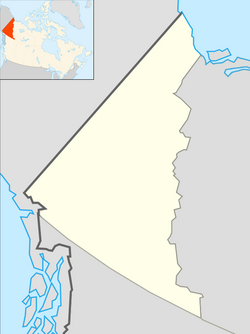
| Coordinates: 60°45′13″N 137°30′39″W / 60.75361°N 137.51083°W / 60.75361; -137.51083 | |
| Country | Canada |
| Territory | Yukon |
| Founded | 1942 |
| Incorporated | 1984 |
| Government | |
| • Village Mayor | Michael Riseborough |
| • Governing body | Village of Haines Junction Council |
| Area | |
| • Land | 34.3 km (13.2 sq mi) |
| Population | |
| • Total | 688 |
| • Density | 20.1/km (52/sq mi) |
| • Change 2016-2021 | |
| Time zone | UTC−07:00 (MST) |
| Postal code | Y0B 1L0 |
| Area code | +1-867 |
| Climate | Dfc / Dsc |
| Website | Official website |
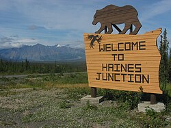
Haines Junction is a village in Yukon, Canada. It is at Kilometre 1,632 (historical mile 1016) of the Alaska Highway at its junction with the Haines Highway, hence the name of the community. According to the 2021 census, the population was 688. However, the Yukon Bureau of Statistics lists the population count for 2022 as 1,018.
Haines Junction lies east of Kluane National Park and Reserve. It is a major administrative centre for the Champagne and Aishihik First Nations.
History

For around two thousand years, the Southern Tutchone people had seasonal hunting and fishing camps in the area of present-day Haines Junction. The original name of the area was "Dakwakada", a Southern Tutchone word meaning "high cache". It was common for Tutchone people to use raised log caches to store food year-round or temporarily while they hunted and fished in an area.
The Haines Junction area was also important for trade between the coastal and interior peoples. It lies at the interior end of the Chilkat Pass, one of only three passes that allowed travel between the coast and the interior, which was used extensively for trade between the coastal Tlingit and Southern Tutchone people.
The current town of Haines Junction was established in 1942 and 1943 during the construction of the Alaska Highway (ALCAN). In 1943, a second highway, the Haines Highway, was built to connect the Alaska Highway with the coastal town of Haines, Alaska, over the Chilkat Pass. Situated at the junction of these two highways, Haines Junction was a construction camp and a supply and service centre for the United States Army Corps of Engineers building the highway. The 1,007 km (626 mi) Haines-Fairbanks Pipeline, a petroleum pipeline from Haines, Alaska to Fairbanks, Alaska that was constructed in 1953–55, with a pumping station was built just north of Haines Junction.
Geography
Climate
Haines Junction has a subarctic climate (Dfc / Dsc) with mild summers and long, cold and snowy winters, with annual snowfall averaging 159.8 cm (62.9 in).
| Climate data for Haines Junction WMO ID: 71505; coordinates 60°46′21″N 137°34′49″W / 60.77250°N 137.58028°W / 60.77250; -137.58028 (Haines Junction); elevation: 595.3 m (1,953 ft); 1991–2020 normals | |||||||||||||
|---|---|---|---|---|---|---|---|---|---|---|---|---|---|
| Month | Jan | Feb | Mar | Apr | May | Jun | Jul | Aug | Sep | Oct | Nov | Dec | Year |
| Record high humidex | 12.5 | 13.4 | 16.4 | 20.4 | 28.2 | 31.8 | 30.9 | 32.2 | 24.2 | 23.0 | 13.1 | 16.3 | 32.2 |
| Record high °C (°F) | 13.6 (56.5) |
13.6 (56.5) |
16.9 (62.4) |
20.7 (69.3) |
28.6 (83.5) |
32.1 (89.8) |
30.5 (86.9) |
31.0 (87.8) |
24.2 (75.6) |
23.8 (74.8) |
14.5 (58.1) |
16.9 (62.4) |
32.1 (89.8) |
| Mean daily maximum °C (°F) | −12.5 (9.5) |
−5.5 (22.1) |
0.0 (32.0) |
7.8 (46.0) |
14.3 (57.7) |
18.8 (65.8) |
20.3 (68.5) |
18.6 (65.5) |
13.5 (56.3) |
5.2 (41.4) |
−6.8 (19.8) |
−10.8 (12.6) |
5.2 (41.4) |
| Daily mean °C (°F) | −17.3 (0.9) |
−12.8 (9.0) |
−7.8 (18.0) |
0.9 (33.6) |
7.1 (44.8) |
11.5 (52.7) |
13.3 (55.9) |
11.5 (52.7) |
6.8 (44.2) |
−0.4 (31.3) |
−12.0 (10.4) |
−16.1 (3.0) |
−1.3 (29.7) |
| Mean daily minimum °C (°F) | −22.6 (−8.7) |
−20.0 (−4.0) |
−15.6 (3.9) |
−5.9 (21.4) |
−0.2 (31.6) |
4.1 (39.4) |
6.3 (43.3) |
4.4 (39.9) |
0.0 (32.0) |
−6.0 (21.2) |
−17.2 (1.0) |
−21.3 (−6.3) |
−7.8 (18.0) |
| Record low °C (°F) | −48.5 (−55.3) |
−45.6 (−50.1) |
−41.8 (−43.2) |
−31.3 (−24.3) |
−8.1 (17.4) |
−3.7 (25.3) |
−1.7 (28.9) |
−4.0 (24.8) |
−13.0 (8.6) |
−29.1 (−20.4) |
−44.1 (−47.4) |
−47.3 (−53.1) |
−48.5 (−55.3) |
| Record low wind chill | −57.0 | −50.1 | −46.5 | −34.4 | −10.1 | −5.1 | −3.5 | −5.0 | −13.1 | −28.3 | −50.1 | −50.3 | −57.0 |
| Average precipitation mm (inches) | 32.3 (1.27) |
18.6 (0.73) |
9.2 (0.36) |
9.0 (0.35) |
15.7 (0.62) |
28.3 (1.11) |
35.2 (1.39) |
28.5 (1.12) |
34.1 (1.34) |
35.4 (1.39) |
30.5 (1.20) |
29.0 (1.14) |
305.7 (12.04) |
| Average rainfall mm (inches) | 1.1 (0.04) |
0.6 (0.02) |
0.3 (0.01) |
0.8 (0.03) |
11.8 (0.46) |
28.3 (1.11) |
35.2 (1.39) |
28.3 (1.11) |
33.7 (1.33) |
13.3 (0.52) |
0.8 (0.03) |
0.1 (0.00) |
154.3 (6.07) |
| Average snowfall cm (inches) | 32.7 (12.9) |
19.4 (7.6) |
9.9 (3.9) |
8.8 (3.5) |
4.0 (1.6) |
0.0 (0.0) |
0.0 (0.0) |
0.1 (0.0) |
0.4 (0.2) |
23.2 (9.1) |
31.3 (12.3) |
29.8 (11.7) |
159.8 (62.9) |
| Average precipitation days (≥ 0.2 mm) | 10.0 | 8.0 | 5.0 | 4.0 | 5.0 | 8.0 | 9.0 | 9.0 | 9.0 | 10.0 | 9.0 | 11.0 | 96.0 |
| Average rainy days (≥ 0.2 mm) | — | — | — | — | 4.0 | 8.0 | 9.0 | 9.0 | 9.0 | 4.0 | — | — | 43.0 |
| Average snowy days (≥ 0.2 cm) | 10.0 | 8.0 | 5.0 | 4.0 | 2.0 | 0.0 | 0.0 | — | — | 7.0 | 9.0 | 11.0 | 54.0 |
| Average relative humidity (%) (at 1500 LST) | 71.0 | 57.6 | 42.9 | 38.0 | 34.6 | 39.2 | 44.2 | 46.6 | 49.6 | 60.9 | 75.6 | 77.2 | 53.1 |
| Source: Environment and Climate Change Canada Precipitation, rain, snow, precipitation days, rain days, and snow days from 1961-1990 station data | |||||||||||||
Demographics
| Year | Pop. | ±% |
|---|---|---|
| 1971 | 183 | — |
| 1976 | 268 | +46.4% |
| 1981 | 366 | +36.6% |
| 1986 | 340 | −7.1% |
| 1991 | 477 | +40.3% |
| 1996 | 574 | +20.3% |
| 2001 | 531 | −7.5% |
| 2006 | 589 | +10.9% |
| 2011 | 593 | +0.7% |
| 2016 | 613 | +3.4% |
| 2021 | 688 | +12.2% |
| Source: Statistics Canada | ||
In the 2021 Canadian census conducted by Statistics Canada, Haines Junction had a population of 688 living in 311 of its 380 total private dwellings, a change of 12.2% from its 2016 population of 613. With a land area of 34.3 km (13.2 sq mi), it had a population density of 20.1/km (52.0/sq mi) in 2021.
| Panethnic group | 2021 | 2016 | 2011 | 2006 | 2001 | |||||
|---|---|---|---|---|---|---|---|---|---|---|
| Pop. | % | Pop. | % | Pop. | % | Pop. | % | Pop. | % | |
| European | 370 | 54.01% | 335 | 55.37% | 330 | 53.23% | 320 | 54.7% | 305 | 57.55% |
| Indigenous | 290 | 42.34% | 255 | 42.15% | 270 | 43.55% | 245 | 41.88% | 215 | 40.57% |
| Southeast Asian | 15 | 2.19% | 0 | 0% | 0 | 0% | 10 | 1.71% | 0 | 0% |
| East Asian | 0 | 0% | 10 | 1.65% | 10 | 1.61% | 20 | 3.42% | 10 | 1.89% |
| South Asian | 0 | 0% | 10 | 1.65% | 0 | 0% | 0 | 0% | 0 | 0% |
| Latin American | 0 | 0% | 0 | 0% | 0 | 0% | 0 | 0% | 10 | 1.89% |
| Middle Eastern | 0 | 0% | 0 | 0% | 0 | 0% | 0 | 0% | 0 | 0% |
| African | 0 | 0% | 0 | 0% | 0 | 0% | 0 | 0% | 0 | 0% |
| Other/multiracial | 0 | 0% | 0 | 0% | 0 | 0% | 0 | 0% | 0 | 0% |
| Total responses | 685 | 99.56% | 605 | 98.69% | 620 | 104.55% | 585 | 99.32% | 530 | 99.81% |
| Total population | 688 | 100% | 613 | 100% | 593 | 100% | 589 | 100% | 531 | 100% |
| Note: Totals greater than 100% due to multiple origin responses | ||||||||||
Infrastructure

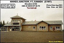
By road, Haines Junction is served by the Alaska Highway and the Haines Highway (Yukon Highway 3). By air, it is served by the Haines Junction Airport.
Fibre connections to most homes and businesses are becoming available in late 2022 / early 2023. Bell Mobility operates a cellular network tower in the area.
See also
Notes
- Statistic includes all persons that did not make up part of a visible minority or an indigenous identity.
- Statistic includes total responses of "Filipino" and "Southeast Asian" under visible minority section on census.
- Statistic includes total responses of "Chinese", "Korean", and "Japanese" under visible minority section on census.
- Statistic includes total responses of "West Asian" and "Arab" under visible minority section on census.
- Statistic includes total responses of "Visible minority, n.i.e." and "Multiple visible minorities" under visible minority section on census.
References
- "Haines Junction". Geographical Names Data Base. Natural Resources Canada.
- "Your Elected Officials". Archived from the original on 2019-01-26. Retrieved 2018-02-17.
- ^ "Population and dwelling counts: Canada, provinces and territories, and census subdivisions (municipalities), Yukon". Statistics Canada. February 9, 2022. Retrieved February 18, 2022.
- "Yukon Bureau of Statistics, Population Report Second Quarter, 2022" (PDF). www.yukon.ca. November 2022. Retrieved January 17, 2024.
- Hollinger, Kristy (April 2003). "The Haines-Fairbanks Pipeline" (PDF). www.arlis.org. Retrieved January 17, 2024.
- ^ "Canadian Climate Normals 1961-1990 Station Data". Environment and Climate Change Canada. June 27, 2024. Retrieved July 22, 2024.
- "Canadian Climate Normals 1991-2020 Data". Environment and Climate Change Canada. June 27, 2024. Retrieved July 22, 2024.
- "Table 2: Population of Census Subdivisions, 1921–1971". 1971 Census of Canada (PDF). Population. Vol. Census Subdivisions (Historical). Ottawa: Statistics Canada. July 1973. Retrieved January 30, 2022.
- "1976 Census of Canada: Population - Geographic Distributions" (PDF). Statistics Canada. June 1977. Retrieved January 30, 2022.
- "1981 Census of Canada: Census subdivisions in decreasing population order" (PDF). Statistics Canada. May 1992. Retrieved January 30, 2021.
- "1986 Census: Population - Census Divisions and Census Subdivisions" (PDF). Statistics Canada. September 1987. Retrieved January 30, 2022.
- "91 Census: Census Divisions and Census Subdivisions - Population and Dwelling Counts" (PDF). Statistics Canada. April 1992. Retrieved January 30, 2022.
- "96 Census: A National Overview - Population and Dwelling Counts" (PDF). Statistics Canada. April 1997. Retrieved January 30, 2022.
- "Population and Dwelling Counts, for Canada, Provinces and Territories, and Census Subdivisions (Municipalities), 2001 and 1996 Censuses - 100% Data (Yukon Territory)". Statistics Canada. August 15, 2012. Retrieved January 30, 2022.
- "Population and dwelling counts, for Canada, provinces and territories, and census subdivisions (municipalities), 2006 and 2001 censuses - 100% data (Yukon Territory)". Statistics Canada. August 20, 2021. Retrieved January 30, 2022.
- "Population and dwelling counts, for Canada, provinces and territories, and census subdivisions (municipalities), 2011 and 2006 censuses (Yukon)". Statistics Canada. July 25, 2021. Retrieved January 30, 2022.
- "Population and dwelling counts, for Canada, provinces and territories, and census subdivisions (municipalities), 2016 and 2011 censuses – 100% data (Yukon)". Statistics Canada. February 8, 2017. Retrieved January 30, 2022.
- Government of Canada, Statistics Canada (2022-10-26). "Census Profile, 2021 Census of Population". www12.statcan.gc.ca. Retrieved 2024-04-27.
- Government of Canada, Statistics Canada (2021-10-27). "Census Profile, 2016 Census". www12.statcan.gc.ca. Retrieved 2024-04-27.
- Government of Canada, Statistics Canada (2015-11-27). "NHS Profile". www12.statcan.gc.ca. Retrieved 2024-04-27.
- Government of Canada, Statistics Canada (2019-08-20). "2006 Community Profiles". www12.statcan.gc.ca. Retrieved 2024-04-27.
- Government of Canada, Statistics Canada (2019-07-02). "2001 Community Profiles". www12.statcan.gc.ca. Retrieved 2024-04-27.
External links
- Official website
 Haines Junction travel guide from Wikivoyage