| Lendenfeld Peak | |
|---|---|
 Lendenfeld Peak (second from right), with the Hochstetter Glacier in the foreground Lendenfeld Peak (second from right), with the Hochstetter Glacier in the foreground | |
| Highest point | |
| Elevation | 3,194 m (10,479 ft) |
| Prominence | 101 m (331 ft) |
| Coordinates | 43°33′37″S 170°10′10″E / 43.560142°S 170.169453°E / -43.560142; 170.169453 |
| Geography | |
 | |
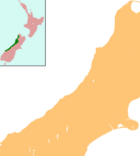
| Location | South Island, New Zealand |
| Parent range | Southern Alps |
| Climbing | |
| First ascent | February 1907 by Alex Graham and Henry Newton |
Lendenfeld Peak (3,194 metres or 10,479 feet), in the past also Mount Lendenfeld, is the eighth highest named summit in New Zealand and in Aoraki / Mount Cook National Park.
The summit is named after the Austrian zoologist and mountaineer Robert J. Lendlmayer von Lendenfeld. It is on the northeast ridge of Mount Tasman, separated from it by the Engineer Col (3093 m). It is normally climbed from the New Zealand Alpine Club hut on the Fox Glacier. The normal route from the Marcel Col (2,987 metres or 9,800 feet) over the east ridge is a relatively easy ascent in good conditions. The best time to climb this mountain is between September and March.
See also
References
- LINZ's 1:50,000 maps at the interactive topographic map of New Zealand
- "Lendenfeld Pk". Climb NZ. Retrieved 7 February 2015.
- "Mount Lendenfeld – Climbing, Hiking & Mountaineering". mountain-forecast.com. Retrieved 4 December 2020.
- Sources
- Bell, James Mackintosh (1907). "The Heart of the Southern Alps, New Zealand". The Geographical Journal: 181. Retrieved 30 October 2008.
- O'Donnell, E. J. "Du Faur, Emmeline Freda (1882–1935)". Australian Dictionary of Biography, Online Edition. Australian National University. ISSN 1833-7538. Retrieved 30 October 2008.
she conquered ... Mount Lendenfeld (3192 m, second ascent).
| Westland Tai Poutini National Park, New Zealand | |
|---|---|
| Mountains | |
| Mountain passes | |
| Glaciers | |
| Lakes | |
| Rivers | |
| Lagoons | |
| Walking tracks | |
| Huts | |
| Reserves and World Heritage Sites | |
| Events | |
| Aoraki / Mount Cook National Park, New Zealand | |
|---|---|
| Mountains | |
| Mountain ranges | |
| Glaciers | |
| Lakes | |
| Rivers | |
| Other geographic features | |
| Settlements and buildings | |
| Walking and cycling tracks | |
| Reserves and World Heritage Sites | |
This West Coast Region (New Zealand) geography article is a stub. You can help Misplaced Pages by expanding it. |
This Canterbury Region-related geography article is a stub. You can help Misplaced Pages by expanding it. |