Municipality in Quebec, Canada
| Les Hauteurs | |
|---|---|
| Municipality | |
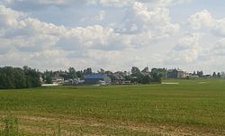
 View of the village of Les Hauteurs View of the village of Les Hauteurs | |
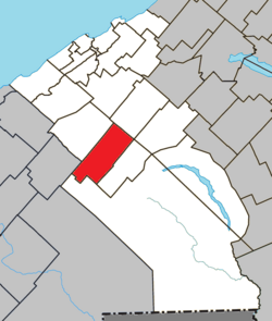
 Location within La Mitis RCM Location within La Mitis RCM | |
 | |
| Coordinates: 48°23′N 68°07′W / 48.383°N 68.117°W / 48.383; -68.117 | |
| Country | Canada |
| Province | Quebec |
| Region | Bas-Saint-Laurent |
| RCM | La Mitis |
| Constituted | November 7, 1918 |
| Government | |
| • Mayor | Gitane Michaud |
| • Federal riding | Avignon—La Mitis—Matane—Matapédia |
| • Prov. riding | Matane-Matapédia |
| Area | |
| • Total | 104.40 km (40.31 sq mi) |
| • Land | 102.92 km (39.74 sq mi) |
| Population | |
| • Total | 485 |
| • Density | 4.7/km (12/sq mi) |
| • Pop 2016-2021 | |
| • Dwellings | 263 |
| Time zone | UTC−05:00 (EST) |
| • Summer (DST) | UTC−04:00 (EDT) |
| Postal code(s) | G0K 1C0 |
| Area code(s) | 418 and 581 |
| Highways | |
| Website | municipalite. leshauteurs.qc.ca |
Les Hauteurs (French pronunciation: [le otœʁ]) is a municipality in Quebec, Canada.
Demographics
In the 2021 Census of Population conducted by Statistics Canada, Les Hauteurs had a population of 485 living in 217 of its 263 total private dwellings, a change of -3.8% from its 2016 population of 504. With a land area of 102.92 km (39.74 sq mi), it had a population density of 4.7/km (12.2/sq mi) in 2021.
Canada census – Les Hauteurs community profile| 2021 | 2016 | 2011 | |
|---|---|---|---|
| Population | 485 (-3.8% from 2016) | 504 (-3.8% from 2011) | 524 (-9.0% from 2006) |
| Land area | 102.92 km (39.74 sq mi) | 103.04 km (39.78 sq mi) | 102.28 km (39.49 sq mi) |
| Population density | 4.7/km (12/sq mi) | 4.9/km (13/sq mi) | 5.1/km (13/sq mi) |
| Median age | 45.6 (M: 48.4, F: 43.2) | 44.9 (M: 47.5, F: 42.0) | 44.9 (M: 47.5, F: 41.5) |
| Private dwellings | 263 (total) 217 (occupied) | 263 (total) | 249 (total) |
| Median household income | $49,600 | $40,064 | $34,705 |
See also
References
- "Les Hauteurs". Geographical Names Data Base. Natural Resources Canada.
- "Banque de noms de lieux du Québec: Reference number 283934". toponymie.gouv.qc.ca (in French). Commission de toponymie du Québec.
- ^ "Répertoire des municipalités: Geographic code 09015". www.mamh.gouv.qc.ca (in French). Ministère des Affaires municipales et de l'Habitation.
- ^ "2021 Community Profiles". 2021 Canadian census. Statistics Canada. February 4, 2022. Retrieved 2024-12-04. Cite error: The named reference "cp2021" was defined multiple times with different content (see the help page).
- "2016 Community Profiles". 2016 Canadian census. Statistics Canada. August 12, 2021. Retrieved 2024-12-04.
- "2011 Community Profiles". 2011 Canadian census. Statistics Canada. March 21, 2019. Retrieved 2024-12-04.
- "2006 Community Profiles". 2006 Canadian census. Statistics Canada. August 20, 2019.
- "2001 Community Profiles". 2001 Canadian census. Statistics Canada. July 18, 2021.
External links
 Media related to Les Hauteurs at Wikimedia Commons
| Adjacent municipal subdivisions | ||||||||||||||||
|---|---|---|---|---|---|---|---|---|---|---|---|---|---|---|---|---|
| ||||||||||||||||
| Cities & towns | |
|---|---|
| Municipalities | |
| Parishes | |
| Villages | |
| Unorganized territories | |
| |
This Quebec location article is a stub. You can help Misplaced Pages by expanding it. |