You can help expand this article with text translated from the corresponding article in French. (September 2021) Click for important translation instructions.
|
| Les Moutiers-en-Retz | |
|---|---|
| Commune | |
 | |
 Coat of arms Coat of arms | |
| Location of Les Moutiers-en-Retz | |
  | |
| Coordinates: 47°03′48″N 2°00′01″W / 47.063369°N 2.000159°W / 47.063369; -2.000159 | |
| Country | France |
| Region | Pays de la Loire |
| Department | Loire-Atlantique |
| Arrondissement | Saint-Nazaire |
| Canton | Pornic |
| Intercommunality | CA Pornic Agglo Pays de Retz |
| Government | |
| • Mayor (2020–2026) | Pascale Briand |
| Area | 9.57 km (3.69 sq mi) |
| Population | 1,827 |
| • Density | 190/km (490/sq mi) |
| Time zone | UTC+01:00 (CET) |
| • Summer (DST) | UTC+02:00 (CEST) |
| INSEE/Postal code | 44106 /44760 |
| Elevation | 0–39 m (0–128 ft) |
| French Land Register data, which excludes lakes, ponds, glaciers > 1 km (0.386 sq mi or 247 acres) and river estuaries. | |
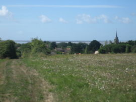
Les Moutiers-en-Retz (French pronunciation: [le mutje ɑ̃ ʁɛ] , literally Les Moutiers in Retz; Breton: Mousteroù-Raez) is a commune in the Loire-Atlantique department in western France.
Climate
The climate which characterises the town was classified, in 2010, as a “frank oceanic climate” (French: climat océanique franc), according to the typology of climates of France [fr] which identified eight major types of climates in metropolitan France. In 2020, the town was classified as having an “oceanic climate” type using the classification established by Météo-France, which only has five main types of climates for mainland France. This type of climate is characterised by mild temperatures and relatively abundant rainfall (in conjunction with disturbances from the Atlantic), distributed throughout the year with a slight maximum from October to February.
The climatic parameters which made it possible to establish the 2010 typology include six variables for temperature and eight for precipitation, the values of which correspond to the monthly data for the 1971–2000 norm. The seven main variables characterising the municipality are presented in the box below.
Municipal climatic parameters over the period 1971–2000
|
These variables have evolved with climate change. A study carried out in 2014 by the General Directorate of Energy and Climate [fr], supplemented by regional studies, indeed predicts that the average temperature should increase and the average rainfall decrease, but with strong regional variations. These changes have been recorded on the nearest Météo-France meteorological station in Pornic, in service since 1919, 10km north of Moutiers-en-Retz, where the mean annual temperature is 13°C and the rainfall is 738.1 mm for the period 1981–2010. At the next closest historical meteorological station, "Nantes-Bouguenais", 31 km east inland of Moutiers-en-Retz in the town of Bouguenais, operational since 1945, the annual average temperature changes by 12.2 °C for the period 1971–2000, 12.5 °C for 1981–2010, then 12.7 °C for 1991–2020.
Population
| Year | Pop. | ±% p.a. |
|---|---|---|
| 1968 | 614 | — |
| 1975 | 635 | +0.48% |
| 1982 | 693 | +1.26% |
| 1990 | 739 | +0.81% |
| 1999 | 905 | +2.28% |
| 2007 | 1,188 | +3.46% |
| 2012 | 1,421 | +3.65% |
| 2017 | 1,640 | +2.91% |
| Source: INSEE | ||
Transport
Les Moutiers-en-Retz station is served by train services between Pornic and Nantes.
See also
Notes
- Annual thermal amplitude measures the difference between the average temperature of July and January. This variable is generally recognised as a discriminating criterion between oceanic and continental climates.
References
- "Répertoire national des élus: les maires" (in French). data.gouv.fr, Plateforme ouverte des données publiques françaises. 13 September 2022.
- "Populations légales 2021" (in French). The National Institute of Statistics and Economic Studies. 28 December 2023.
- ^ Joly, Daniel; Brossard, Thierry; Cardot, Hervé; Cavailhes, Jean; Hilal, Mohamed; Wavresky, Pierre (18 June 2010). "Les types de climats en France, une construction spatiale" [Climate types in France, a spatial construction]. Cybergéo (in French) (501). doi:10.4000/cybergeo.23155.
- "Le climat en France métropolitaine" [The climate in metropolitan France] (in French). 4 February 2020. Retrieved 16 July 2021.
- "Définition d'une normale climatologique" [Definition of a climatological norm] (in French). Retrieved 16 July 2021.
- "Le climat de la France au XXIe siècle - Volume 4 - Scénarios régionalisés : édition 2014 pour la métropole et les régions d'outre-mer" [The climate of France in the 21st century - Volume 4 - Regionalized scenarios: 2014 edition for metropolitan France and overseas regions] (PDF) (in French). Direction générale de l'Énergie et du Climat. Retrieved 12 June 2021..
- "Observatoire régional sur l'agriculture et le changement climatique (ORACLE) - Pays de la Loire" [Regional Observatory on Agriculture and Climate Change (ORACLE) - Pays de la Loire] (PDF) (in French). Pays de la Loire Chambers of Agriculture. 2018. Retrieved 16 July 2021.
- "Station Météo-France Pornic - métadonnées" (PDF). Météo-France. Retrieved 16 July 2021.
- "Station Météo-France Pornic - fiche climatologique - statistiques 1981-2010 et records" (PDF) (in French). Météo-France. Retrieved 16 July 2021..
- "Station météorologique de Nantes-Bouguenais - Normales pour la période 1971-2000" [Nantes-Bouguenais meteorological station - Norms for the period 1971-2000] (in French). www.infoclimat.fr. Retrieved 16 July 2021.
- "Station météorologique de Nantes-Bouguenais - Normales pour la période 1991-2020" [Nantes-Bouguenais meteorological station - Norms for the period 1991-2020] (in French). www.infoclimat.fr/. Retrieved 16 July 2021.
- Population en historique depuis 1968, INSEE
This Loire-Atlantique geographical article is a stub. You can help Misplaced Pages by expanding it. |