Map all coordinates using OpenStreetMap
Download coordinates as:
| This list is incomplete; you can help by adding missing items. (February 2011) |
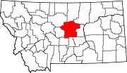
There are at least 14 named lakes and reservoirs in Fergus County, Montana.
Lakes
- Crystal Lake, 46°48′01″N 109°30′55″W / 46.80028°N 109.51528°W / 46.80028; -109.51528 (Crystal Lake), el. 6,014 feet (1,833 m)
Reservoirs
- Bear Creek Reservoir, 47°16′21″N 108°40′58″W / 47.27250°N 108.68278°W / 47.27250; -108.68278 (Bear Creek Reservoir), el. 3,143 feet (958 m)
- Carters Pond, 47°08′31″N 109°25′44″W / 47.14194°N 109.42889°W / 47.14194; -109.42889 (Carters Pond), el. 4,022 feet (1,226 m)
- Flat Top Reservoir, 47°37′17″N 108°47′11″W / 47.62139°N 108.78639°W / 47.62139; -108.78639 (Flat Top Reservoir), el. 2,890 feet (880 m)
- Harri Reservoir, 47°25′51″N 108°34′04″W / 47.43083°N 108.56778°W / 47.43083; -108.56778 (Harri Reservoir), el. 2,881 feet (878 m)
- Jakes Reservoir, 47°30′28″N 108°37′22″W / 47.50778°N 108.62278°W / 47.50778; -108.62278 (Jakes Reservoir), el. 3,002 feet (915 m)
- Jordan Reservoir, 47°26′30″N 108°38′05″W / 47.44167°N 108.63472°W / 47.44167; -108.63472 (Jordan Reservoir), el. 2,923 feet (891 m)
- Kachia Reservoir, 47°23′29″N 108°34′53″W / 47.39139°N 108.58139°W / 47.39139; -108.58139 (Kachia Reservoir), el. 2,943 feet (897 m)
- Kosier Reservoir, 47°24′17″N 108°38′12″W / 47.40472°N 108.63667°W / 47.40472; -108.63667 (Kosier Reservoir), el. 2,910 feet (890 m)
- Lincoln Reservoir, 47°22′31″N 108°42′18″W / 47.37528°N 108.70500°W / 47.37528; -108.70500 (Lincoln Reservoir), el. 3,064 feet (934 m)
- Rindal Reservoir, 47°22′00″N 109°01′39″W / 47.36667°N 109.02750°W / 47.36667; -109.02750 (Rindal Reservoir), el. 3,652 feet (1,113 m)
- Sloan Reservoir, 47°23′26″N 108°42′00″W / 47.39056°N 108.70000°W / 47.39056; -108.70000 (Sloan Reservoir), el. 3,045 feet (928 m)
- Stafford Reservoir, 47°33′56″N 109°23′36″W / 47.56556°N 109.39333°W / 47.56556; -109.39333 (Stafford Reservoir), el. 3,241 feet (988 m)
- Upper Carters Pond, 47°09′05″N 109°25′38″W / 47.15139°N 109.42722°W / 47.15139; -109.42722 (Upper Carters Pond), el. 4,062 feet (1,238 m)
See also
Notes
- "Crystal Lake". Geographic Names Information System. United States Geological Survey, United States Department of the Interior.
- "Bear Creek Reservoir". Geographic Names Information System. United States Geological Survey, United States Department of the Interior.
- "Carters Pond". Geographic Names Information System. United States Geological Survey, United States Department of the Interior.
- "Flat Top Reservoir". Geographic Names Information System. United States Geological Survey, United States Department of the Interior.
- "Harri Reservoir". Geographic Names Information System. United States Geological Survey, United States Department of the Interior.
- "Jakes Reservoir". Geographic Names Information System. United States Geological Survey, United States Department of the Interior.
- "Jordan Reservoir". Geographic Names Information System. United States Geological Survey, United States Department of the Interior.
- "Kachia Reservoir". Geographic Names Information System. United States Geological Survey, United States Department of the Interior.
- "Kosier Reservoir". Geographic Names Information System. United States Geological Survey, United States Department of the Interior.
- "Lincoln Reservoir". Geographic Names Information System. United States Geological Survey, United States Department of the Interior.
- "Rindal Reservoir". Geographic Names Information System. United States Geological Survey, United States Department of the Interior.
- "Sloan Reservoir". Geographic Names Information System. United States Geological Survey, United States Department of the Interior.
- "Stafford Reservoir". Geographic Names Information System. United States Geological Survey, United States Department of the Interior.
- "Upper Carters Pond". Geographic Names Information System. United States Geological Survey, United States Department of the Interior.
| Municipalities and communities of Fergus County, Montana, United States | ||
|---|---|---|
| County seat: Lewistown | ||
| City |  | |
| Towns | ||
| CDPs | ||
| Other communities | ||
| Ghost town | ||
| Indian reservation | ||
| Footnotes | ‡This populated place also has portions in an adjacent county or counties | |