| This article does not cite any sources. Please help improve this article by adding citations to reliable sources. Unsourced material may be challenged and removed. Find sources: "Madona district" – news · newspapers · books · scholar · JSTOR (May 2013) (Learn how and when to remove this message) |
| Madona district Madonas rajons | |
|---|---|
| District | |
 Coat of arms Coat of arms | |
 | |
| Country | Latvia |
| Area | |
| • Total | 3,349.3 km (1,293.2 sq mi) |
| Population | |
| • Total | 44,306 |
| • Density | 13/km (34/sq mi) |
| Website | madona.lv/ |
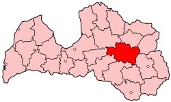
Madona district (Latvian: Madonas rajons) was an administrative division of Latvia from 1949 to 2009. it was located in the Vidzeme and Latgale regions in the country's east. Within the district is the highest point in Latvia - Gaiziņkalns. The district also bordered Latvia's largest lake, Lake Lubāns.
Districts were eliminated during the administrative-territorial reform in 2009. Most of Madona district was merged with the town of Madona to form Madona Municipality. Cesvaine, Ērgļi, Lubāna and Varakļāni were split off as separate municipalities until 2021.
Cities
| Madona Municipality | |
|---|---|
| Towns | |
| Parishes | |
| Defunct counties and districts of Latvia | |
|---|---|
| Former counties (dissolved before 1949) | |
| Former districts (dissolved 2009) |
|
56°51′N 26°13′E / 56.850°N 26.217°E / 56.850; 26.217
This Vidzeme location article is a stub. You can help Misplaced Pages by expanding it. |
This Latgale location article is a stub. You can help Misplaced Pages by expanding it. |