 Map of Missouri State Parks (red) and
State Historic Sites (blue)
This is a list of state parks and state historic sites in Missouri. In the U.S. state of Missouri both state parks and state historic sites are administered by the Division of State Parks of the Missouri Department of Natural Resources. As of 2017 the division manages a total of 92 parks and historic sites plus the Roger Pryor Pioneer Backcountry, which together total more than 200,000 acres (81,000 ha). According to the state, its parks system includes approximately 3,500 campsites, 194 cabins, and 1,000 miles (1,600 km) of trails, including the longest developed rails-to-trails project in the nation.


State parks
| Name | County | Size | Estab- lished | |
|---|---|---|---|---|
| Babler State Park | St. Louis | 2,441 acres | 988 ha | 1937 |
| Sam A. Baker State Park | Wayne | 5,323.62 acres | 2,154.39 ha | 1926 |
| Bennett Spring State Park | Dallas, Laclede | 3,216.74 acres | 1,301.77 ha | 1923 |
| Big Lake State Park | Holt | 407.41 acres | 164.87 ha | 1932 |
| Big Oak Tree State Park | Mississippi | 1,028.68 acres | 416.29 ha | 1937 |
| Big Sugar Creek State Park | McDonald | 2,082.54 acres | 842.77 ha | 1992 |
| Bryant Creek State Park | Douglas | 2,917 acres | 1,180 ha | 2016 |
| Castlewood State Park | St. Louis | 1,818.3 acres | 735.8 ha | 1974 |
| Crowder State Park | Grundy | 1,912.10 acres | 773.80 ha | 1938 |
| Cuivre River State Park | Lincoln | 6,393.94 acres | 2,587.54 ha | 1946 |
| Current River State Park | Shannon | 780 acres | 320 ha | 2008 |
| Don Robinson State Park | Jefferson | 843 acres | 341 ha | 2012 |
| Echo Bluff State Park | Shannon | 410 acres | 170 ha | 2016 |
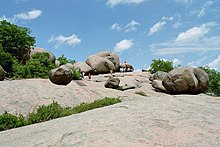
| Elephant Rocks State Park | Iron | 131.74 acres | 53.31 ha | 1967 |
| Eleven Point State Park | Oregon | 4,167 acres | 1,686 ha | 2016 |
| Finger Lakes State Park | Boone | 1,128.69 acres | 456.76 ha | 1973 |
| Graham Cave State Park | Montgomery | 369.51 acres | 149.54 ha | 1964 |
| Grand Gulf State Park | Oregon | 321.96 acres | 130.29 ha | 1984 |
| Ha Ha Tonka State Park | Camden | 3,709.74 acres | 1,501.28 ha | 1978 |
| Harry S Truman State Park | Benton | 1,440 acres | 580 ha | 1976 |
| Hawn State Park | Ste. Genevieve | 4,953.66 acres | 2,004.68 ha | 1955 |
| Jay Nixon State Park | Reynolds | 1,230 acres | 500 ha | 2017 |
| Johnson's Shut-Ins State Park | Reynolds | 8,549.51 acres | 3,459.86 ha | 1955 |
| Jones-Confluence Point State Park | St. Charles | 1,121.43 acres | 453.83 ha | 2001 |
| Katy Trail State Park | Boone, Callaway, Cooper, Henry, Howard, Montgomery, Pettis, St. Charles, Warren | 239.6 mi | 385.6 km | 1990 |
| Knob Noster State Park | Johnson | 3,934.38 acres | 1,592.19 ha | 1946 |
| Lake of the Ozarks State Park | Camden, Miller | 17,626.55 acres | 7,133.21 ha | 1946 |
| Lake Wappapello State Park | Wayne | 1,854.23 acres | 750.38 ha | 1956 |
| Lewis and Clark State Park | Buchanan | 189.13 acres | 76.54 ha | 1934 |
| Long Branch State Park | Macon | 1,828.47 acres | 739.96 ha | 1983 |
| Mark Twain State Park | Monroe | 2,775.14 acres | 1,123.06 ha | 1924 |
| Meramec State Park | Crawford, Franklin, Washington |
6,896.33 acres | 2,790.85 ha | 1927 |
| Montauk State Park | Dent | 1,396.12 acres | 564.99 ha | 1926 |
| Morris State Park | Dunklin | 161.22 acres | 65.24 ha | 2000 |
| Onondaga Cave State Park | Crawford | 1,317.70 acres | 533.25 ha | 1982 |
| Ozark Mountain State Park | Taney | 1,011 acres | 409 ha | 2016 |
| Pershing State Park | Linn | 3,565.66 acres | 1,442.97 ha | 1937 |
| Pomme de Terre State Park | Hickory | 734.44 acres | 297.22 ha | 1960 |
| Prairie State Park | Barton | 3,942 acres | 1,595 ha | 1980 |
| Roaring River State Park | Barry | 4,093.38 acres | 1,656.53 ha | 1928 |
| Robertsville State Park | Franklin | 1,224.65 acres | 495.60 ha | 1979 |
| Rock Bridge Memorial State Park | Boone | 2,272.83 acres | 919.78 ha | 1967 |
| Rock Island Trail State Park | Cass, Henry, Johnson | 47.5 mi | 76.4 km | 2016 |
| Roger Pryor Pioneer Backcountry | Dent, Shannon | 60,000 acres | 24,000 ha | 2001 |
| Route 66 State Park | St. Louis | 418.61 acres | 169.41 ha | 1997 |
| St. Francois State Park | St. Francois | 2,734.97 acres | 1,106.80 ha | 1964 |
| St. Joe State Park | St. Francois | 8,242.98 acres | 3,335.82 ha | 1976 |
| Stockton State Park | Cedar | 2,175.90 acres | 880.56 ha | 1969 |
| Table Rock State Park | Stone, Taney | 356.03 acres | 144.08 ha | 1959 |
| Taum Sauk Mountain State Park | Iron, Reynolds | 7,501.09 acres | 3,035.58 ha | 1991 |
| Thousand Hills State Park | Adair | 3,079.70 acres | 1,246.31 ha | 1952 |
| Trail of Tears State Park | Cape Girardeau | 3,415.39 acres | 1,382.16 ha | 1957 |
| Van Meter State Park | Saline | 1,104.63 acres | 447.03 ha | 1932 |
| Wakonda State Park | Lewis | 1,053.87 acres | 426.49 ha | 1960 |
| Wallace State Park | Clinton | 501.61 acres | 202.99 ha | 1932 |
| Washington State Park | Washington | 2,147.57 acres | 869.09 ha | 1932 |
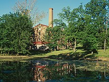
| Watkins Woolen Mill State Park | Clay | 1,500.22 acres | 607.12 ha | 1964 |
| Weston Bend State Park | Platte | 1,133.08 acres | 458.54 ha | 1980 |
State historic sites
See also
References
- ^ "About the Missouri State Park System". Missouri State Parks. Missouri Department of Natural Resources. Retrieved October 8, 2014.
- ^ connie.schmidt (January 18, 2018). "Park/Site Data Sheets". mostateparks.com. Retrieved November 3, 2024.
- ^ jennifer.sieg (August 25, 2011). "State Park Land Acquisition Summary". mostateparks.com. Retrieved November 3, 2024.
- jim.malven (December 7, 2022). "Rock Island Trail State Park". mostateparks.com. Retrieved November 3, 2024.
External links
- Missouri State Parks and Historic Sites Missouri Department of Natural Resources
- Missouri State Parks - List of Parks and Historic Sites Missouri Department of Natural Resources