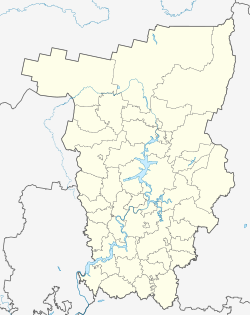
| Nyrob Ныроб | |
|---|---|
| Work settlement | |
 Flag Flag Coat of arms Coat of arms | |
| Location of Nyrob | |
  | |
| Coordinates: 60°44′22″N 56°43′25″E / 60.73944°N 56.72361°E / 60.73944; 56.72361 | |
| Country | Russia |
| Federal subject | Perm Krai |
| Administrative district | Cherdynsky District |
| Population | |
| • Total | 5,523 |
| Time zone | UTC+5 (MSK+2 |
| Postal code(s) | 618630 |
| OKTMO ID | 57656157051 |
Nyrob (Russian: Ныроб) is an urban locality (a work settlement) in Cherdynsky District of Perm Krai, Russia. Population: 5,523 (2010 Census); 7,500 (2002 Census); 5,526 (1989 Soviet census).
Etymology
The name of settlement is a concatenation of Komi-Permyak words "ныр" (meaning "nose") and "ыб" (meaning "field"). With "Nose" being one of the first residents of the locality, the name as a whole can be translated as "a field belonging to Nose".
History
It was first mentioned in written sources in 1579.
It served as the administrative center of Nyrobsky District between February 27, 1924 and June 10, 1931 and then again between October 20, 1931 and November 4, 1959. Urban-type settlement status was granted to it in 1963.
Architecture
There are some architectural sights. One of them is Nikolskaya Church (completed in 1704); to the west of it there is also Bogoyavlenskaya Church (1736).
Transportation
Nyrob is connected with the town of Cherdyn by a 41-kilometer (25 mi) long paved road.
References
- ^ Russian Federal State Statistics Service (2011). Всероссийская перепись населения 2010 года. Том 1 [2010 All-Russian Population Census, vol. 1]. Всероссийская перепись населения 2010 года (in Russian). Federal State Statistics Service.
- "Об исчислении времени". Официальный интернет-портал правовой информации (in Russian). June 3, 2011. Retrieved January 19, 2019.
- Почта России. Информационно-вычислительный центр ОАСУ РПО. (Russian Post). Поиск объектов почтовой связи (Postal Objects Search) (in Russian)
- Federal State Statistics Service (May 21, 2004). Численность населения России, субъектов Российской Федерации в составе федеральных округов, районов, городских поселений, сельских населённых пунктов – районных центров и сельских населённых пунктов с населением 3 тысячи и более человек [Population of Russia, Its Federal Districts, Federal Subjects, Districts, Urban Localities, Rural Localities—Administrative Centers, and Rural Localities with Population of Over 3,000] (XLS). Всероссийская перепись населения 2002 года (in Russian).
- Всесоюзная перепись населения 1989 г. Численность наличного населения союзных и автономных республик, автономных областей и округов, краёв, областей, районов, городских поселений и сёл-райцентров [All Union Population Census of 1989: Present Population of Union and Autonomous Republics, Autonomous Oblasts and Okrugs, Krais, Oblasts, Districts, Urban Settlements, and Villages Serving as District Administrative Centers]. Всесоюзная перепись населения 1989 года (in Russian). Институт демографии Национального исследовательского университета: Высшая школа экономики . 1989 – via Demoscope Weekly.
| Administrative divisions of Perm Krai | |||
|---|---|---|---|
| Administrative center: Perm • Rural localities | |||
| Administrative districts |
| ||
| Administrative districts of Komi-Permyak Okrug | |||
| Closed administrative-territorial formations | |||
| Cities and towns (all levels) | |||
| Urban-type settlements | |||
Categories: