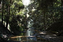
River in New South Wales, Australia
| Ourimbah Ourinbah Creek | |
|---|---|
 | |
| Etymology | Aboriginal: meaning bora or ceremonial ground; word for "the sacred circle on the initiation site for investing the Oorin or belt of manhood" |
| Location | |
| Country | Australia |
| State | New South Wales |
| Region | Sydney Basin (IBRA), Central Coast |
| Local government area | Central Coast |
| Physical characteristics | |
| Source | Hunter Range |
| • location | near Kulnura |
| • elevation | 304 m (997 ft) |
| Mouth | Tuggerah Lake |
| • location | near Tuggerah |
| • elevation | 7 m (23 ft) |
| Length | 37 km (23 mi) |
| Basin features | |
| River system | Central Coast catchment |
| Nature reserve | Jilliby State Conservation Area |

Ourimbah Creek, a perennial river of the Central Coast catchment, is located in the Central Coast region of New South Wales, Australia.
Course and features
Ourimbah Creek rises on the southern slopes of the Hunter Range, about 1.6 kilometres (0.99 mi) south of Kulnura. The river flows generally south southeast and east northeast, before reaching its mouth within Tuggerah Lake, about 4.8 kilometres (3.0 mi) southeast of Tuggerah. The river descends 304 metres (997 ft) over its 37-kilometre (23 mi) course.
Ourimbah Creek and the Wyong River supply most of the fresh water that flows into Tuggerah Lake, which is usually open to the Tasman Sea at The Entrance.
The Pacific Motorway and the Pacific Highway both cross the river, at Kangy Angy.
Etymology
The name of the town Ourimbah, near which the river passes, is derived from the Australian Aboriginal word meaning bora or ceremonial ground; or the word for "the sacred circle on the initiation site for investing the Oorin or belt of manhood".
See also
References
- ^ "Ourimbah Creek". Geographical Names Register (GNR) of NSW. Geographical Names Board of New South Wales. Retrieved 19 October 2013.

- ^ "Map of Ourimbah Creek, NSW". Bonzle Digital Atlas of Australia. Retrieved 19 October 2013.
- Reed, A. W. (1984). Place name of Australia (3rd reprint ed.). Frenchs Forest, New South Wales: Reed Books. p. 171. ISBN 0-589-50128-3.
External links
- "Lake Macquarie & Tuggerah Lakes catchments" (map). Office of Environment and Heritage. Government of New South Wales.
33°20′S 151°20′E / 33.333°S 151.333°E / -33.333; 151.333
Categories: