| This article needs additional citations for verification. Please help improve this article by adding citations to reliable sources. Unsourced material may be challenged and removed. Find sources: "Salient" geography – news · newspapers · books · scholar · JSTOR (July 2016) (Learn how and when to remove this message) |

A salient, panhandle, or bootheel is an elongated protrusion of a geopolitical entity, such as a subnational entity or a sovereign state.
While similar to a peninsula in shape, a salient is most often not surrounded by water on three sides. Instead, it has a land border on at least two sides and extends from the larger geographical body of the administrative unit.
In American English, the term panhandle is often used to describe a relatively long and narrow salient, such as the westernmost extensions of Florida and Oklahoma, or the northernmost portion of Idaho. Another term is bootheel, used for the Missouri Bootheel and New Mexico Bootheel areas.
Origin
The term salient is derived from military salients. The term "panhandle" derives from the analogous part of a cooking pan, and its use is generally confined to North America.
The salient shape can be the result of arbitrarily drawn international or subnational boundaries, though the location of administrative borders can also take into account other considerations such as economic ties or topography.
Country-level salients
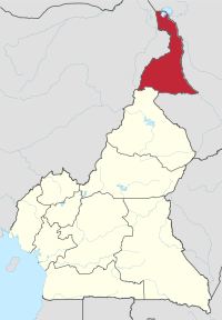
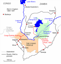
Africa
Asia


Europe

South America

| Salient | Country |
|---|---|
| Misiones | |
| Leticia Trapeze | |
| Southeast Guainía Department | |
| Yavaraté, Vaupés Department | |
| Petén Department | |
| Tumbes Region | |
| Amazonas |
North America
| Salient | Country |
|---|---|
| Southeast Alaska | |
| Southern Ontario (particularly Ontario Peninsula) | |
| Tatshenshini-Alsek Park, British Columbia | |
| Madawaska County, New Brunswick | |
| Labrador West, Newfoundland and Labrador |
Subnational salients
The following locations are salients in First-level administrative subdivisions of nations.
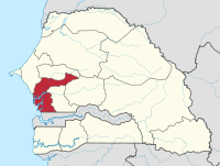
Africa

South America
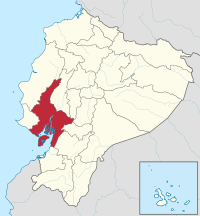

| Salient | Country |
|---|---|
| Southern Buenos Aires Province | |
| Luis Calvo, Chuquisaca Department | |
| Sud Cinti, Chuquisaca Department | |
| Whale Coast, Bahia | |
| Alto Parnaíba, Balsas, and Tasso Fragoso, southernmost Maranhão | |
| Northern Mato Grosso | |
| Ponta do Abunã in northwest Rondônia | |
| Triângulo Mineiro, Minas Gerais | |
| Arauco Province, Bío Bío Region | |
| San Antonio Province, Valparaíso Region | |
| Urabá region, Antioquia Department | |
| Unguía and Acandí in northernmost Chocó Department | |
| Santander Department northern tip | |
| Santa Rosa and Piamonte in southeastern Cauca Department | |
| Cotacachi Canton, Imbabura Province | |
| Eastern Tena Canton, Napo Province | |
| Balzar and El Empalme Cantons, Guayas Province | |
| Northern East Berbice-Corentyne | |
| Caravelí Province, Arequipa Region | |
| Northern Tapanahony, Sipaliwini District | |
| Páez, Apure | |
| Western Andrés Eloy Blanco Municipality, Barinas | |
| Arismendi Municipality, Barinas |
North and Central America
| Salient | Country |
|---|---|
| Toronto (East York, Etobicoke, Old Toronto, York) | |
| Northwestern British Columbia | |
| Middle Côte-Nord, Quebec | |
| Western Puntarenas Province | |
| Guamá, Santiago de Cuba Province | |
| Southern Hato Mayor Province | |
| Southern Samaná Province | |
| Southern San Miguel Department | |
| Norte, Jalisco | |
| Eastern Tabasco | |
| Southeastern Zacatecas | |
| Southern Zacatecas | |
| Chiriquí Grande District, Bocas del Toro Province | |
| Southern Chimán District, Panamá Province | |
| Mariato District, Veraguas Province | |
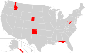
| Alaska | |
| Connecticut | |
| Florida | |
| Idaho | |
| Maryland | |
| Nebraska | |
| Oklahoma | |
| Texas | |
| Eastern West Virginia | |
| Missouri Bootheel | |
| Northern West Virginia | |
| New Mexico Bootheel | |
| Trans-Pecos | |
| The Thumb |
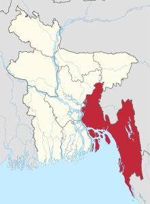
Asia


Europe

Oceania

| Salient | Country |
|---|---|
| Northeastern Nadroga-Navosa Province, Western Division | |
| Southern Anetan District | |
| Rangitaiki River Valley, Bay of Plenty Region | |
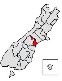
| Hunter River Valley, Otago region | |
| Upper Rangitata Valley, Timaru District | |
| Upper Waitaki Valley, Waitaki District | |
| Northeastern West New Britain Province |
See also
- Bootheel
- Border irregularities of the United States
- Border
- Chicken's Neck (disambiguation)
- Corridor (disambiguation)
- Enclave and exclave
- Fergana Valley (triple junction of Uzbekistan, Kyrgyzstan and Tajikistan)
- Gerrymandering
- Political geography
- Salients, re-entrants and pockets
- The Thumb
Notes
- This definition includes the following counties: Bay, Calhoun, Escambia, Franklin, Gadsden, Gulf, Holmes, Jackson, Jefferson, Leon, Liberty, Madison, Okaloosa, Santa Rosa, Taylor, Wakulla, Walton, and Washington.
- This definition includes the following counties: Allegany, Frederick, Garrett, and Washington
- Not a geopolitical salient, but a normal geographical feature similar to that of a peninsula.
References
- "San Isidro". Google Maps. Google LLC. Retrieved 14 January 2020.
Further reading
- Robert Reid (4 April 2016). "America's Panhandles, Ranked From 1 to 10". National Geographic. Retrieved 2019-05-16.