| Raseiniai District Municipality Raseinių rajono savivaldybė | |
|---|---|
| Municipality | |
 Pond near Raseiniai Pond near Raseiniai | |
 Flag Flag Coat of arms Coat of arms Brandmark Brandmark | |
 Location of Raseiniai district municipality within Lithuania Location of Raseiniai district municipality within Lithuania | |
 Map of Raseiniai district municipality Map of Raseiniai district municipality | |
| Country | |
| Ethnographic region | Samogitia |
| County | |
| Capital | Raseiniai |
| Elderships | 12 |
| Area | |
| • Total | 1,573 km (607 sq mi) |
| • Rank | 12th |
| Population | |
| • Total | 31,192 |
| • Rank | 23-24th |
| • Density | 20/km (51/sq mi) |
| • Rank | 34-35th |
| Time zone | UTC+2 (EET) |
| • Summer (DST) | UTC+3 (EEST) |
| Telephone code | 428 |
| Major settlements | |
| Website | www |
Raseiniai District Municipality is one of 60 municipalities in Lithuania.
Symbols
Coat of arms: A traditional Iberic shield Argent, resting on a base Vert a lynx salient Proper.
Partners

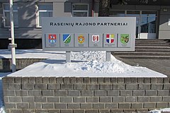
Raseiniai is twinned with:
 Ķekava, Latvia
 Lubartów, Poland
 Mława, Poland
 Jászberény, Hungary
 Rapla County, Estonia
 Unstrut-Hainich-Kreis, Germany
 Zhmerynka, Ukraine
References
- https://osp.stat.gov.lt/documents/10180/9601028/Gyventojai_gyvenamosiose_vietovese.xlsx Archived 2022-03-07 at the Wayback Machine
- "Tarptautinis bendradarbiavimas". raseiniai.lt (in Lithuanian). Raseiniai. Retrieved 2019-09-06.
55°23′49″N 23°09′40″E / 55.39694°N 23.16111°E / 55.39694; 23.16111
This Kaunas County, Lithuania location article is a stub. You can help Misplaced Pages by expanding it. |
