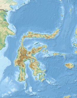
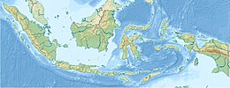
  Show map of Sulawesi Show map of Sulawesi  Show map of Indonesia Show map of Indonesia | |
| UTC time | 2012-08-18 09:41:52 |
|---|---|
| USGS-ANSS | ComCat |
| Local date | 18 August 2012 (2012-08-18) |
| Local time | 17:41:52 WITA (UTC+8) |
| Magnitude | 6.3 Mw |
| Depth | 10 km (6 mi) |
| Epicenter | 1°18′54″S 120°05′46″E / 1.315°S 120.096°E / -1.315; 120.096 |
| Areas affected | Sulawesi, Indonesia |
| Max. intensity | MMI VIII (Severe) |
| Landslides | Yes |
| Casualties | 6 fatalities, 43 injuries |
On 18 August 2012, at 17:41:52 WITA (09:41:52 UTC), a Mw 6.3 earthquake struck Sigi Regency in Central Sulawesi, Indonesia, 51 km (32 mi) south-southeast of Palu.
Tectonic setting
Sulawesi lies within the complex zone of interaction between the Australian, Pacific, Philippine and Sunda plates in which many small microplates are developed. The main active structure onshore in the western part of Central Sulawesi is the left-lateral NNW-SSE Palu-Koro strike-slip fault that forms the boundary between the North Sula and Makassar blocks.
Earthquake
The United States Geological Survey reported a magnitude (Mww ) of 6.3, at a depth of 10 km (6.2 mi) and a maximum Modified Mercalli intensity of VIII (Severe).
Impact
Six people were killed by falling debris and tons of mud, including a nine-year-old boy. 43 others were injured, including 8 in critical condition. 471 homes were destroyed and 1,097 damaged in the epicentral area. Landslides also blocked roads and some bridges.
References
- ^ ANSS. "M 6.3 - 51 km SSE of Palu, Indonesia 2012". Comprehensive Catalog. U.S. Geological Survey.
- Socquet A.; Simons W.; Vigny C.; McCaffrey R.; Subarya C.; Sarsito D.; Ambrosius B.; Spakman W. (2006). "Microblock rotations and fault coupling in SE Asia triple junction (Sulawesi, Indonesia) from GPS and earthquake slip vector data". Journal of Geophysical Research: Solid Earth. 111 (B8): B08409. Bibcode:2006JGRB..111.8409S. doi:10.1029/2005JB003963.
- National Geophysical Data Center / World Data Service (NGDC/WDS): NCEI/WDS Global Significant Earthquake Database. NOAA National Centers for Environmental Information. "Significant Earthquake Information". Retrieved 22 November 2024.
- "Earthquake rocks central Indonesia province". Al Jazeera English. 18 August 2024. Retrieved 22 November 2024.
| ← Earthquakes in 2012 → | |
|---|---|
| February |
|
| March |
|
| April |
|
| May |
|
| June |
|
| July |
|
| August |
|
| September |
|
| October |
|
| November |
|
| December |
|
| |
This article about an earthquake in Asia is a stub. You can help Misplaced Pages by expanding it. |