You can help expand this article with text translated from the corresponding article in Hungarian. (September 2017) Click for important translation instructions.
|
| Alsótold | |
|---|---|
| Village and Municipality | |
 Street with chapel Street with chapel | |
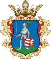
 Coat of arms Coat of arms | |
| Country | |
| Region | Northern Hungary |
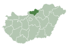
| County | Nógrád |
| District | Pásztó |
| Government | |
| • Mayor | Éva Sándor Szandra (Ind.) |
| Area | |
| • Total | 7.86 km (3.03 sq mi) |
| Population | |
| • Total | 231 |
| • Density | 29/km (76/sq mi) |
| Time zone | UTC+1 (Central European Time) |
| Area code | 32 |
Alsótold is a village and municipality in the comitat of Nógrád, Hungary. The village is the part of the Novohrad-Nógrád Geopark.
| Year | Population |
|---|---|
| 1870 | 288 |
| 1880 | 218 |
| 1890 | 236 |
| 1900 | 262 |
| 1910 | 300 |
| 1920 | 403 |
| 1930 | 369 |
| 1941 | 344 |
| 1949 | 363 |
| 1960 | 342 |
| 1970 | 280 |
| 1980 | 242 |
| 1990 | 273 |
| 2001 | 294 |
| 2011 | 237 |
References
- "Nógrád county - Data on localities - Population number, population density". Hungarian Central Statistical Office/Központi Statisztikai Hivatal. Retrieved 2021-05-22.
Links
47°57′N 19°36′E / 47.950°N 19.600°E / 47.950; 19.600
This Nógrád county location article is a stub. You can help Misplaced Pages by expanding it. |

