| Tar | |
|---|---|
| Village | |
 Saint Michael Church Saint Michael Church | |
 Flag Flag Coat of arms Coat of arms | |
 | |
| Coordinates: 47°57′02″N 19°44′29″E / 47.95056°N 19.74139°E / 47.95056; 19.74139 | |
| Country | |
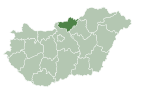
| County | Nógrád |
| District | Pásztó |
| First mentioned | 1265 |
| Government | |
| • Mayor | Zsolt Turopoli (Ind.) |
| Area | |
| • Total | 27.34 km (10.56 sq mi) |
| Population | |
| • Total | 1,790 |
| • Density | 65/km (170/sq mi) |
| Time zone | UTC+1 (CET) |
| • Summer (DST) | UTC+2 (CEST) |
| Postal code | 3073 |
| Area code | 32 |
| Website | www.tarkozseg.hu |

Tar is a village in Nógrád County, Hungary, beside of the Zagyva river, between the Cserhát and Mátra mountain ranges. As of 2022 census, it has a population of 1790 (see Demographics). The (Nr. 81) Hatvan–Fiľakovo railway line go across the village, which located beside of the main road 21 and 34.4 km away from the M3 motorway. The village have an own railway station with public transport.
History
The first written mention of the settlement dates from 1265, when the village belonged to the Rátót genus, from which the Tari family also originates. St. Michael's Church was built in the 13th century, which was expanded by Lőrinc Tari [hu] and a manor house was built nearby. In the 15th century, the settlement was given the status of a market town. The Ottomans destroyed the manor house in 1559, but the church remained. The ruins of the manor house are still visible today. In the 18th century, the church was rebuilt in the Baroque style. The church's wall paintings, significant art historical monuments, and the appearance of elements in the Roman, Gothic, Baroque and Classicist styles give its architectural value. It was owned by the Esterházy, Drašković, Reviczky [hu] and Almásy [fr] families until the 19th century. In the fire of 1880, 76 houses burned down. The population lived from agriculture. After the opening of the Bátonyterenye mines, commuting began. The settlement's own cooperative existed until 1975, after 1996 private farms became the main form in the capital-poor agriculture of the village. A doctor's office were built in 1975, and the pharmacy was opened in 1978. In 1980, the post office and community center were built. The current building of the primary school was built in 1994. The Dalai Lama inaugurated the stupa of Sándor Kőrösi Csoma next to main road 21 in 1992. The Hungarian orientalist was declared a bodhisattva in 1933.
In July 2023, the "Sándor Kőrösi Csoma Center for Scythian and Hungarian Spirituality" was opened in the Buddha park created here. In December 2023, the National Assembly rejected the initiative supported by 1371 signatures, which would have declared the Scythians as an indigenous minority.
In January 2024, the police arrested 11 people who declared an armed struggle against the Hungarian state and wanted to create a "Scythian Hungary".
Demographics
According the 2022 census, 87.2% of the population were of Hungarian ethnicity, 13.8% were Gypsies and 12.8% were did not wish to answer. The religious distribution was as follows: 51.8% Roman Catholic, 1.4% Lutheran, 1.0% Calvinist, 9.6% non-denominational, and 33.5% did not wish to answer. The Gypsies have a local nationality government. 1802 people live in the village and 23 persons live in 4 farms.
Population by years:
| Year | 1870 | 1880 | 1890 | 1900 | 1910 | 1920 | 1930 | 1941 |
|---|---|---|---|---|---|---|---|---|
| Population | 1321 | 1205 | 1256 | 1389 | 1705 | 1900 | 2156 | 2203 |
| Year | 1949 | 1960 | 1970 | 1980 | 1990 | 2001 | 2011 | 2022 |
| Population | 2287 | 2466 | 2654 | 2552 | 2332 | 2058 | 1926 | 1790 |
Politics
Mayors since 1990:
- 1990–2006: Lajos Becze (independent)
- 2006–2014: István Román (independent)
- 2014–: Zsolt Turopoli (independent)
References
- "Our village" (in Hungarian). Retrieved 17 February 2024.
- "There are more than 2000 Scythians in Hungary, yet they are not recognized as an official ethnic group" (in Hungarian). Retrieved 17 February 2024.
- "Armed scythians wanted to overthrow the power of Viktor Orbán, CTC had to go for them" (in Hungarian). Retrieved 17 February 2024.
- "Tar". ksh.hu. Hungarian Central Statistical Office. Retrieved 16 February 2024.
- "Population number, population density". Hungarian Central Statistical Office. Retrieved 2024-02-22.
- "Tar settlement election results" (txt) (in Hungarian). National Election Office. Retrieved 2024-02-16.
- "Tar settlement election results" (in Hungarian). National Election Office. Retrieved 2024-02-16.
- "Tar settlement election results" (in Hungarian). National Election Office. Retrieved 2024-02-16.
- "Tar settlement election results" (in Hungarian). National Election Office. Retrieved 2024-02-16.
- "Tar settlement election results" (in Hungarian). National Election Office. Retrieved 2024-02-16.
- "Tar settlement election results" (in Hungarian). National Election Office. Retrieved 2024-02-16.
- "Tar settlement election results" (in Hungarian). National Election Office. Retrieved 2024-02-16.
- "Tar settlement election results" (in Hungarian). National Election Office. Retrieved 2024-02-16.
- "Tar settlement election results" (in Hungarian). National Election Office. Retrieved 2024-11-23.
| Towns and villages of Pásztó District | ||
|---|---|---|
| Town (1) |
| |
| Villages (25) | ||
This Nógrád county location article is a stub. You can help Misplaced Pages by expanding it. |

