| Márkháza | |
|---|---|
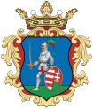
 Coat of arms Coat of arms | |
 | |
| Coordinates: 48°00′59″N 19°43′18″E / 48.01641°N 19.72170°E / 48.01641; 19.72170 | |
| Country | Hungary |
| Region | Northern Hungary |
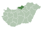
| County | Nógrád |
| Subregion | Bátonyterenyei |
| Rank | Village |
| Area | |
| • Total | 6.31 km (2.44 sq mi) |
| Population | |
| • Total | 228 |
| • Density | 36/km (94/sq mi) |
| Time zone | UTC+1 (CET) |
| • Summer (DST) | UTC+2 (CEST) |
| Postal code | 3075 |
| Area code | +36 32 |
| KSH code | 14641 |
| Website | http://markhaza.hu/ |
Márkháza is a village in Nógrád County, Hungary. It is located 15 kilometers from Salgótarján in the Kis Zagyva Valley.
The village is believed to have been named after Mark, the son of one of the owners of Fehérkő Castle. It was first mentioned in writing in 1548, when it was destroyed by Turkish troops. Afterwards, it was known as Tótmarokháza, indicating a Slovak presence and influence in the village.
Historically, the village's primary industry was coal mining.
References
- ^ Márkháza at the Hungarian Central Statistical Office (Hungarian).
- Márkháza at the Hungarian Central Statistical Office (Hungarian). 1 January 2008
48°01′N 19°44′E / 48.017°N 19.733°E / 48.017; 19.733
Category:
