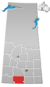
Hamlet in Saskatchewan, Canada
| Ardill | |
|---|---|
| Hamlet | |
  | |
| Coordinates: 49°56′21″N 105°50′31″W / 49.9392°N 105.8419°W / 49.9392; -105.8419 | |
| Country | Canada |
| Province | Saskatchewan |
| Region | Southwest Saskatchewan |
| Census division | 3 |
| Rural Municipality | Lake Johnston |
| Restructured (Hamlet) | December 31, 1972 |
| Government | |
| • Reeve | Ivan Costley |
| • Administrator | Sherry Green |
| • Governing body | Lake Johnston No. 102 |
| Area | |
| • Total | 0 km (0 sq mi) |
| Population | |
| • Total | 0 |
| • Density | 0/km (0/sq mi) |
| Time zone | CST |
| Postal code | S0H 3G0 |
| Area code | 306 |
| Highways | Highway 2 Highway 715 |
Ardill is a hamlet in RM of Lake Johnston No. 102, Saskatchewan, Canada. Listed as a designated place by Statistics Canada, the hamlet had a listed population of 0 in the Canada 2006 Census.
All that currently remains is the bar which was issued liquor licence #1. Ardill is located between Assiniboia and Moose Jaw, south of Old Wives Lake and at the northern end of Lake of the Rivers.
Demographics
| Year | Pop. | ±% |
|---|---|---|
| 1921 | 26 | — |
| 1926 | 49 | +88.5% |
| 1931 | 38 | −22.4% |
| 1936 | 36 | −5.3% |
| 1941 | 82 | +127.8% |
| 1946 | 37 | −54.9% |
| 1951 | 38 | +2.7% |
| 1956 | 34 | −10.5% |
| 1961 | 31 | −8.8% |
| 1966 | 28 | −9.7% |
| 1971 | 26 | −7.1% |
| Source: Government of Canada | ||
Ardill, like so many other small communities throughout Saskatchewan, has struggled to maintain a sturdy population, resulting in a ghost town with no population.
Previously, Ardill was incorporated under village status, but on December 31, 1972, it was restructured as a hamlet under the jurisdiction of the Rural Municipality of Lake Johnston No. 102.
In 2001, Ardill had a population of 0, the same as in 1996. The village had a land area of 0 km (0 sq mi).
Infrastructure
The former Saskatchewan Transportation Company provided intercity bus service to Ardill.
See also
References
- "Restructured Villages". Saskatchewan Ministry of Municipal Affairs. Archived from the original on March 25, 2008. Retrieved August 12, 2024.
- National Archives, Archivia Net, Post Offices and Postmasters, archived from the original on October 6, 2006
- Government of Saskatchewan, MRD Home, Municipal Directory System, archived from the original on November 21, 2008
- Canadian Textiles Institute. (2005), CTI Determine your provincial constituency, archived from the original on September 11, 2007
- Commissioner of Canada Elections, Chief Electoral Officer of Canada (2005), Elections Canada On-line, archived from the original on April 21, 2007
- Canada 2006 Census: Designated places in Saskatchewan
- "Census of Saskatchewan 1936" (PDF). Government of Canada. p. 96. Retrieved August 9, 2024.
- "Census of the Prairie Provinces 1946". Government of Canada. p. 182. Retrieved August 9, 2024.
- "Census of Canada 1956" (PDF). Government of Canada. Retrieved August 9, 2024.
- "1966 Census of Canada" (PDF). Government of Canada. Retrieved August 9, 2024.
- "1971 Census of Canada" (PDF). Government of Canada. Retrieved August 9, 2024.
- "STC route Map" (PDF). Archived from the original (PDF) on October 4, 2013. Retrieved June 24, 2010.
| Places adjacent to Ardill, Saskatchewan | ||||||||||||||||
|---|---|---|---|---|---|---|---|---|---|---|---|---|---|---|---|---|
| ||||||||||||||||
49°56′21″N 105°50′31″W / 49.93917°N 105.84194°W / 49.93917; -105.84194
Categories: