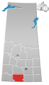
Locality in Saskatchewan, Canada
| Killdeer | |
|---|---|
| Locality | |
  | |
| Coordinates: 49°06′27″N 106°21′45″W / 49.10750°N 106.36250°W / 49.10750; -106.36250 | |
| Country | Canada |
| Province | Saskatchewan |
| Census division | 3 |
| Rural Municipality | Old Post No. 43 |
| Time zone | CST |
| Area code | 306 |
| Highways | Hwy 2, Hwy 18 |
Killdeer is an unincorporated community in Rural Municipality of Old Post No. 43, Saskatchewan, Canada. The locality is located near the intersection of Highway 2 and Highway 18 about 270 kilometres (170 mi) southwest of Regina and 13 kilometres (8.1 mi) north of the Canada–United States border.
Geography
Killdeer is located on the southern slopes of Wood Mountain Hills and just east of the Rock Creek Badlands. These badlands are also known as the Killdeer Badlands.
See also
References
- "Geographic Place names - Killdeer". Natural Resources Canada. Government of Canada. Retrieved January 30, 2018.
- "Rock Creek Badlands - Badlands Parkway". Tourism Saskatchewan. Government of Saskatchewan. Retrieved November 10, 2022.
| Places adjacent to Killdeer, Saskatchewan | ||||||||||||||||
|---|---|---|---|---|---|---|---|---|---|---|---|---|---|---|---|---|
| ||||||||||||||||
This article about a location in the Census Division No. 3 of Saskatchewan is a stub. You can help Misplaced Pages by expanding it. |
