Human settlement in England
| Burgh on Bain | |
|---|---|
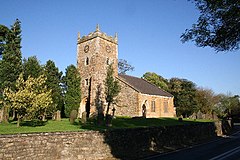
 Church of St Helen, Burgh on Bain Church of St Helen, Burgh on Bain | |
 | |
| Population | 172 (Including Gayton le Wold and Grimblethorpe) 2011) |
| OS grid reference | TF222863 |
| • London | 130 mi (210 km) S |
| District | |
| Shire county | |
| Region | |
| Country | England |
| Sovereign state | United Kingdom |
| Post town | Market Rasen |
| Postcode district | LN8 |
| Police | Lincolnshire |
| Fire | Lincolnshire |
| Ambulance | East Midlands |
| UK Parliament | |
| |
Burgh on Bain is a village and civil parish in the East Lindsey district of Lincolnshire, England. It is situated on the A157 road, 7 miles (11 km) west from Louth and 7 miles east from Market Rasen. According to the 2001 census it had a population of 114, increasing to 172 at the 2011 census. The parish includes the hamlet of Girsby.
Burgh on Bain Grade II listed Anglican church is dedicated to St Helen.
Toponomy
"Burgh" comes from "burh", meaning fortification, while Bain refers to the River Bain.
Archaeology

Located on a slope overlooking the Bain Valley is a Neolithic long barrow, marked on maps as a "Tumulus". On the smaller side compared to others found in Lincolnshire, the mound is 27 metres long by 14 metres wide. Today, it is obscured by a cluster of trees and has been burrowed by small animals. In addition, there are several Bronze Age round barrows.
Several artefacts have been discovered in Burgh on Bain's fields, such as a polished flint celt and several arrowheads on the grounds of Baxter Square Farm. These have been preserved in Lincoln Museum and Louth Museum.
History
Burgh on Bain was recorded in the Domesday Book (1086) as part of the wapentake of Wraggoe. Local Bishop's transcripts date back to 1561, while parish records begin in 1575.

There was a manor at Girsby (a medieval settlement), which was owned by the Fox family in the 19th century. It was abandoned before being demolished in the mid 20th century and replaced with a new house.
One of Burgh on Bain's Bronze Age round barrows was excavated when RAF Ludford Magna was built in 1942. From the late 1950s to 1991, another round barrow was used as a Royal Observer Corps monitoring post.
References
- "Parish population 2011". Neighbourhood Statistics. Office for National Statistics. Retrieved 20 August 2015.
- Historic England. "Church of St Helen (1359948)". National Heritage List for England. Retrieved 3 July 2011.
- ^ "Burgh on Bain, Lincolnshire". Genuki. Retrieved 23 October 2024.
- "Burgh on Bain Long Barrow". Stone Circles. Retrieved 23 October 2024.
- ^ "Burgh on Bain Round Barrows, Lincolnshire". Stone Circles. Retrieved 23 October 2024.
- "Monument record MLI40575 - Neolithic/Bronze Age artefacts found, Burgh on Bain". Lincolnshire Heritage Explorer. Retrieved 23 October 2024.
- "Burgh[-on-Bain]". Open Domesday. Retrieved 23 October 2024.
- "Monument record MLI84523 - Girsby medieval settlement, Burgh on Bain". Lincolnshire Heritage Explorer. Retrieved 23 October 2024.
- "Girsby Manor". Lost Heritage. Retrieved 23 October 2024.
- "Monument record MLI40577 - Site of a round barrow, Burgh on Bain". Lincolnshire Heritage Explorer. Retrieved 23 October 2024.
External links
 Media related to Burgh on Bain at Wikimedia Commons
This Lincolnshire location article is a stub. You can help Misplaced Pages by expanding it. |