| Kajjansi | |
|---|---|
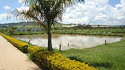
 Ponds at the Aquaculture Research and Development Centre, Kajjansi Ponds at the Aquaculture Research and Development Centre, Kajjansi | |
 | |
| Coordinates: 00°12′54″N 32°33′00″E / 0.21500°N 32.55000°E / 0.21500; 32.55000 | |
| Country | |
| Region | Central Uganda |
| District | Wakiso District |
| Elevation | 1,180 m (3,870 ft) |
| Population | |
| • Total | 7,530 |
| Time zone | UTC+3 (EAT) |


Kajjansi is a town in Central Uganda. It is one of the urban centers in Wakiso District.

Location
The township is situated on the tarmacked, all-weather Kampala - Entebbe Road. Kajjansi is located approximately 16 kilometres (9.9 mi), by road, south of Kampala, Uganda's capital and largest city. This location is approximately 25 kilometres (16 mi), by road, north of Entebbe International Airport, Uganda's largest civilian and military airport. The coordinates of Kajjansi are:0°12'54.0"N, 32°33'00.0"E (Latitude:0.2150; Longitude:32.5500).
Population
In 2006, the population of Kajjansi was estimated at 7,530.
Points of interest
The following points of interest lie within the town limits or close to the edges of town:
- Uganda Clays Limited - The headquarters and main factory are located in Kajjansi
- Kajjansi Airport - A private civilian airport belonging to Mission Aviation Fellowship
- A branch of Equity Bank
- Kajjansi Roses - A horticultural company; a member of the Madhvani Group of Companies
- Headquarters of the Rotary Club of Kajjansi, Uganda. Club Number:61815
- Kajjansi Aquaculture Research Station - A government fisheries research and training center
- Palliative Care Association of Uganda (PCAU)
- Sunfish Farms Limited - A private fish farm
- Kajjansi Central Market
See also
References
- "Road Distance Between Kampala And Kajjansi With Map". Globefeed.com. Retrieved 17 April 2004.
- "Road Distance Between Entebbe Airport and Kajjansi with Map". Globefeed.com. Retrieved 17 April 2014.
- "Location of Kajjansi At Google Maps" (Map). Google Maps. Retrieved 4 July 2015.
- "Estimated Population of Kajjansi In 2006". Mongabay.com. Retrieved 17 April 2014.
External links
00°12′54″N 32°33′00″E / 0.21500°N 32.55000°E / 0.21500; 32.55000
Categories: