| Sierra de Santa Cruz | |
|---|---|
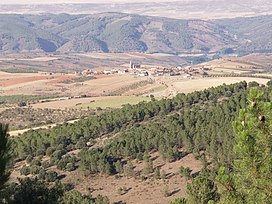
 Sierra de Santa Cruz near Orcajo Sierra de Santa Cruz near Orcajo | |
| Highest point | |
| Peak | Cerro de Santa Cruz |
| Elevation | 1,423 m (4,669 ft) |
| Listing | List of mountains in Aragon |
| Coordinates | 41°06′15″N 01°33′55″W / 41.10417°N 1.56528°W / 41.10417; -1.56528 |
| Geography | |
 | |
| Location | Campo de Daroca (Aragon) |
| Parent range | Iberian System |
| Geology | |
| Orogeny | Alpine orogeny |
| Climbing | |
| First ascent | Unknown |
| Easiest route | Drive from Orcajo or Cubel |
Sierra de Santa Cruz is a mountain range in the Campo de Daroca comarca, Aragon, Spain. It is located north of the Laguna de Gallocanta.
Geography
The ridge is aligned in a NW-SE direction. Its highest point is Cerro de Santa Cruz (1,423 m). The Ermita de Santa Cruz shrine is located in the range.
This mountain chain rises west of Daroca and stretches through the municipal terms of Balconchán, Atea, Orcajo, Cubel, Valdehorna, Val de San Martín and Santed.
Ecology
The plant Centaurea pinnata is an endangered species present in this mountain range.
See also
References
External links
 Media related to Sierra de Santa Cruz at Wikimedia Commons
- CAI Aragon - Sierra de de Santa Cruz
- Hiking in Sierra de Santa Cruz
This article about a location in Aragon, Spain, is a stub. You can help Misplaced Pages by expanding it. |