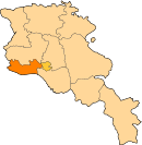
40°03′17″N 44°18′10″E / 40.05472°N 44.30278°E / 40.05472; 44.30278
This article is about the village in eastern part of the Armavir Province. For for village in western part, see Araks, Armavir (west). For other uses of Araks, see Araks (disambiguation). Place in Armavir, Armenia| Araks Արաքս | |
|---|---|
 | |
| Coordinates: 40°03′17″N 44°18′10″E / 40.05472°N 44.30278°E / 40.05472; 44.30278 | |
| Country | Armenia |
| Province | Armavir |
| Municipality | Araks |
| Founded | 1923 |
| Population | |
| • Total | 1,364 |
| Time zone | UTC+4 |
Araks (Armenian: Արաքս), known as Nerkin Karkhun and Sharifabad until 1946, is a village in the eastern part of the Armavir Province of Armenia, specifically in the Araks Municipality.
References
- "Armavir (Armenia): Towns and Villages in Municipalities". www.citypopulation.de. Retrieved 2024-11-09.
- Kiesling, Brady (June 2000). Rediscovering Armenia: An Archaeological/Touristic Gazetteer and Map Set for the Historical Monuments of Armenia (PDF). Archived (PDF) from the original on 6 November 2021.
- Araks, Armenia (Araks Municipality) at GEOnet Names Server
- World Gazeteer: Armenia – World-Gazetteer.com
- Report of the results of the 2001 Armenian Census, Statistical Committee of Armenia
- Kiesling, Brady (June 2000). Rediscovering Armenia: An Archaeological/Touristic Gazetteer and Map Set for the Historical Monuments of Armenia (PDF). Archived (PDF) from the original on 6 November 2021.
This article about a location in Armavir Province, Armenia is a stub. You can help Misplaced Pages by expanding it. |
