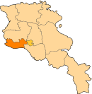
40°05′35″N 43°57′03″E / 40.09306°N 43.95083°E / 40.09306; 43.95083
Place in Armavir, Armenia| Araks Արաքս | |
|---|---|
 Araks village as seen from Sardarapat Monument Araks village as seen from Sardarapat Monument | |
 | |
| Coordinates: 40°05′35″N 43°57′03″E / 40.09306°N 43.95083°E / 40.09306; 43.95083 | |
| Country | Armenia |
| Province | Armavir |
| Municipality | Armavir |
| Founded | 1946 |
| Population | |
| • Total | 1,651 |
| Time zone | UTC+4 |
Araks (Armenian: Արաքս), is a village with 1,651 inhabitants (2011) in the western part of the Armavir Province of Armenia. It was founded as a state farm in 1940. The Battle of Sardarapat of 1918, took place near the village of Araks. In 1968, the Sardarapat Battle Memorial was erected on the site of the battle. Additionally there is the state owned Armenia Ethnography Museum.

References
- ^ "Armavir (Armenia): Towns and Villages in Municipalities". www.citypopulation.de. Retrieved 2024-11-08.
- Sketches of the Soviet Union - Page 145 by Anton Refregier - 1978
- Baboyan, Albert (1979). ""The centuries under the arches"". Soviet Armenia. 4: 10–11.
This article about a location in Armavir Province, Armenia is a stub. You can help Misplaced Pages by expanding it. |
