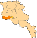
40°08′17″N 43°55′53″E / 40.13806°N 43.93139°E / 40.13806; 43.93139
Place in Armavir, Armenia| Arevadasht Արևադաշտ | |
|---|---|
 Entering Arevadasht Entering Arevadasht | |
 | |
| Coordinates: 40°08′17″N 43°55′53″E / 40.13806°N 43.93139°E / 40.13806; 43.93139 | |
| Country | Armenia |
| Marz (Province) | Armavir |
| Population | |
| • Total | 283 |
| Time zone | UTC+4 ( ) |
Arevadasht (Armenian: Արևադաշտ), is a village in the Armavir Province of Armenia.
Arevadasht has a population of 283 at the 2011 census, down from 375 at the 2001 census.
The village is home to the "Karas" brandy factory.
References
- Kiesling, Brady (June 2000). Rediscovering Armenia: An Archaeological/Touristic Gazetteer and Map Set for the Historical Monuments of Armenia (PDF). Archived (PDF) from the original on 6 November 2021.
- Report of the Results of the 2011 Armenian Census, Statistical Committee of Armenia
- Report of the results of the 2001 Armenian Census, Statistical Committee of Armenia
This article about a location in Armavir Province, Armenia is a stub. You can help Misplaced Pages by expanding it. |
