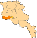
40°06′53″N 43°40′15″E / 40.11472°N 43.67083°E / 40.11472; 43.67083
Place in Armavir, Armenia| Yervandashat Երվանդաշատ | |
|---|---|
 Overlooking the village of Yervandashat Overlooking the village of Yervandashat | |
 | |
| Coordinates: 40°06′53″N 43°40′15″E / 40.11472°N 43.67083°E / 40.11472; 43.67083 | |
| Country | Armenia |
| Marz (Province) | Armavir |
| Founded | 3rd century BCE |
| Population | |
| • Total | 654 |
| Time zone | UTC+4 ( ) |
| • Summer (DST) | UTC+5 ( ) |
Yervandashat (Armenian: Երվանդաշատ) is a village in the Armavir Province of Armenia. The village has a ruined basilica dated to the 4th or 5th century and the Saint Shushanik church of the 10th to 17th century. Along the main highway leading to and from the area are khachkar monuments. It is named after the nearby Armenian historic city of Yervandashat.
See also
References
- "Armavir (Armenia): Towns and Villages in Municipalities". www.citypopulation.de. Retrieved 2024-11-09.
- Yervandashat, Armenia at GEOnet Names Server
- The Kingdom of Armenia By Mack Chahin
- History of Armenia, by Moses of Chorene
- Report of the results of the 2001 Armenian Census, Statistical Committee of Armenia
- Kiesling, Brady (June 2000). Rediscovering Armenia: An Archaeological/Touristic Gazetteer and Map Set for the Historical Monuments of Armenia (PDF). Archived (PDF) from the original on 6 November 2021.
External links
This article about a location in Armavir Province, Armenia is a stub. You can help Misplaced Pages by expanding it. |
